File:Castellserà - Creu de terme.jpg

Original file (1,896 × 1,422 pixels, file size: 231 KB, MIME type: image/jpeg)
Captions
Captions
| Description |
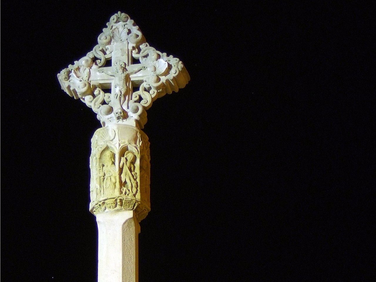
3936-MH Aquesta creu de terme data del segle XIV, està situada a la Plaça del Sitjar, abans es trobava a la sortida de la localitat. Hi veiem representats, en una cara la figura del Crist Redemptor i en l'altra la figura de Maria, envoltada d'àngels, tenint les puntes de la creu unides per ornaments entrellaçats. La llanterna està formada per un fris amb vuit capelletes amb diferents sants a cada una d'elles, entre els quals es pot identificar a sant Miquel, sant Joan, sant Roc i sant Pere. Totes aquestes figures estan ornamentades amb dosserets que dibuixen petites columnes, llaçades, creus, etc. i recolzades sobre una cornisa decorada amb àngels, escuts i motius geomètrics.
|
||
| Date | |||
| Source | Flickr: Castellserà - Creu de terme | ||
| Author | Ramon de cal Benido | ||
| Permission (Reusing this file) |
This file is licensed under the Creative Commons Attribution-Share Alike 2.0 Generic license.
|
| Object location | | View this and other nearby images on: OpenStreetMap |
|---|

|
This image was uploaded as part of Wiki Loves Monuments 2011.
|
|
File history
Click on a date/time to view the file as it appeared at that time.
| Date/Time | Thumbnail | Dimensions | User | Comment | |
|---|---|---|---|---|---|
| current | 13:44, 6 September 2011 | | 1,896 × 1,422 (231 KB) | Flickr upload bot (talk | contribs) | Uploaded from http://flickr.com/photo/29105160@N06/3334333888 using Flickr upload bot |
You cannot overwrite this file.
File usage on Commons
The following page uses this file:
File usage on other wikis
The following other wikis use this file: