File:Cedar mesa.jpg
Jump to navigation
Jump to search
Size of this preview: 800 × 600 pixels. Other resolutions: 320 × 240 pixels | 640 × 480 pixels | 1,024 × 768 pixels | 1,280 × 960 pixels | 2,560 × 1,920 pixels | 4,608 × 3,456 pixels.
Original file (4,608 × 3,456 pixels, file size: 3.06 MB, MIME type: image/jpeg)
Captions
Captions
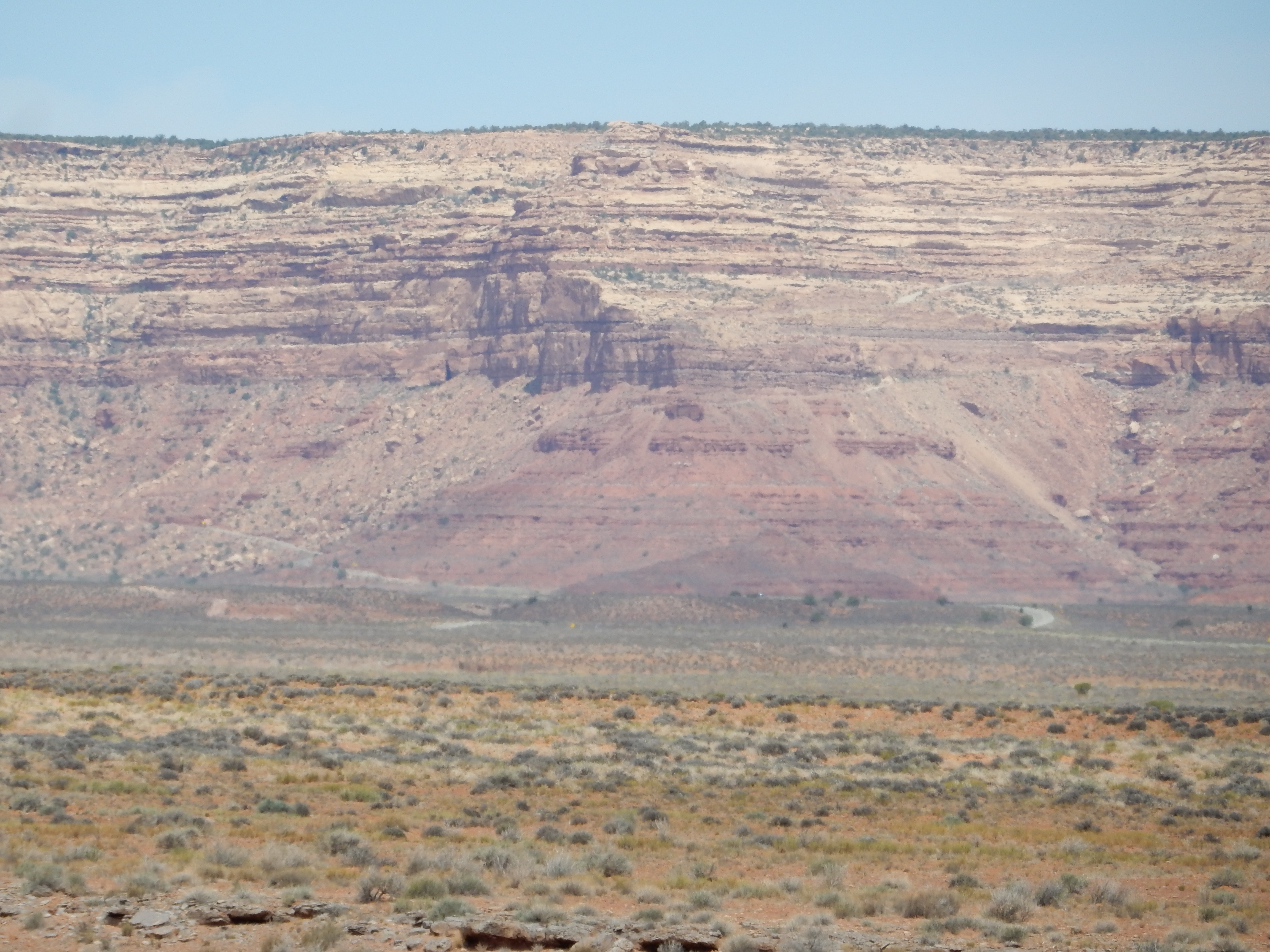
Cedar Mesa in southeastern Utah
Summary
[edit]
| Description |
English: This image shows Cedar Mesa in southeastern Utah. This is the type locale for the Cedar Mesa Sandstone, which makes up the sandstone beds capping the mesa. The red beds beneath are the lower beds of the Cutler Group, sometimes assigned to the Halgaito Formation in this area. Both are Permian in age. The Halgaito Formation records the advance of river deltas from the Uncompahgre uplift across the underlying limestone of the Honaker Trail Formation, while the Cedar Mesa Sandstone records the deposition of sand sheets across the Halgaito river valleys. |
| Date | |
| Source | Own work |
| Author | Kent G. Budge |
| Camera location | | View this and other nearby images on: OpenStreetMap |
|---|
Licensing
[edit]
I, the copyright holder of this work, hereby publish it under the following license:
| This file is made available under the Creative Commons CC0 1.0 Universal Public Domain Dedication. | |
| The person who associated a work with this deed has dedicated the work to the public domain by waiving all of their rights to the work worldwide under copyright law, including all related and neighboring rights, to the extent allowed by law. You can copy, modify, distribute and perform the work, even for commercial purposes, all without asking permission.
|
File history
Click on a date/time to view the file as it appeared at that time.
| Date/Time | Thumbnail | Dimensions | User | Comment | |
|---|---|---|---|---|---|
| current | 00:08, 3 June 2021 | | 4,608 × 3,456 (3.06 MB) | Kent G. Budge (talk | contribs) | Uploaded own work with UploadWizard |
You cannot overwrite this file.
File usage on Commons
There are no pages that use this file.
File usage on other wikis
The following other wikis use this file:
- Usage on en.wikipedia.org