File:Celia jun 22 2010.jpg
Jump to navigation
Jump to search
Size of this preview: 740 × 600 pixels. Other resolutions: 296 × 240 pixels | 592 × 480 pixels | 948 × 768 pixels | 1,264 × 1,024 pixels | 2,527 × 2,048 pixels | 4,904 × 3,974 pixels.
Original file (4,904 × 3,974 pixels, file size: 5.19 MB, MIME type: image/jpeg)
Captions
Captions
Add a one-line explanation of what this file represents
Summary
[edit]
| Description |
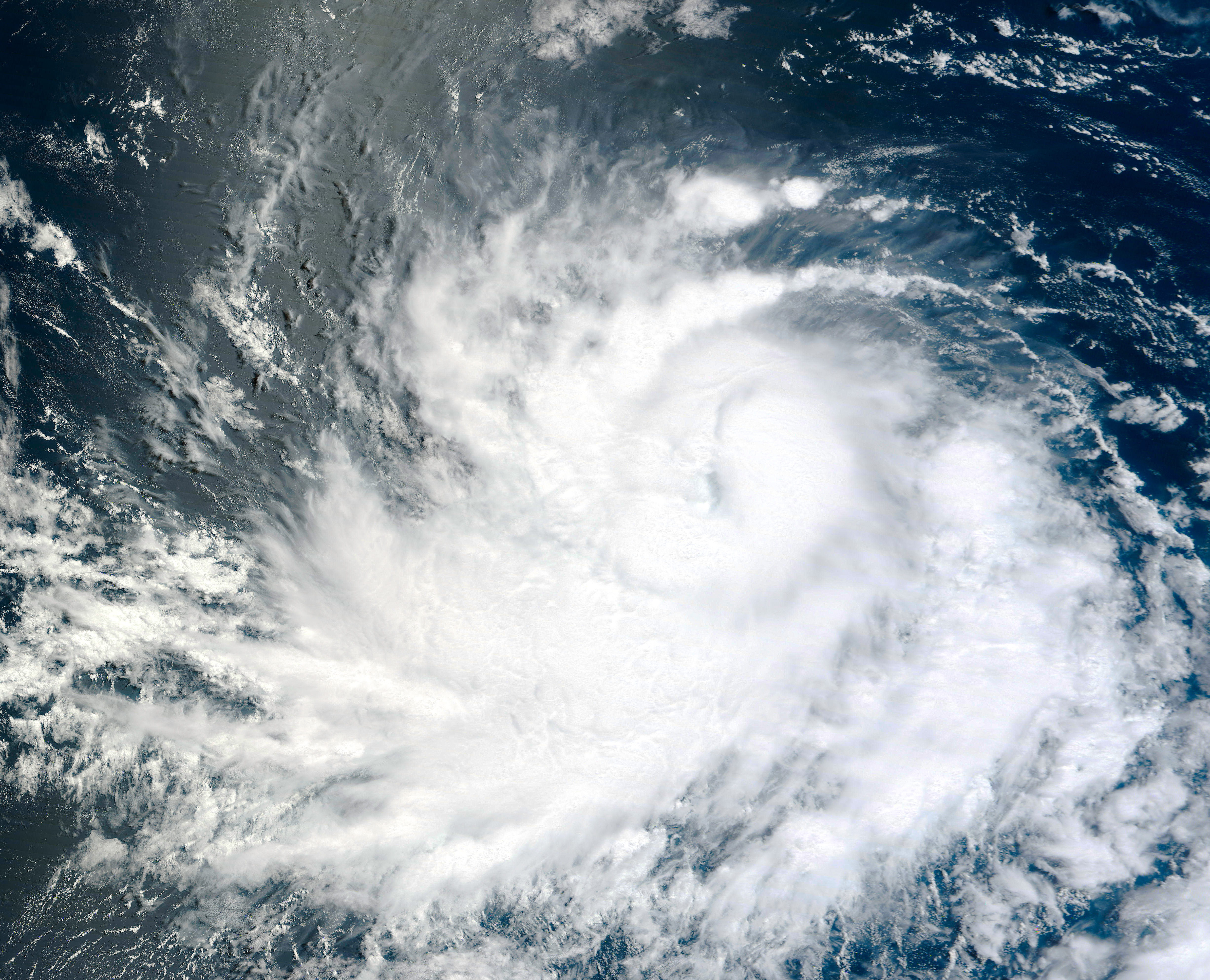
English: After briefly weakening, Hurricane Celia re-strengthened to a Category 2 hurricane on June 23, 2010, the U.S. National Hurricane Center (NHC) reported. At 8:00 a.m. Pacific Daylight Time (15:00 UTC) on June 23, Celia was located roughly 740 miles (1,190 kilometers) south of the southern tip of Baja California. The storm had maximum sustained winds of 100 miles (160 kilometers) per hour with higher gusts. Because the storm was headed away from land, however, no coastal watches or warnings were in effect.
The Moderate Resolution Imaging Spectroradiometer (MODIS) on NASA’s Terra satellite captured this true-color image of Celia on June 22, 2010. Though not distinct, a faint eye does appear near the center of the hurricane. |
| Date | |
| Source | http://earthobservatory.nasa.gov/NaturalHazards/view.php?id=44414 |
| Author | NASA/ GSFC, MODIS Rapid Response System, Caption by Michon Scott |
Licensing
[edit]
| This file is in the public domain in the United States because it was solely created by NASA. NASA copyright policy states that "NASA material is not protected by copyright unless noted". (See Template:PD-USGov, NASA copyright policy page or JPL Image Use Policy.) | ||
 |
Warnings:
|
File history
Click on a date/time to view the file as it appeared at that time.
| Date/Time | Thumbnail | Dimensions | User | Comment | |
|---|---|---|---|---|---|
| current | 03:36, 8 August 2010 | | 4,904 × 3,974 (5.19 MB) | Supportstorm (talk | contribs) | {{Information |Description={{en|1=After briefly weakening, Hurricane Celia re-strengthened to a Category 2 hurricane on June 23, 2010, the U.S. National Hurricane Center (NHC) reported. At 8:00 a.m. Pacific Daylight Time (15:00 UTC) on June 23, Celia was |
You cannot overwrite this file.
File usage on Commons
There are no pages that use this file.