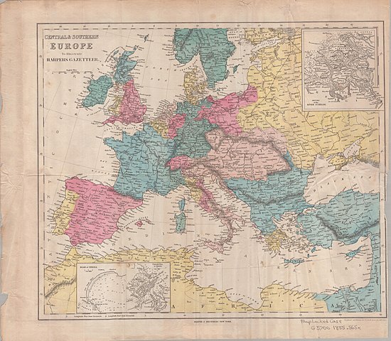
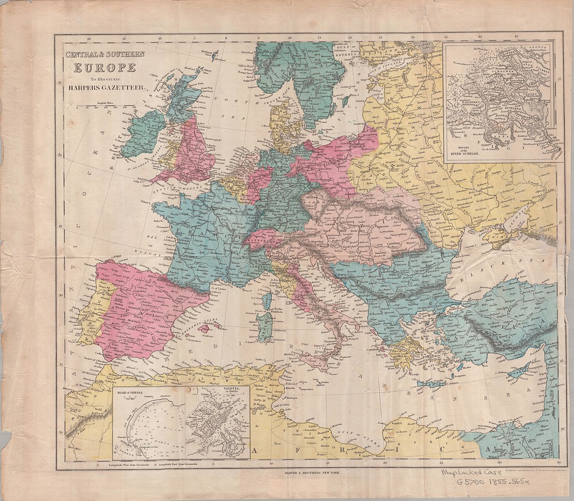
File:Central and Southern Europe Map 1855.jpg
Jump to navigation
Jump to search

Size of this preview: 687 × 600 pixels. Other resolutions: 275 × 240 pixels | 550 × 480 pixels | 880 × 768 pixels | 1,173 × 1,024 pixels | 2,346 × 2,048 pixels | 5,844 × 5,102 pixels.
Original file (5,844 × 5,102 pixels, file size: 3.12 MB, MIME type: image/jpeg)
Captions
Captions
Add a one-line explanation of what this file represents
Summary
[edit]
| Description | Map of Central and Southern Europe 1855 |
| Date | |
| Source | https://archive.org/details/centralsoutherne00jcsm |
| Author | Published by Harper's, NY |
Licensing
[edit]
This media file is in the public domain in the United States. This applies to U.S. works where the copyright has expired, often because its first publication occurred prior to January 1, 1929, and if not then due to lack of notice or renewal. See this page for further explanation.
|
 | |
 |
File history
Click on a date/time to view the file as it appeared at that time.
| Date/Time | Thumbnail | Dimensions | User | Comment | |
|---|---|---|---|---|---|
| current | 19:22, 27 October 2012 | | 5,844 × 5,102 (3.12 MB) | INeverCry (talk | contribs) | {{Information |Description=Map of Central and Southern Europe 1855 |Source=http://archive.org/details/centralsoutherne00jcsm |Date=1855 |Author=Published by Harper's, NY |Permission= |other_versions= }} Category:1855 maps Category:Maps of Europe |
You cannot overwrite this file.
File usage on Commons
There are no pages that use this file.
File usage on other wikis
The following other wikis use this file:
- Usage on he.wikipedia.org