File:Cercanías Asturias Map.svg
Jump to navigation
Jump to search

Size of this PNG preview of this SVG file: 512 × 510 pixels. Other resolutions: 241 × 240 pixels | 482 × 480 pixels | 771 × 768 pixels | 1,028 × 1,024 pixels | 2,056 × 2,048 pixels.
Original file (SVG file, nominally 512 × 510 pixels, file size: 1.72 MB)
Captions
Captions
Add a one-line explanation of what this file represents
Summary[edit]
| Description |
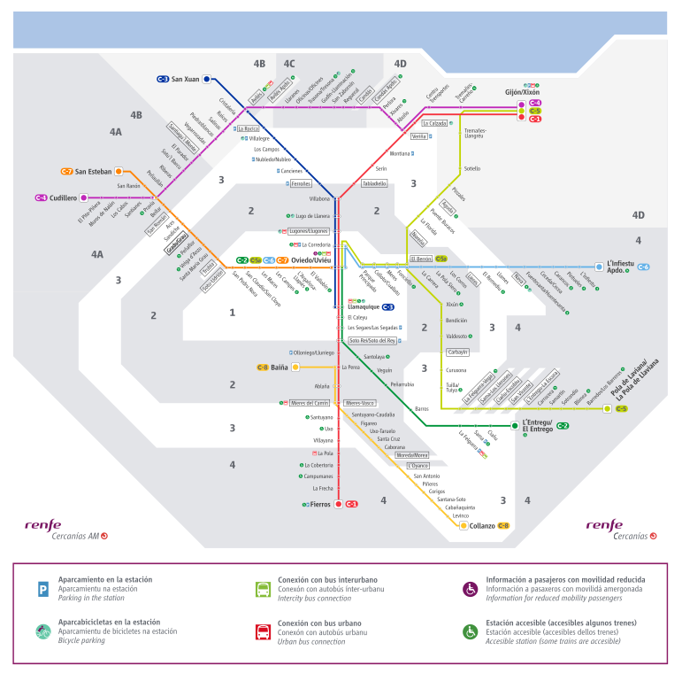
English: Map of the Cercanías Asturias network as of 2021, with the most recent name changes in order to include Asturian toponyms.
Español: Mapa de la red de Cercanías Asturias en 2021, con los cambios más recientes para incluir topónimos asturianos.
Català: Mapa de la xarxa de Cercanías Asturias el 2021, amb els canvis més recents per a incloure topònims asturians.
Asturianu: Mapa de la rede de Cercaníes Asturies en 2021, colos cambeos más recién pa incluir topónimos asturianos. |
| Date | |
| Source | https://twitter.com/JotaEle_/status/1477423657555218444 |
| Author | Joan L. Díaz |
Licensing[edit]
This file is licensed under the Creative Commons Attribution-Share Alike 4.0 International license.
- You are free:
- to share – to copy, distribute and transmit the work
- to remix – to adapt the work
- Under the following conditions:
- attribution – You must give appropriate credit, provide a link to the license, and indicate if changes were made. You may do so in any reasonable manner, but not in any way that suggests the licensor endorses you or your use.
- share alike – If you remix, transform, or build upon the material, you must distribute your contributions under the same or compatible license as the original.
File history
Click on a date/time to view the file as it appeared at that time.
| Date/Time | Thumbnail | Dimensions | User | Comment | |
|---|---|---|---|---|---|
| current | 13:30, 3 April 2022 | | 512 × 510 (1.72 MB) | Swaare (talk | contribs) | Uploaded a work by Joan L. Díaz from https://twitter.com/JotaEle_/status/1477423657555218444 with UploadWizard |
You cannot overwrite this file.
File usage on Commons
There are no pages that use this file.
File usage on other wikis
The following other wikis use this file:
- Usage on ca.wikipedia.org
- Usage on en.wikipedia.org