File:Chains of pit craters in Utopia Planitia 2.jpg
Jump to navigation
Jump to search
Size of this preview: 600 × 600 pixels. Other resolutions: 240 × 240 pixels | 480 × 480 pixels | 768 × 768 pixels | 1,024 × 1,024 pixels | 1,624 × 1,624 pixels.
Original file (1,624 × 1,624 pixels, file size: 1.22 MB, MIME type: image/jpeg)
Captions
Captions
Add a one-line explanation of what this file represents
Summary
[edit]
| Description |
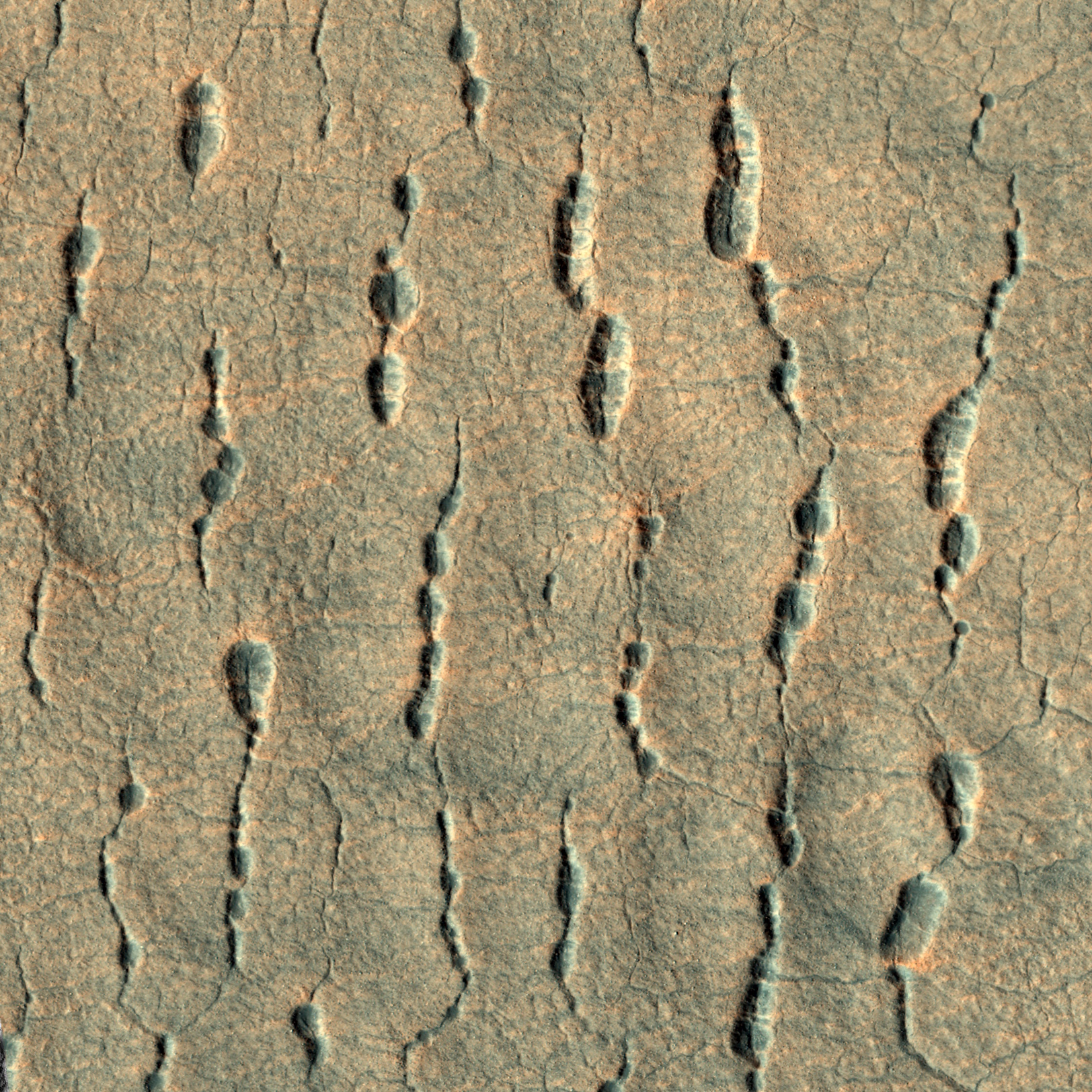
Українська: Ланцюжки кратерів на Марсі, на заході рівнини Утопія (координати центру — 44,761°N, 85,410°E). Утворилися при провалюванні ґрунту в тріщини. Знято камерою HiRISE на супутнику Mars Reconnaissance Orbiter. Ширина знімку — біля 760 м (виміряно у JMARS). Північ угорі, висота Сонця — 41°, знято з висоти 302 км. English: Chains of pit craters on Mars, in western Utopia Planitia (centered at 44.761°N, 85.410°E). Taken by camera HiRISE on Mars Reconnaissance Orbiter. Width of the image is about 760 m (measured in JMARS). North is up, Sun is about 41° above the horizon, height of spacecraft is 302 km. |
| Date | |
| Source | http://hirise.lpl.arizona.edu/ESP_018948_2250 (see also viewer.mars.asu.edu). Merged RGB, map-projected. Cropped and with increased brightness. |
| Author | NASA |
Licensing
[edit]
| This file is in the public domain in the United States because it was solely created by NASA. NASA copyright policy states that "NASA material is not protected by copyright unless noted". (See Template:PD-USGov, NASA copyright policy page or JPL Image Use Policy.) | ||
 |
Warnings:
|
File history
Click on a date/time to view the file as it appeared at that time.
| Date/Time | Thumbnail | Dimensions | User | Comment | |
|---|---|---|---|---|---|
| current | 03:00, 1 November 2014 | | 1,624 × 1,624 (1.22 MB) | Sneeuwschaap (talk | contribs) | User created page with UploadWizard |
You cannot overwrite this file.
File usage on Commons
There are no pages that use this file.