File:ChannelCountryFloodingCollingwoodAfterNASAToponymy.jpg
Jump to navigation
Jump to search

Size of this preview: 800 × 600 pixels. Other resolutions: 320 × 240 pixels | 640 × 480 pixels | 1,024 × 768 pixels | 1,363 × 1,022 pixels.
Original file (1,363 × 1,022 pixels, file size: 478 KB, MIME type: image/jpeg)
Captions
Captions
Add a one-line explanation of what this file represents
Summary[edit]
| Description |
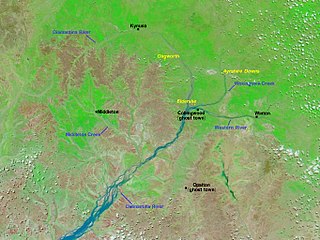
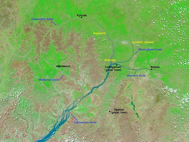
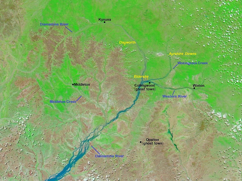
English: Image of Central West Queensland, Australia, derived from image acquired on February 18, 2009. This image uses a combination of infrared and visible light to increase the contrast between water and land. Vegetation, even sparse vegetation, appears bright green. Clouds appear sky blue. Water varies in colour from electric blue to navy. Bare ground appears pink-brown. Placenames have been added by the uploader. Those in yellow are homesteads on stations (pastoral properties). This image is centred at roughly -22.36, 142.16 and north is at the top. The distance between Collingwood and Middleton is roughly 102 km. |
| Date | |
| Source | http://earthobservatory.nasa.gov/ |
| Author | Earth Observatory |
| Other versions |
  |
Licensing[edit]
| This file is in the public domain in the United States because it was solely created by NASA. NASA copyright policy states that "NASA material is not protected by copyright unless noted". (See Template:PD-USGov, NASA copyright policy page or JPL Image Use Policy.) | ||
 |
Warnings:
|
File history
Click on a date/time to view the file as it appeared at that time.
| Date/Time | Thumbnail | Dimensions | User | Comment | |
|---|---|---|---|---|---|
| current | 05:31, 16 September 2017 | | 1,363 × 1,022 (478 KB) | Kelisi (talk | contribs) | == {{int:filedesc}} == {{Information |Description ={{en|1=Image of Northwest Queensland and the Northern Territory, Australia, derived from image acquired on February 18, 2009. This image uses a combination of infrared and visible light to increase... |
You cannot overwrite this file.
File usage on Commons
The following page uses this file:
File usage on other wikis
The following other wikis use this file:
- Usage on en.wikipedia.org
- Usage on es.wikipedia.org