File:Charles William Meredith van de Velde, Map of the Holy Land 01 (FL199992294 2369094).jpg
Jump to navigation
Jump to search

Size of this preview: 706 × 600 pixels. Other resolutions: 283 × 240 pixels | 565 × 480 pixels | 904 × 768 pixels | 1,206 × 1,024 pixels | 2,411 × 2,048 pixels | 7,120 × 6,048 pixels.
Original file (7,120 × 6,048 pixels, file size: 15.29 MB, MIME type: image/jpeg)
Captions
Captions
Add a one-line explanation of what this file represents
Summary[edit]
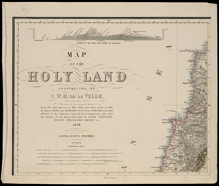
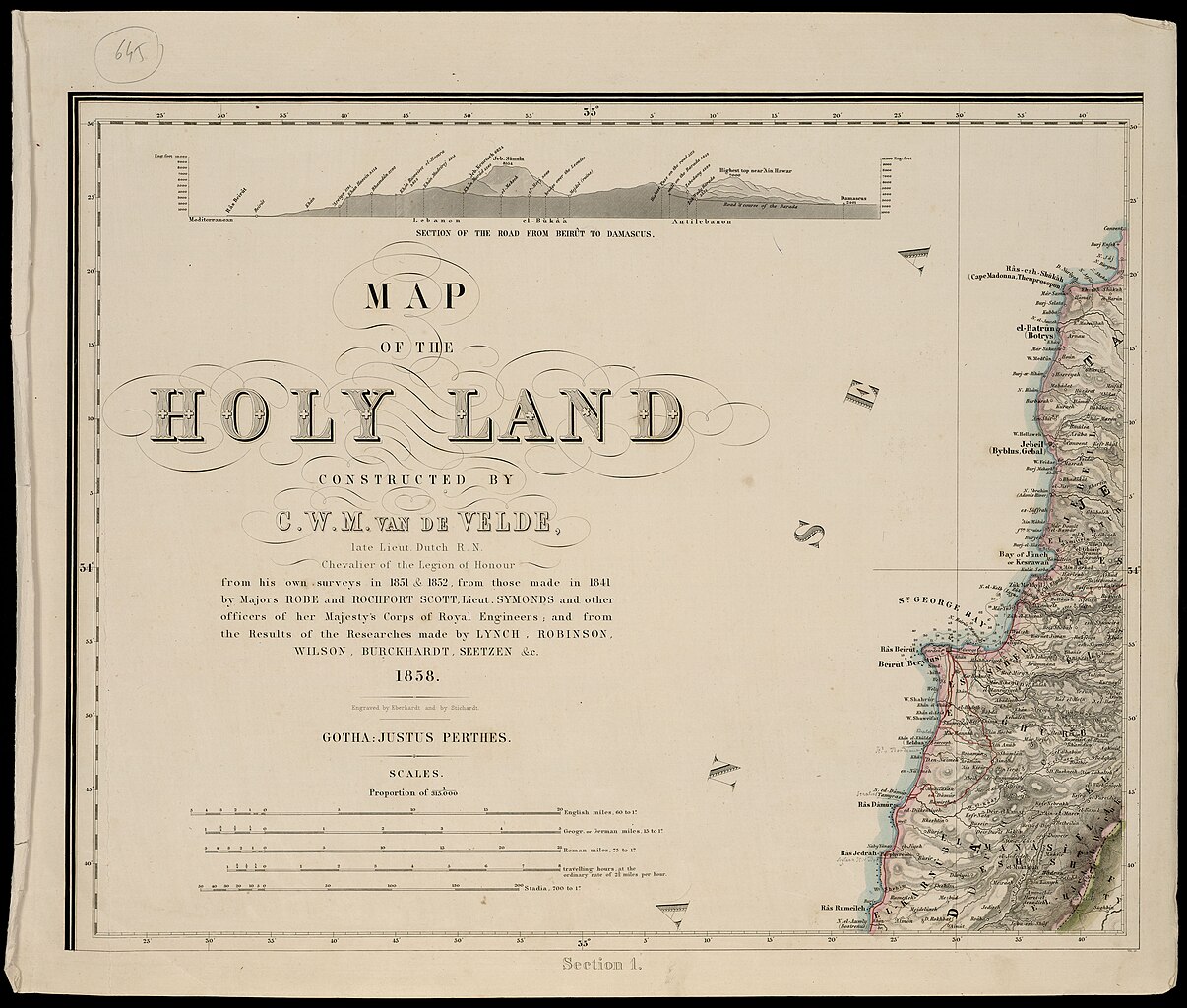
| Charles William Meredith van de Velde: Map of the Holy Land
( |
||||||||||||||||||||||||
|---|---|---|---|---|---|---|---|---|---|---|---|---|---|---|---|---|---|---|---|---|---|---|---|---|
| Artist |
| |||||||||||||||||||||||
| Contributors | Eberhardt, H., engraver Stichardt, H. | |||||||||||||||||||||||
| Title |
Map of the Holy Land |
|||||||||||||||||||||||
| Publisher |
Justus Perthes |
|||||||||||||||||||||||
| Description |
Map of the Holy Land. constructed by C.W.M. Van de Velde... from his own surveys in 1851 & 1852, from those made in 1841 by Majors Robe and Rochfort Scott, Lieut. Symonds... and from the Results of the Researches made by Lynch, Robinson, Wilson, Burckhardt, Seetzen & c. Engraved by Eberhardt and by Stichardt. |
|||||||||||||||||||||||
| Language | English | |||||||||||||||||||||||
| Publication date | 1858 | |||||||||||||||||||||||
| Medium | Eight sections, each 336x630 mm. | |||||||||||||||||||||||
| Collection |
|
|||||||||||||||||||||||
| Current location |
|
|||||||||||||||||||||||
| Place of publication | Gotha | |||||||||||||||||||||||
| search Merhav catalog | Gotha | |||||||||||||||||||||||
| Notes | Two insets: Map of the environs of Jerusalem, in section 6; Plan of Jerusalem in section 8; 1st edition of this map. Published together with the author's Memoir to accompany the map of the Holy Land, Gotha, Justus perthes, 1858 | |||||||||||||||||||||||
| scale | 1:315,000 cm | |||||||||||||||||||||||
| IE PID | IE199992292 | |||||||||||||||||||||||
| Rosetta filename | FL199992294 | |||||||||||||||||||||||
| NNL item ID (P3959) | 990023690940205171 | |||||||||||||||||||||||
| search Merhav catalog | English, Charles William Meredith van de Velde | |||||||||||||||||||||||
| search Merhav catalog | Justus Perthes | |||||||||||||||||||||||
| Source/Photographer |
|
|||||||||||||||||||||||
| Other versions | ||||||||||||||||||||||||
| Jpg / Tif version |
|
|||||||||||||||||||||||


.jpg)

.jpg&action=edit§ion=1)
Licensing[edit]
.jpg&action=edit§ion=2)
The copyright situation of this work is theoretically uncertain, because in the country of origin copyright lasts 70 years after the death of the author, and the date of the author's death is unknown. However, the date of creation of the work was over 120 years ago, and it is thus a reasonable assumption that the copyright has expired (see here for the community discussion). Do not use this template if the date of death of the author is known.
| |
| This file has been identified as being free of known restrictions under copyright law, including all related and neighboring rights. | |
File history
Click on a date/time to view the file as it appeared at that time.
| Date/Time | Thumbnail | Dimensions | User | Comment | |
|---|---|---|---|---|---|
| current | 01:21, 29 July 2023 | | 7,120 × 6,048 (15.29 MB) | Geagea (talk | contribs) | pattypan 22.03 |
You cannot overwrite this file.
File usage on Commons
The following page uses this file:
.jpg&oldid=854632507)