File:Chickamauga park map with elevations 1896.jpg
Jump to navigation
Jump to search

Size of this preview: 396 × 599 pixels. Other resolutions: 158 × 240 pixels | 317 × 480 pixels | 507 × 768 pixels | 676 × 1,024 pixels | 1,353 × 2,048 pixels | 6,479 × 9,806 pixels.
Original file (6,479 × 9,806 pixels, file size: 16.92 MB, MIME type: image/jpeg)
Captions
Captions
Add a one-line explanation of what this file represents
| Warning | The original file is very high-resolution. It might not load properly or could cause your browser to freeze when opened at full size. |
|---|
| Description |
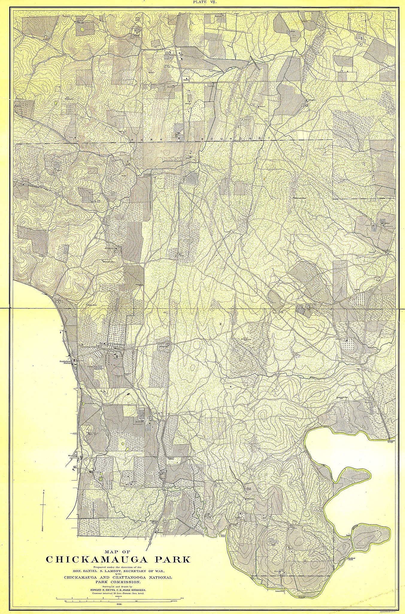
English: Chickamauga and Chattanooga National Military Park Map with elevations. Prepared under the direction of Daniel Lamont, Secretary of War by the Chickamauga and Chattanooga National Park Commission. Compiled and drawn by Edward E. Betts, Park Engineer. 1896.
|
||||||
| Date | |||||||
| Source | http://memory.loc.gov/gmd//gmd392m/g3922m/g3922cm/gcw0160000/ca000011.jp2 | ||||||
| Author | United States Government | ||||||
| Permission (Reusing this file) |
|
||||||

| Camera location | | View this and other nearby images on: OpenStreetMap |
|---|
| This is a retouched picture, which means that it has been digitally altered from its original version. Modifications: Converted from Jpeg2000, Photoshop color curve 150-255 to remove yellowing of paper, sharpened.
|
File history
Click on a date/time to view the file as it appeared at that time.
| Date/Time | Thumbnail | Dimensions | User | Comment | |
|---|---|---|---|---|---|
| current | 22:13, 1 September 2009 | | 6,479 × 9,806 (16.92 MB) | J JMesserly (talk | contribs) | {{Information |description= {{en| Chickamauga and Chattanooga National Military Park Map with elevations. Prepared under the direction of Daniel Lamont, Secretary of War by the Chickamauga and Chattanooga National Park Commission. Compiled and drawn by |
You cannot overwrite this file.
File usage on Commons
There are no pages that use this file.