File:Chiusella location map.jpg
Jump to navigation
Jump to search
Size of this preview: 800 × 574 pixels. Other resolutions: 320 × 229 pixels | 640 × 459 pixels | 940 × 674 pixels.
Original file (940 × 674 pixels, file size: 327 KB, MIME type: image/jpeg)
Captions
Captions
Add a one-line explanation of what this file represents
Summary[edit]
| Description |
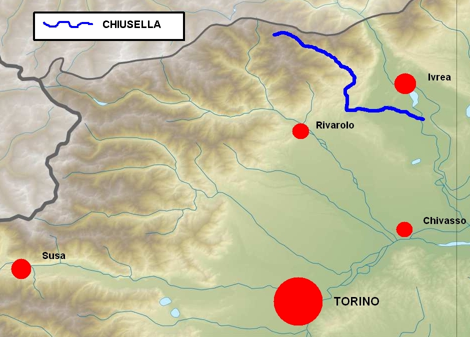
Italiano: Posizione del torrente nella provincia di Torino English: Chiusella position within Turin province (NW Italy) |
| Date | |
| Source | Own work |
| Author | F Ceragioli |
| This is a retouched picture, which means that it has been digitally altered from its original version. Modifications: Added river position. The original can be viewed here: Piemonte relief location map.jpg:
|
Licensing[edit]
I, the copyright holder of this work, hereby publish it under the following license:
This file is licensed under the Creative Commons Attribution-Share Alike 3.0 Unported license.
- You are free:
- to share – to copy, distribute and transmit the work
- to remix – to adapt the work
- Under the following conditions:
- attribution – You must give appropriate credit, provide a link to the license, and indicate if changes were made. You may do so in any reasonable manner, but not in any way that suggests the licensor endorses you or your use.
- share alike – If you remix, transform, or build upon the material, you must distribute your contributions under the same or compatible license as the original.
File history
Click on a date/time to view the file as it appeared at that time.
| Date/Time | Thumbnail | Dimensions | User | Comment | |
|---|---|---|---|---|---|
| current | 20:39, 16 January 2013 | | 940 × 674 (327 KB) | F Ceragioli (talk | contribs) | User created page with UploadWizard |
You cannot overwrite this file.
File usage on Commons
There are no pages that use this file.
File usage on other wikis
The following other wikis use this file: