File:Christmas 1969 nor'easter snowfall map.jpg
跳转到导航
跳转到搜索
本预览的尺寸:776 × 600像素。 其他分辨率:311 × 240像素 | 621 × 480像素 | 994 × 768像素 | 1,056 × 816像素。
原始文件 (1,056 × 816像素,文件大小:524 KB,MIME类型:image/jpeg)
说明
说明
添加一行文字以描述该文件所表现的内容
| 描述 |
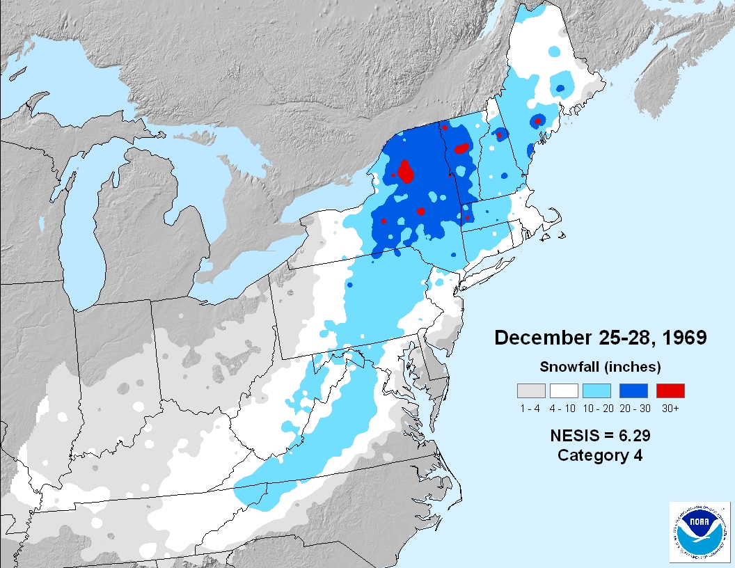
English: Snowfall map of the Christmas 1969 nor'easter. |
|||
| 来源 | http://www1.ncdc.noaa.gov/pub/data/cmb/images/snow/nesis/19691225-19691228-6.29.jpg | |||
| 作者 | National Climatic Data Center | |||
| 授权 (二次使用本文件) |
|
文件历史
点击某个日期/时间查看对应时刻的文件。
| 日期/时间 | 缩略图 | 大小 | 用户 | 备注 | |
|---|---|---|---|---|---|
| 当前 | 2011年1月7日 (五) 15:21 | | 1,056 × 816(524 KB) | Juliancolton(留言 | 贡献) | {{Information |Description={{en|1=Snowfall map of the Christmas 1969 nor'easter.}} |Source=http://www1.ncdc.noaa.gov/pub/data/cmb/images/snow/nesis/19691225-19691228-6.29.jpg |Author=National Climatic Data Center |Date= |Permission={{PD-USGov-NOAA}} |othe |
您不可以覆盖此文件。
文件用途
没有页面使用本文件。
全域文件用途
以下其他wiki使用此文件:
- en.wikipedia.org上的用途
- www.wikidata.org上的用途
- zh.wikipedia.org上的用途