File:Claes Janszoon Visscher II, Geographische beschrijvinge van t'Beloofde-Landt Canaan, doorwandelt vanJesu Christo neffens syne Apostelen van nieus gecorigeert ende seer verbeetert (FL199992154 2369105).jpg
Jump to navigation
Jump to search

Size of this preview: 800 × 584 pixels. Other resolutions: 320 × 234 pixels | 640 × 467 pixels | 1,024 × 748 pixels | 1,280 × 935 pixels | 2,560 × 1,869 pixels | 8,392 × 6,128 pixels.
Original file (8,392 × 6,128 pixels, file size: 31.6 MB, MIME type: image/jpeg)
Captions
Captions
Add a one-line explanation of what this file represents
Summary
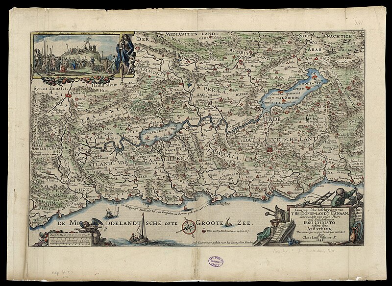
[edit]| Claes Janszoon Visscher II: Geographische beschrijvinge van t'Beloofde-Landt Canaan, doorwandelt vanJesu Christo neffens syne Apostelen van nieus gecorigeert ende seer verbeetert
( |
||||||||||||||||||||||||
|---|---|---|---|---|---|---|---|---|---|---|---|---|---|---|---|---|---|---|---|---|---|---|---|---|
| Artist |
| |||||||||||||||||||||||
| Contributors | Visscher, Claes Janssen | |||||||||||||||||||||||
| Title |
Geographische beschrijvinge van t'Beloofde-Landt Canaan, doorwandelt vanJesu Christo neffens syne Apostelen van nieus gecorigeert ende seer verbeetert |
|||||||||||||||||||||||
| Description |
Geographische beschrijvinge van t'Beloofde-Landt Canaan, doorwandelt van...Jesu Christo neffens syne Apostelen van nieus gecorigeert ende seer verbeetert. door Claes Ianss. Visscher. |
|||||||||||||||||||||||
| Language | Latin | |||||||||||||||||||||||
| Publication date | 1648 | |||||||||||||||||||||||
| Dimensions | 304 × 473 mm (11.96 × 18.62 in) | |||||||||||||||||||||||
| Collection |
|
|||||||||||||||||||||||
| Current location |
|
|||||||||||||||||||||||
| Place of publication | Amsterdam | |||||||||||||||||||||||
| search Merhav catalog | Amsterdam | |||||||||||||||||||||||
| Notes | Copperplate; From a Dutch Bible, Dese Kaert wert gestelt voor het Evangelium Matthei; Dutch text on both sides of verso: Geographische Beschryvinghe...; The map is exactly the same as the 1645 edition, only on an enlarged scale. There are minor changes in the decoration. | |||||||||||||||||||||||
| IE PID | IE199992152 | |||||||||||||||||||||||
| Rosetta filename | FL199992154 | |||||||||||||||||||||||
| NNL item ID (P3959) | 990023691050205171 | |||||||||||||||||||||||
| search Merhav catalog | Latin, Claes Janszoon Visscher II | |||||||||||||||||||||||
| search Merhav catalog | ChristianityEretz IsraelMaps | |||||||||||||||||||||||
| Source/Photographer |
|
|||||||||||||||||||||||
| Other versions | ||||||||||||||||||||||||
| Jpg / Tif version |
|
|||||||||||||||||||||||

.jpg)

.jpg&action=edit§ion=1)
Licensing
[edit].jpg&action=edit§ion=2)
The copyright situation of this work is theoretically uncertain, because in the country of origin copyright lasts 70 years after the death of the author, and the date of the author's death is unknown. However, the date of creation of the work was over 120 years ago, and it is thus a reasonable assumption that the copyright has expired (see here for the community discussion). Do not use this template if the date of death of the author is known.
| |
| This file has been identified as being free of known restrictions under copyright law, including all related and neighboring rights. | |
File history
Click on a date/time to view the file as it appeared at that time.
| Date/Time | Thumbnail | Dimensions | User | Comment | |
|---|---|---|---|---|---|
| current | 01:55, 29 July 2023 | | 8,392 × 6,128 (31.6 MB) | Geagea (talk | contribs) | pattypan 22.03 |
You cannot overwrite this file.
File usage on Commons
The following page uses this file:
.jpg&oldid=861627259)