File:Cliff's edge in Westfield.jpg
Jump to navigation
Jump to search

Size of this preview: 800 × 532 pixels. Other resolutions: 320 × 213 pixels | 640 × 426 pixels | 1,024 × 681 pixels | 1,280 × 851 pixels | 2,560 × 1,702 pixels | 6,016 × 4,000 pixels.
Original file (6,016 × 4,000 pixels, file size: 6.37 MB, MIME type: image/jpeg)
Captions
Captions
Add a one-line explanation of what this file represents
|
This is an image of a place or building that is listed on the National Register of Historic Places in the United States of America. Its reference number is 83001655. |
| Camera location | | View this and other nearby images on: OpenStreetMap |
|---|
| Description |
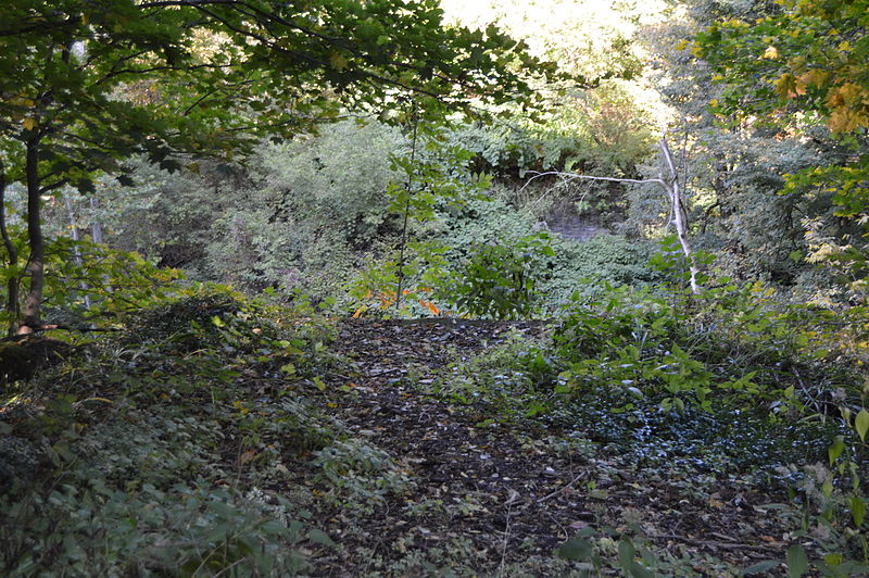
English: Overview of the site of the Rorig Bridge, which formerly carried Water Street over Chautauqua Creek in Westfield, New York, United States. Built in 1883, it was listed on the National Register of Historic Places in 1983; although destroyed, it has not yet been removed from the Register. |
||
| Date | Taken on 4 October 2014 | ||
| Source | Own work | ||
| Author | Nyttend | ||
| Permission (Reusing this file) |
|
File history
Click on a date/time to view the file as it appeared at that time.
| Date/Time | Thumbnail | Dimensions | User | Comment | |
|---|---|---|---|---|---|
| current | 01:48, 25 October 2014 | | 6,016 × 4,000 (6.37 MB) | Nyttend (talk | contribs) | {{NRHP|83001655}} {{Location|42|18|56|N|79|34|43|W}} {{Information |Description={{en|Overview of the site of the {{w|Rorig Bridge}}, which formerly carried Water Street over Chautauqua Creek in {{w|Westfield (village), New York|Westfield}}, {{w|New Yor... |
You cannot overwrite this file.
File usage on Commons
There are no pages that use this file.
File usage on other wikis
The following other wikis use this file:
- Usage on en.wikipedia.org
- Usage on www.wikidata.org