File:Clitheroe town centre - geograph.org.uk - 74167.jpg
Salta a la navegació
Salta a la cerca
Mida d'aquesta previsualització: 450 × 600 píxels. Altres resolucions: 180 × 240 píxels | 480 × 640 píxels.
Fitxer original (480 × 640 píxels, mida del fitxer: 172 Ko, tipus MIME: image/jpeg)
Llegendes
Llegendes
Afegeix una explicació d'una línia del que representa aquest fitxer
Resum[modifica]
| Descripció |
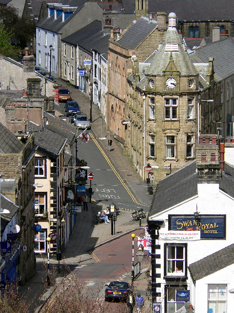
English: Clitheroe town centre. Photographed from clitheroe castle. |
| Data | |
| Font | From geograph.org.uk |
| Autor | Jon Royle |
| Reconeixement (required by the license) | Jon Royle / Clitheroe town centre / |
| Posició de la càmera | | Aquesta i altres imatges properes a: OpenStreetMap |
|---|
_&language=ca)
| Posició de l'objecte | | Aquesta i altres imatges properes a: OpenStreetMap |
|---|
_&language=ca)
Llicència[modifica]

|
Aquesta imatge prové de la col·lecció del projecte Geograph British Isles. Vegeu la pàgina d'aquesta fotografia al lloc web Geograph per a més informació del fotògraf. El titular dels drets d'autor d'aquesta imatge és Jon Royle i autoritza utilitzar-la sota la llicència Reconeixement-CompartirIgual 2.0 de Creative Commons.
|
Aquest fitxer està publicat sota la llicència de Creative Commons Reconeixement i Compartir Igual 2.0 Genèrica.
Reconeixement: Jon Royle
- Sou lliure de:
- compartir – copiar, distribuir i comunicar públicament l'obra
- adaptar – fer-ne obres derivades
- Amb les condicions següents:
- reconeixement – Heu de donar la informació adequada sobre l'autor, proporcionar un enllaç a la llicència i indicar si s'han realitzat canvis. Podeu fer-ho amb qualsevol mitjà raonable, però de cap manera no suggereixi que l'autor us dóna suport o aprova l'ús que en feu.
- compartir igual – Si modifiqueu, transformeu, o generareu amb el material, haureu de distribuir les vostres contribucions sota una llicència similar o una de compatible com l'original
Historial del fitxer
Cliqueu una data/hora per veure el fitxer tal com era aleshores.
| Data/hora | Miniatura | Dimensions | Usuari/a | Comentari | |
|---|---|---|---|---|---|
| actual | 14:18, 30 gen 2010 | | 480 × 640 (172 Ko) | GeographBot (discussió | contribucions) | == {{int:filedesc}} == {{Information |description={{en|1=Clitheroe town centre. Photographed from clitheroe castle.}} |date=2005-05-08 |source=From [http://www.geograph.org.uk/photo/74167 geograph.org.uk] |author=[http://www.geograph.org.uk/profile/3169 J |
No podeu sobreescriure aquest fitxer.
Ús del fitxer
Les 49 pàgines següents utilitzen aquest fitxer:
- Category:Alumni by school in Lancashire
- Category:Archaeological sites in Lancashire
- Category:Bridges in Lancashire
- Category:Bus stations in Lancashire
- Category:Canals in Lancashire
- Category:Cemeteries in Lancashire
- Category:Clitheroe
- Category:Deaths in Lancashire
- Category:Forests in Lancashire
- Category:Geography of Lancashire
- Category:Hospitals in Lancashire
- Category:Lancashire
- Category:Lancashire in the 17th century
- Category:Lancashire in the 1830s
- Category:Lancashire in the 1840s
- Category:Lancashire in the 1850s
- Category:Lancashire in the 1860s
- Category:Lancashire in the 1880s
- Category:Lancashire in the 1890s
- Category:Lancashire in the 18th century
- Category:Lancashire in the 1900s
- Category:Lancashire in the 1910s
- Category:Lancashire in the 1920s
- Category:Lancashire in the 1930s
- Category:Lancashire in the 1940s
- Category:Lancashire in the 1950s
- Category:Lancashire in the 1960s
- Category:Lancashire in the 1970s
- Category:Lancashire in the 1980s
- Category:Lancashire in the 1990s
- Category:Lancashire in the 19th century
- Category:Lancashire in the 2000s
- Category:Lancashire in the 2010s
- Category:Lancashire in the 20th century
- Category:Lancashire in the 21st century
- Category:Maps of Lancashire
- Category:People of Lancashire
- Category:Populated places in Lancashire
- Category:Prisons in Lancashire
- Category:Rail transport in Lancashire
- Category:Railway viaducts in Lancashire
- Category:Rivers of Lancashire
- Category:Roads in Lancashire
- Category:Sports in Lancashire
- Category:Towers in Lancashire
- Category:Views of Lancashire
- Category:Villages in Lancashire
- Category:Visitor attractions in Lancashire
- Category:Windmills in Lancashire
Ús global del fitxer
Utilització d'aquest fitxer en altres wikis:
- Utilització a ar.wikipedia.org
- Utilització a arz.wikipedia.org
- Utilització a ast.wikipedia.org
- Utilització a azb.wikipedia.org
- Utilització a az.wikipedia.org
- Utilització a ban.wikipedia.org
- Utilització a be.wikipedia.org
- Utilització a br.wikipedia.org
- Utilització a ca.wikipedia.org
- Utilització a ceb.wikipedia.org
- Utilització a cy.wikipedia.org
- Utilització a de.wikipedia.org
- Utilització a de.wikivoyage.org
- Utilització a en.wikipedia.org
- Utilització a en.wikivoyage.org
- Utilització a eo.wikipedia.org
- Utilització a es.wikipedia.org
- Utilització a fa.wikipedia.org
- Utilització a ga.wikipedia.org
- Utilització a gl.wikipedia.org
- Utilització a he.wikipedia.org
- Utilització a hu.wikipedia.org
- Utilització a ia.wikipedia.org
- Utilització a id.wikipedia.org
- Utilització a ku.wikipedia.org
- Utilització a lld.wikipedia.org
- Utilització a nn.wikipedia.org
- Utilització a no.wikipedia.org
- Utilització a os.wikipedia.org
- Utilització a ro.wikipedia.org
- Utilització a ru.wikipedia.org
- Utilització a sr.wikipedia.org
- Utilització a tg.wikipedia.org
- Utilització a tr.wikipedia.org
- Utilització a www.wikidata.org
- Utilització a zh-yue.wikipedia.org
- Utilització a zh.wikipedia.org