File:Coal Harbour Seaplane Hangar.jpg
Jump to navigation
Jump to search
Size of this preview: 800 × 600 pixels. Other resolutions: 320 × 240 pixels | 640 × 480 pixels | 1,024 × 768 pixels.
Original file (1,024 × 768 pixels, file size: 148 KB, MIME type: image/jpeg)
Captions
Captions
Add a one-line explanation of what this file represents
Summary
[edit]
| Description |
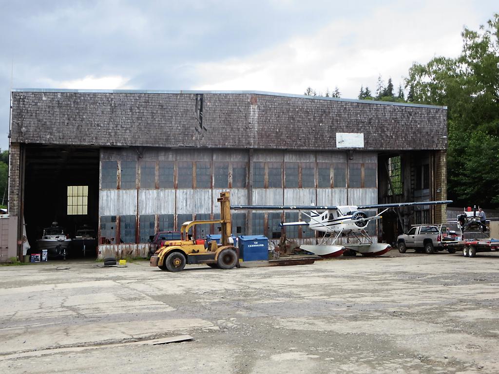
English: During World War Two this hangar at Coal Harbour on northern Vancouver Island, British Columbia, was part of a Royal Canadian Air Force seaplane base. |
| Date | Taken on 13 July 2016, 16:21:45 |
| Source | https://www.flickr.com/photos/davidstanleytravel/28635433054/ |
| Author | David Stanley |
| Camera location | | View this and other nearby images on: OpenStreetMap |
|---|
Licensing
[edit]
This file is licensed under the Creative Commons Attribution 2.0 Generic license.
- You are free:
- to share – to copy, distribute and transmit the work
- to remix – to adapt the work
- Under the following conditions:
- attribution – You must give appropriate credit, provide a link to the license, and indicate if changes were made. You may do so in any reasonable manner, but not in any way that suggests the licensor endorses you or your use.
| This image was originally posted to Flickr by D-Stanley at https://flickr.com/photos/79721788@N00/28635433054. It was reviewed on 4 September 2020 by FlickreviewR 2 and was confirmed to be licensed under the terms of the cc-by-2.0. |
File history
Click on a date/time to view the file as it appeared at that time.
| Date/Time | Thumbnail | Dimensions | User | Comment | |
|---|---|---|---|---|---|
| current | 05:38, 4 September 2020 | | 1,024 × 768 (148 KB) | Ponderosapine210 (talk | contribs) | Uploaded a work by David Stanley from https://www.flickr.com/photos/davidstanleytravel/28635433054/ with UploadWizard |
You cannot overwrite this file.
File usage on Commons
There are no pages that use this file.