File:Colombia location map.svg
跳至導覽
跳至搜尋

此 SVG 檔案的 PNG 預覽的大小:512 × 579 像素。 其他解析度:212 × 240 像素 | 424 × 480 像素 | 679 × 768 像素 | 905 × 1,024 像素 | 1,811 × 2,048 像素。
原始檔案 (SVG 檔案,表面大小:512 × 579 像素,檔案大小:1.07 MB)
說明
說明
添加單行說明來描述出檔案所代表的內容
摘要[編輯]
| 描述 |
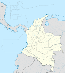
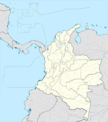
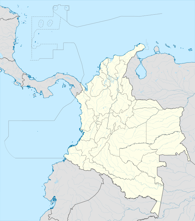
English: Location map of Colombia
Equirectangular projection. Geographic limits of the map:
|
| 日期 | |
| 來源 | 自己的作品 (Original text: own work, using Demis data) |
| 作者 | Milenioscuro |
| 其他版本 |
Derivative works of this file: Bajo Nuevo Colombia location.png
|
| SVG開發 |


.svg)

授權條款[編輯]
Milenioscuro,此作品的版權所有人,決定用以下授權條款發佈本作品:
此檔案採用創用CC 姓名標示-相同方式分享 3.0 未在地化版本授權條款。
姓名標示: Milenioscuro
- 您可以自由:
- 分享 – 複製、發佈和傳播本作品
- 重新修改 – 創作演繹作品
- 惟需遵照下列條件:
- 姓名標示 – 您必須指名出正確的製作者,和提供授權條款的連結,以及表示是否有對內容上做出變更。您可以用任何合理的方式來行動,但不得以任何方式表明授權條款是對您許可或是由您所使用。
- 相同方式分享 – 如果您利用本素材進行再混合、轉換或創作,您必須基於如同原先的相同或兼容的條款,來分布您的貢獻成品。
| 註解 | 該圖片含有註解:在維基媒體共享資源上查看註解 |


檔案歷史
點選日期/時間以檢視該時間的檔案版本。
| 日期/時間 | 縮圖 | 尺寸 | 使用者 | 備註 | |
|---|---|---|---|---|---|
| 目前 | 2022年2月22日 (二) 20:17 | | 512 × 579(1.07 MB) | Milenioscuro(留言 | 貢獻) | standard colors |
| 2017年12月1日 (五) 11:10 |  | 2,027 × 2,294(1.37 MB) | Milenioscuro(留言 | 貢獻) | limits | |
| 2017年12月1日 (五) 11:00 |  | 2,027 × 2,294(1.37 MB) | Milenioscuro(留言 | 貢獻) | more visible limits | |
| 2014年1月28日 (二) 05:48 |  | 2,027 × 2,294(1.39 MB) | Milenioscuro(留言 | 貢獻) | correction of departamental, international and maritime boundaries, courses of rivers, coastline, and line thickness | |
| 2012年5月29日 (二) 17:01 |  | 2,007 × 2,298(1.07 MB) | Milenioscuro(留言 | 貢獻) | correction of some departamental borders | |
| 2012年3月26日 (一) 18:58 |  | 2,007 × 2,298(1.08 MB) | Milenioscuro(留言 | 貢獻) | correction of international borders, added layers, rivers, etc | |
| 2011年11月17日 (四) 08:12 |  | 2,007 × 2,298(1.04 MB) | Milenioscuro(留言 | 貢獻) | simplification of rivers, correction of some borders | |
| 2009年11月2日 (一) 23:48 |  | 2,007 × 2,298(1.14 MB) | Milenioscuro(留言 | 貢獻) | thick boundaries of departments | |
| 2009年11月1日 (日) 09:10 |  | 2,007 × 2,298(1.15 MB) | Milenioscuro(留言 | 貢獻) | Adjusted to match style of location maps 2008 | |
| 2009年10月26日 (一) 07:30 |  | 2,268 × 2,676(1.4 MB) | Milenioscuro(留言 | 貢獻) | maritime boundaries |
無法覆蓋此檔案。
檔案用途
超過 100 個頁面有用到此檔案。 下列清單只列出前 100 筆有用到此檔案的頁面。 您也可以檢視完整清單。
- User talk:NordNordWest/Archive
- File:Amazonas in Colombia.svg
- File:Amazonas in Colombia (mainland).svg
- File:Antioquia in Colombia.svg
- File:Antioquia in Colombia (mainland).svg
- File:Arauca in Colombia.svg
- File:Arauca in Colombia (mainland).svg
- File:Atlantico in Colombia.svg
- File:Atlantico in Colombia (mainland).svg
- File:Atlantico in Colombia (special marker).svg
- File:Atlantico in Colombia (special marker) (mainland).svg
- File:Bajo Nuevo Bank in United States (US48).svg
- File:Bajo Nuevo Bank in United States (US48+2).svg
- File:Bajo Nuevo Bank in United States (US49).svg
- File:Bajo Nuevo Bank in United States (US49+1).svg
- File:Bajo Nuevo Colombia location.png
- File:Bolivar in Colombia.svg
- File:Bolivar in Colombia (mainland).svg
- File:Boyaca in Colombia.svg
- File:Boyaca in Colombia (mainland).svg
- File:Caldas in Colombia.svg
- File:Caldas in Colombia (mainland).svg
- File:Capital District in Colombia.svg
- File:Capital District in Colombia (mainland).svg
- File:Capital District in Colombia (special marker).svg
- File:Capital District in Colombia (special marker) (mainland).svg
- File:Caqueta in Colombia.svg
- File:Caqueta in Colombia (mainland).svg
- File:Casanare in Colombia.svg
- File:Casanare in Colombia (mainland).svg
- File:Cauca in Colombia.svg
- File:Cauca in Colombia (mainland).svg
- File:Cesar in Colombia.svg
- File:Cesar in Colombia (mainland).svg
- File:Choco in Colombia.svg
- File:Choco in Colombia (mainland).svg
- File:Colombia, administrative divisions - Nmbrs - colored.svg
- File:Colombia, administrative divisions - Nmbrs - colored (+box).svg
- File:Colombia, administrative divisions - Nmbrs - colored (cropped).svg
- File:Colombia, administrative divisions - Nmbrs - monochrome.svg
- File:Colombia, administrative divisions - Nmbrs - monochrome (+box).svg
- File:Colombia, administrative divisions - Nmbrs - monochrome (cropped).svg
- File:Colombia, administrative divisions - de - colored.svg
- File:Colombia, administrative divisions - de - colored (+box).svg
- File:Colombia, administrative divisions - de - colored (cropped).svg
- File:Colombia, administrative divisions - de - monochrome.svg
- File:Colombia, administrative divisions - de - monochrome (+box).svg
- File:Colombia, administrative divisions - de - monochrome (cropped).svg
- File:Colombia Mapa Oficial.svg
- File:Colombia adm location map (colored).svg
- File:Colombia location map2.svg
- File:Colombia relief location map.jpg
- File:Cordoba in Colombia.svg
- File:Cordoba in Colombia (mainland).svg
- File:Cundinamarca in Colombia.svg
- File:Cundinamarca in Colombia (mainland).svg
- File:Flag of the FARC-EP.svg
- File:Guainia in Colombia.svg
- File:Guainia in Colombia (mainland).svg
- File:Guaviare in Colombia.svg
- File:Guaviare in Colombia (mainland).svg
- File:Huila in Colombia.svg
- File:Huila in Colombia (mainland).svg
- File:La Guajira in Colombia.svg
- File:La Guajira in Colombia (mainland).svg
- File:Magdalena in Colombia.svg
- File:Magdalena in Colombia (mainland).svg
- File:Mapa del Caribe (límites marinos).svg
- File:Meta in Colombia.svg
- File:Meta in Colombia (mainland).svg
- File:Narino in Colombia.svg
- File:Narino in Colombia (mainland).svg
- File:Norte de Santander in Colombia.svg
- File:Norte de Santander in Colombia (mainland).svg
- File:Putumayo in Colombia.svg
- File:Putumayo in Colombia (mainland).svg
- File:Quindio in Colombia.svg
- File:Quindio in Colombia (mainland).svg
- File:Quindio in Colombia (special marker).svg
- File:Quindio in Colombia (special marker) (mainland).svg
- File:Risaralda in Colombia.svg
- File:Risaralda in Colombia (mainland).svg
- File:Risaralda in Colombia (special marker).svg
- File:Risaralda in Colombia (special marker) (mainland).svg
- File:San Andres and Providencia in Colombia.svg
- File:San Andres and Providencia in Colombia (special marker).svg
- File:Santander in Colombia.svg
- File:Santander in Colombia (mainland).svg
- File:Serranilla Bank in United States (US48).svg
- File:Serranilla Bank in United States (US48+2).svg
- File:Serranilla Bank in United States (US49).svg
- File:Serranilla Bank in United States (US49+1).svg
- File:Sucre in Colombia.svg
- File:Sucre in Colombia (mainland).svg
- File:Tolima in Colombia.svg
- File:Tolima in Colombia (mainland).svg
- File:Valle del Cauca in Colombia.svg
- File:Valle del Cauca in Colombia (mainland).svg
- File:Vaupes in Colombia.svg
- File:Vaupes in Colombia (mainland).svg
.svg)
.svg)
.svg)
.svg)
.svg)
_(mainland).svg)
.svg)
.svg)
.svg)
.svg)
.svg)
.svg)
.svg)
.svg)
.svg)
_(mainland).svg)
.svg)
.svg)
.svg)
.svg)
.svg)
.svg)
.svg)
.svg)
.svg)
.svg)
.svg)
.svg)
.svg)
.svg)
.svg)
.svg)
.svg)
.svg)
.svg)
.svg)
.svg)
.svg)
.svg)
.svg)
.svg)
.svg)
.svg)
_(mainland).svg)
.svg)
.svg)
_(mainland).svg)
.svg)
.svg)
.svg)
.svg)
.svg)
.svg)
.svg)
.svg)
.svg)
.svg)
檢視連結到這個檔案的更多連結。
全域檔案使用狀況
以下其他 wiki 使用了這個檔案:
- af.wikipedia.org 的使用狀況
- als.wikipedia.org 的使用狀況
- an.wikipedia.org 的使用狀況
- ar.wikipedia.org 的使用狀況
- ast.wikipedia.org 的使用狀況
- Bogotá
- Cali
- Estadiu Doce de Octubre
- Puerto Colombia (Guainía)
- González (Cesar)
- Estadiu Deportivo Cali
- Módulu:Mapa de llocalización/datos/Colombia
- Ríu Magdalena
- Capitoliu Nacional de Colombia
- Comisión Colombiana del Espaciu
- Nevado del Ruiz
- Módulu:Mapa de llocalización/datos/Colombia/usu
- Barranquilla
- Cartagena de Indias
- Estadiu Metropolitanu Roberto Meléndez
- Palenque de San Basilio
- Copa América 2001
- Sierra de Chiribiquete
- Inírida
- Aeropuertu Internacional El Dorado
- Casa d'Adoración Norte del Cauca
- Aeropuertu Guaymaral
- Aeropuertu Internacional Alfonso Bonilla Aragón
- Aeropuertu Internacional Alfredo Vásquez Cobo
- Aeropuertu Internacional Camilo Daza
- Aeropuertu Internacional El Edén
- Aeropuertu Internacional Ernesto Cortissoz
- Aeropuertu Internacional Gustavo Rojas Pinilla
- Aeropuertu Internacional José María Córdova
- Aeropuertu Internacional Matecaña
檢視此檔案的更多全域使用狀況。