File:Colonisation 1885.png

Fichièr d'origina (1 200 × 526 pixèl, talha del fichièr: 206 Ko, tipe MIME: image/png)
Llegendes
Llegendes
| Descripcion |
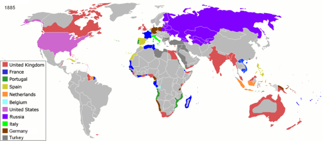
Map of major world powers by year, derived from public domain animated map on wikipedia.
As the orriginal licence of the animation was Public Domain, this image which has been derived from it is too:
|
||||||||||||||||||
| Data | |||||||||||||||||||
| Font | public domain animated map by ArdadN here | ||||||||||||||||||
| Autor | ArdadN | ||||||||||||||||||
.jpg)
._LOC_2001620596.jpg)

|
Aquesta imatge (de tipus historical map) s'hauria de tornar a crear utilitzant gràfics vectorials com ara un fitxer SVG. Això té diversos avantatges; en trobareu més informació a Commons:Media for cleanup. Si ja disposeu d'una versió d'aquesta imatge en format SVG, us preguem que la pengeu; després, reemplaceu aquesta plantilla amb la plantilla {{Vector version available|nom nou de la imatge.svg}} en aquesta imatge.
|
Istoric del fichièr
Clicar sus una data e una ora per veire lo fichièr tal coma èra a aqueste moment
| Data e ora | Miniatura | Dimensions | Utilizaire | Comentari | |
|---|---|---|---|---|---|
| actual | 8 novembre de 2021 a 09.05 | | 1 200 × 526 (206 Ko) | Randomastwritter (discussion | contribucions) | jubaland |
| 5 abril de 2020 a 09.52 |  | 1 200 × 526 (206 Ko) | Ориенталист (discussion | contribucions) | South Sakhalin was part of Russia in 1885 | |
| 2 mai de 2015 a 11.17 |  | 1 425 × 625 (49 Ko) | Chrischerf (discussion | contribucions) | German Empire and colonies in 1885; Sudan under control of the Mahdi | |
| 3 agost de 2014 a 02.57 |  | 1 425 × 625 (54 Ko) | Alvin Lee (discussion | contribucions) | correcting the boundaries of Russia and China | |
| 3 novembre de 2013 a 13.54 |  | 1 425 × 625 (78 Ko) | McZusatz (discussion | contribucions) | Reverted to version as of 00:22, 24 January 2011 [corrupt file?] | |
| 3 novembre de 2012 a 15.24 |  | 1 425 × 625 (67 Ko) | Franco310397 (discussion | contribucions) | Spanish presence in Micronesia (Oceania) included in the Captaincy General of the Philippines. In the Caroline Islands and the Mariana Islands. | |
| 24 genièr de 2011 a 00.22 |  | 1 425 × 625 (78 Ko) | Micsha~commonswiki (discussion | contribucions) | Reverted to version as of 02:17, 3 May 2010 | |
| 24 genièr de 2011 a 00.22 |  | 506 × 326 (85 Ko) | Micsha~commonswiki (discussion | contribucions) | Only Africa; includes map key | |
| 3 mai de 2010 a 02.17 |  | 1 425 × 625 (78 Ko) | Kieran4 (discussion | contribucions) | slight edit | |
| 3 mai de 2010 a 02.14 |  | 1 425 × 625 (78 Ko) | Kieran4 (discussion | contribucions) | Correct Dutch East INdies |
Podètz pas remplaçar aqueste fichièr.
Paginas que contenon lo fichièr
Las paginas çaijós compòrtan aqueste imatge :
Usatge global del fichièr
Los autres wikis seguents utilizan aqueste imatge :
- Utilizacion sus am.wikipedia.org
- Utilizacion sus de.wikipedia.org
- Utilizacion sus en.wikipedia.org
- Utilizacion sus es.wikipedia.org
- Utilizacion sus fr.wikipedia.org
- Utilizacion sus he.wikipedia.org
- Utilizacion sus oc.wikipedia.org
- Utilizacion sus sk.wikipedia.org