File:Confluence of Coyote Creek and San Gabriel River, Long Beach, California, on Approach to Long Beach Airport (6013277245) crop.jpg
Jump to navigation
Jump to search
Size of this preview: 800 × 570 pixels. Other resolutions: 320 × 228 pixels | 640 × 456 pixels | 1,024 × 730 pixels | 1,280 × 912 pixels | 2,560 × 1,825 pixels | 3,805 × 2,712 pixels.
Original file (3,805 × 2,712 pixels, file size: 5.32 MB, MIME type: image/jpeg)
Captions
Captions
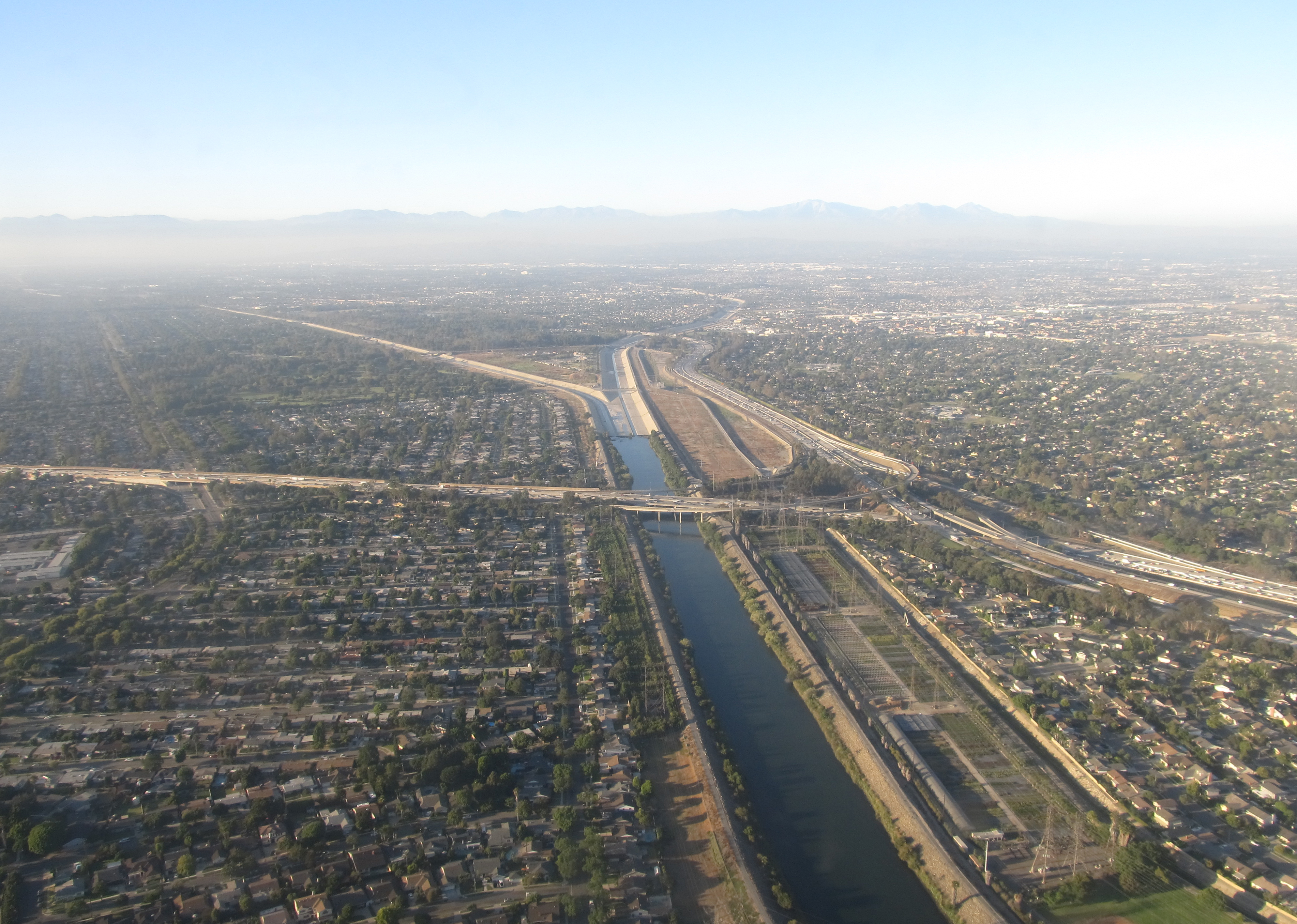
San Gabriel River in Los Alamitos, near its confluence with Coyote Creek
Summary
[edit]| Description |
English: Cropped and rotated original file, also removed plane window smudge.
Original file description: Coyote Creek is a principal tributary of the San Gabriel River in northwest Orange County, southeast Los Angeles County, and southwest Riverside County in the U.S. state of California. It drains a land area of roughly 41.3 square miles (107 km2) covering five major cities, including Brea, Buena Park, Fullerton, La Habra, and La Palma. Some major tributaries of the creek in the highly urbanized watershed include Brea Creek, Fullerton Creek and Carbon Creek. The mostly flat creek basin is separated by a series of low mountains, and is bounded by several small mountain ranges, including the Chino Hills, Puente Hills and West Coyote Hills. |
| Date | |
| Source | cropped from Flickr version: https://www.flickr.com/photos/kenlund/6013277245 File:Confluence of Coyote Creek and San Gabriel River, Long Beach, California, on Approach to Long Beach Airport (6013277245).jpg |
| Author | Ken Lund from Reno, Nevada, USA |
| Other versions |
.jpg)
_crop.jpg&action=edit§ion=1)
Licensing
[edit]_crop.jpg&action=edit§ion=2)
This file is licensed under the Creative Commons Attribution-Share Alike 2.0 Generic license.
- You are free:
- to share – to copy, distribute and transmit the work
- to remix – to adapt the work
- Under the following conditions:
- attribution – You must give appropriate credit, provide a link to the license, and indicate if changes were made. You may do so in any reasonable manner, but not in any way that suggests the licensor endorses you or your use.
- share alike – If you remix, transform, or build upon the material, you must distribute your contributions under the same or compatible license as the original.
| This image, originally posted to Flickr, was reviewed on 19:15, 18 March 2016 (UTC) by the administrator or reviewer ww2censor, who confirmed that it was available on Flickr under the stated license on that date. |
File history
Click on a date/time to view the file as it appeared at that time.
| Date/Time | Thumbnail | Dimensions | User | Comment | |
|---|---|---|---|---|---|
| current | 17:01, 18 March 2016 | | 3,805 × 2,712 (5.32 MB) | Shannon1 (talk | contribs) | {{Information |Description ={{en|1=Cropped and rotated original file, also removed plane window smudge. Original file description: Coyote Creek is a principal tributary of the San Gabriel River in northwest Orange County, southeast Los Angeles Coun... |
You cannot overwrite this file.
File usage on Commons
The following page uses this file:
File usage on other wikis
The following other wikis use this file:
- Usage on en.wikipedia.org
- Usage on fr.wikipedia.org
_crop.jpg&oldid=874265962)