File:CongressOwnMap.jpg
Jump to navigation
Jump to search
Size of this preview: 733 × 599 pixels. Other resolutions: 294 × 240 pixels | 587 × 480 pixels | 851 × 696 pixels.
Original file (851 × 696 pixels, file size: 83 KB, MIME type: image/jpeg)
Captions
Captions
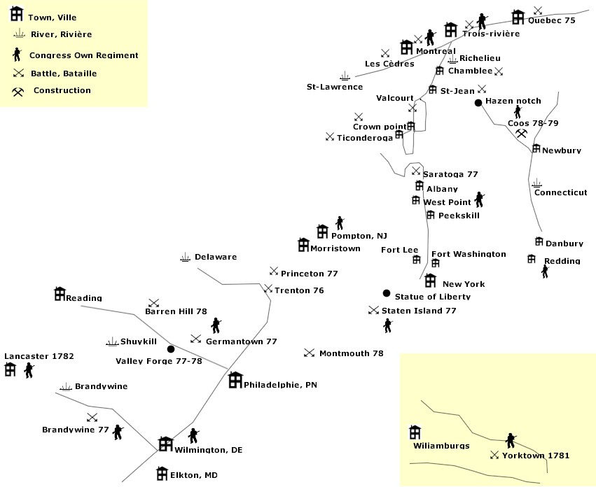
Visual representation of general relative locations of major events of the unit through the war. Not to scale, though maintains some geographic relations between locations.
Summary
[edit]
| Description | Carte schématique pour expliquer les déplacements d'un régiment. Cette carte n'est pas à l'échelle et n'est pas forcément exacte. Elle vient seulement illustrer un site autrement difficile à comprendre. |
| Date | 4 March 2007 (original upload date) |
| Source | No machine-readable source provided. Own work assumed (based on copyright claims). |
| Author | No machine-readable author provided. Imagewikipedia assumed (based on copyright claims). |
Licensing
[edit]
| I, the copyright holder of this work, release this work into the public domain. This applies worldwide. In some countries this may not be legally possible; if so: I grant anyone the right to use this work for any purpose, without any conditions, unless such conditions are required by law. |
File history
Click on a date/time to view the file as it appeared at that time.
| Date/Time | Thumbnail | Dimensions | User | Comment | |
|---|---|---|---|---|---|
| current | 20:45, 4 March 2007 | | 851 × 696 (83 KB) | Imagewikipedia (talk | contribs) | Carte shématique pour expliquer les déplacements d'un régiment Cette carte n'est pas à l'échelle et n'est pas forcément exacte Elle vient illustrée un site autrement difficile à comprendre |
You cannot overwrite this file.
File usage on Commons
There are no pages that use this file.
File usage on other wikis
The following other wikis use this file:
- Usage on en.wikipedia.org
- Usage on fr.wikipedia.org
- Usage on it.wikipedia.org
- Usage on ja.wikipedia.org