File:Contarini map western detail.jpg
Jump to navigation
Jump to search
No higher resolution available.
Contarini_map_western_detail.jpg (427 × 323 pixels, file size: 110 KB, MIME type: image/jpeg)
Captions
Captions
Add a one-line explanation of what this file represents
Summary
[edit]
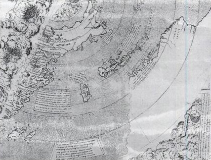
| Description | The Contarini map (1506), first printed map showing the Americas; detail showing Cuba, Zipangu (Japan), and Asia |
| Date | Map created 1506; jpeg image creation unknown; uploaded 13 October 2006 |
| Source | John Allen, North American Exploration, page 300, via Google Books |
| Author | Map created by Giovanni Matteo Contarini; file author unknown |
| Permission (Reusing this file) |
none; reproduction of a public domain work |
Licensing
[edit]
|
This work is in the public domain in its country of origin and other countries and areas where the copyright term is the author's life plus 70 years or fewer. | |
| This file has been identified as being free of known restrictions under copyright law, including all related and neighboring rights. | |
File history
Click on a date/time to view the file as it appeared at that time.
| Date/Time | Thumbnail | Dimensions | User | Comment | |
|---|---|---|---|---|---|
| current | 03:31, 14 October 2006 | | 427 × 323 (110 KB) | Gribeco (talk | contribs) | {{Information |Description=The Contarini map (1506), first printed map showing the Americas; detail showing Cuba, Zipangu (Japan), and Asia |Source=John Allen, ''North American Exploration'', page 300, via Google Books |Date=Map created 1506; jpeg image c |
You cannot overwrite this file.
File usage on Commons
There are no pages that use this file.
File usage on other wikis
The following other wikis use this file:
- Usage on de.wikipedia.org
- Usage on fr.wikipedia.org
- Usage on it.wikipedia.org
- Usage on ru.wikipedia.org
- Usage on uk.wikipedia.org