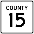
File:County 15 square.svg
Une page de Wikimedia Commons, la médiathèque libre.
Aller à la navigation
Aller à la recherche
- Fichier
- Historique du fichier
- Utilisations locales du fichier
- Utilisations du fichier sur d’autres wikis
- Métadonnées

Taille de cet aperçu PNG pour ce fichier SVG : 600 × 600 pixels. Autres résolutions : 240 × 240 pixels | 480 × 480 pixels | 768 × 768 pixels | 1 024 × 1 024 pixels | 2 048 × 2 048 pixels.
Fichier d’origine (Fichier SVG, nominalement de 600 × 600 pixels, taille : 6 kio)
Informations sur le fichier
Données structurées
Légendes
Légendes
Ajoutez en une ligne la description de ce que représente ce fichier
Description
[modifier]| DescriptionCounty 15 square.svg | Square county route marker as seen on guide signs in Minnesota |
| Date | |
| Source | Travail personnel |
| Auteur | Fredddie |
Conditions d’utilisation
[modifier]| Public domainPublic domainfalsefalse |
This file is in the public domain because it comes from the Minnesota Manual on Uniform Traffic Control Devices, sign number M1-X4a, which states specifically in its introduction, on page iii that:
|
 |
Historique du fichier
Cliquer sur une date et heure pour voir le fichier tel qu'il était à ce moment-là.
| Date et heure | Vignette | Dimensions | Utilisateur | Commentaire | |
|---|---|---|---|---|---|
| actuel | 8 septembre 2017 à 07:17 |  | 600 × 600 (6 kio) | HWY Shield Bot (d | contributions) | == {{int:filedesc}} == {{Information |Description={{en|1=Minnesota county highway shield}} |Source=File:County 00 square template.svg |Date={{subst:VI-time}} |Author=Minnesota Department of Transportation<br />Template: {{user|Fredddie}}<br />Fil... |
| 12 juin 2014 à 17:48 |  | 601 × 601 (9 kio) | Fredddie (d | contributions) | ||
| 12 juin 2014 à 17:32 |  | 601 × 601 (8 kio) | Fredddie (d | contributions) |
Vous ne pouvez pas remplacer ce fichier.
Utilisations locales du fichier
Les 2 pages suivantes utilisent ce fichier :
Utilisations du fichier sur d’autres wikis
Les autres wikis suivants utilisent ce fichier :
- Utilisation sur en.wikipedia.org
- Minnesota State Highway 1
- Minnesota State Highway 23
- List of crossings of the Minnesota River
- U.S. Route 10 in Minnesota
- User:SpaceJunkie/Sandbox
- List of county roads in Le Sueur County, Minnesota
- List of county roads in Lake County, Minnesota
- List of county roads in Cass County, Minnesota
- User:Vcap36/sandbox/County roads in Crow Wing County, Minnesota
- List of county roads in Sibley County, Minnesota
- List of county roads in Sherburne County, Minnesota
- List of county roads in Cook County, Minnesota
- List of county roads in Houston County, Minnesota
- List of county roads in Lake of the Woods County, Minnesota
- List of county roads in Winona County, Minnesota
- List of county roads in Aitkin County, Minnesota
- List of county roads in Carver County, Minnesota
- Utilisation sur fr.wikipedia.org
Métadonnées
Ce fichier contient des informations supplémentaires, probablement ajoutées par l'appareil photo numérique ou le numériseur utilisé pour le créer.
Si le fichier a été modifié depuis son état original, certains détails peuvent ne pas refléter entièrement l'image modifiée.
| Largeur | 600 |
|---|---|
| Hauteur | 600 |