File:Covid-19 Outbreak Map TT.jpg
Jump to navigation
Jump to search
Size of this preview: 800 × 450 pixels. Other resolutions: 320 × 180 pixels | 640 × 360 pixels | 1,280 × 720 pixels.
Original file (1,280 × 720 pixels, file size: 169 KB, MIME type: image/jpeg)
Captions
Captions
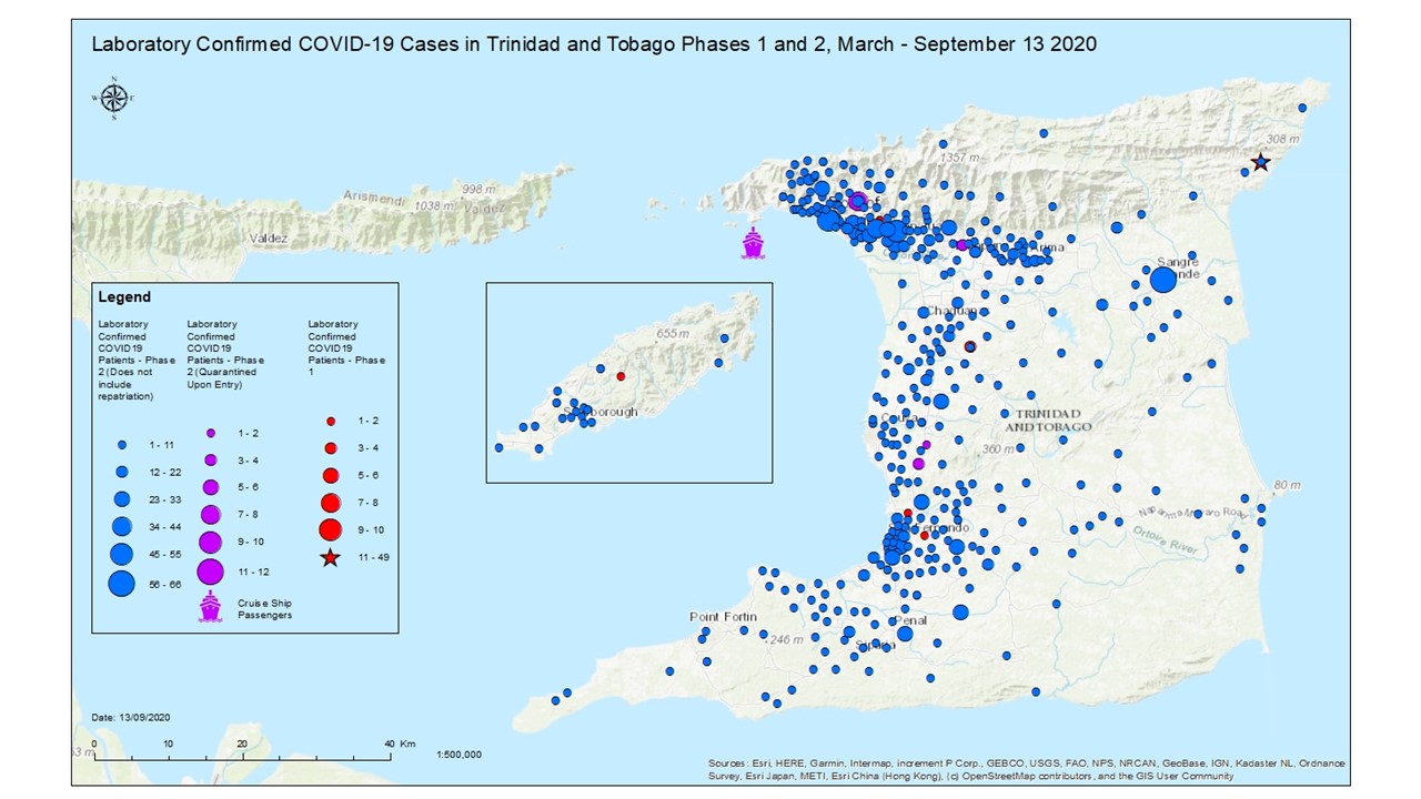
Map showing the Covid-19 outbreak in Trinidad and Tobago
Summary[edit]
| Description |
English: Map showing the Covid-19 outbreak in Trinidad and Tobago |
| Date | |
| Source | http://www.health.gov.tt/sitepages/default.aspx?id=313 |
| Author | Ministry of Health |
Licensing[edit]

This documentation is transcluded from File:Covid-19 Outbreak Map TT.jpg/doc.
</noinclude>
| This work has been released into the public domain by its author, Ministry of Health. This applies worldwide. In some countries this may not be legally possible; if so: Ministry of Health grants anyone the right to use this work for any purpose, without any conditions, unless such conditions are required by law.
|
File history
Click on a date/time to view the file as it appeared at that time.
| Date/Time | Thumbnail | Dimensions | User | Comment | |
|---|---|---|---|---|---|
| current | 02:41, 29 November 2020 | | 1,280 × 720 (169 KB) | Joshuarshah (talk | contribs) | Updated image showing more detailed data. |
| 16:56, 7 September 2020 |  | 960 × 540 (46 KB) | Joshuarshah (talk | contribs) | September 2020 Update | |
| 23:35, 25 August 2020 |  | 1,080 × 656 (65 KB) | Joshuarshah (talk | contribs) | Updates Outbreak Map as at August 2020 from the Ministry of Health | |
| 23:33, 25 August 2020 |  | 1,280 × 989 (112 KB) | Joshuarshah (talk | contribs) | Uploaded a work by Ministry of Health from https://uwi.maps.arcgis.com/apps/opsdashboard/index.html#/67c3cc49334549868aadb02659d91564 with UploadWizard |
You cannot overwrite this file.
File usage on Commons
There are no pages that use this file.
File usage on other wikis
The following other wikis use this file:
- Usage on id.wikipedia.org
- Usage on it.wikipedia.org
- Usage on uk.wikipedia.org
- Usage on vi.wikipedia.org