File:Cowley's Circumnavigation 1699.jpg
Jump to navigation
Jump to search
Size of this preview: 800 × 463 pixels. Other resolutions: 320 × 185 pixels | 640 × 371 pixels | 1,024 × 593 pixels | 1,280 × 741 pixels | 2,560 × 1,483 pixels | 6,387 × 3,699 pixels.
Original file (6,387 × 3,699 pixels, file size: 5.24 MB, MIME type: image/jpeg)
Captions
Captions
Add a one-line explanation of what this file represents
Summary[edit]
| Description |
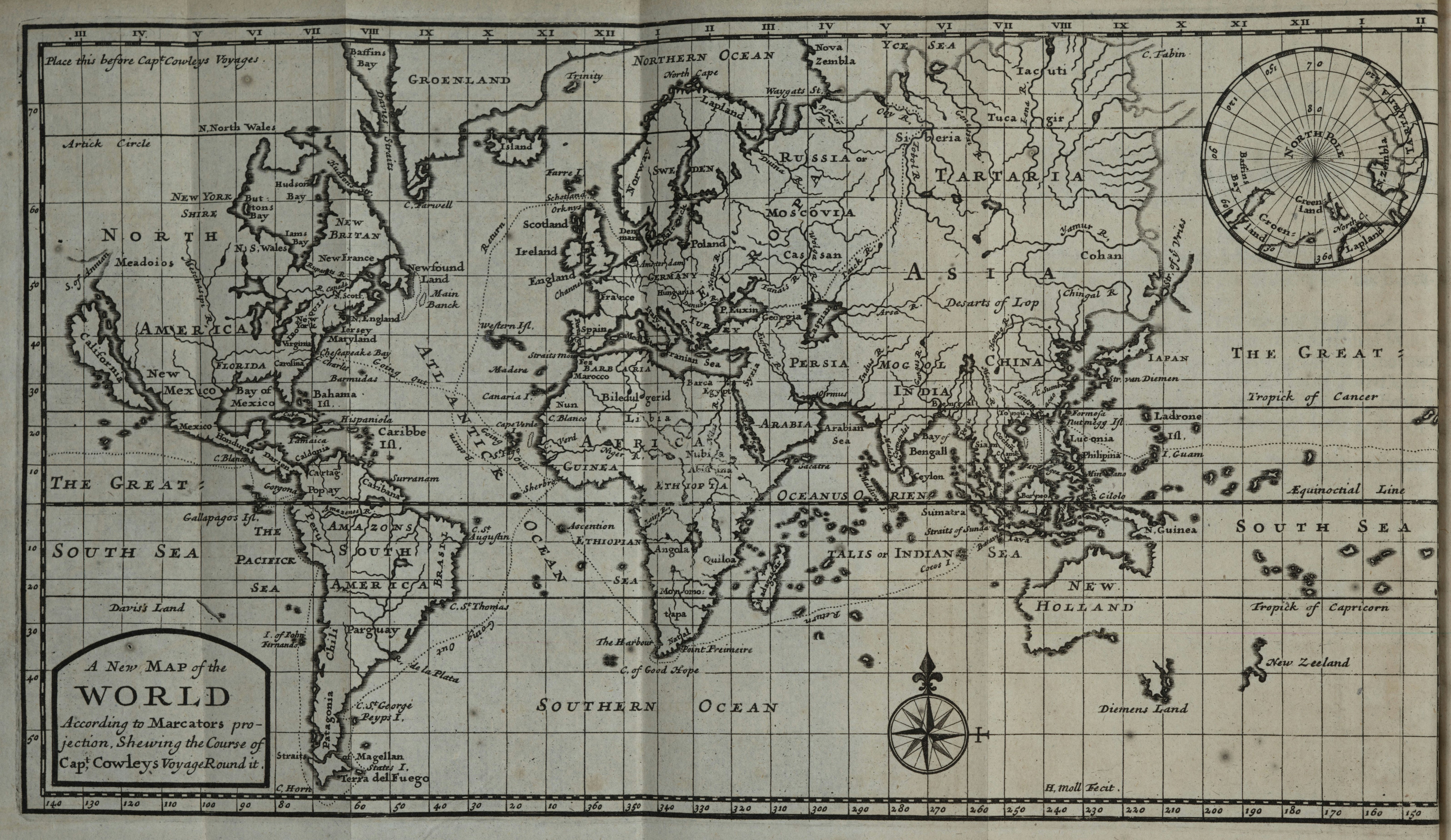
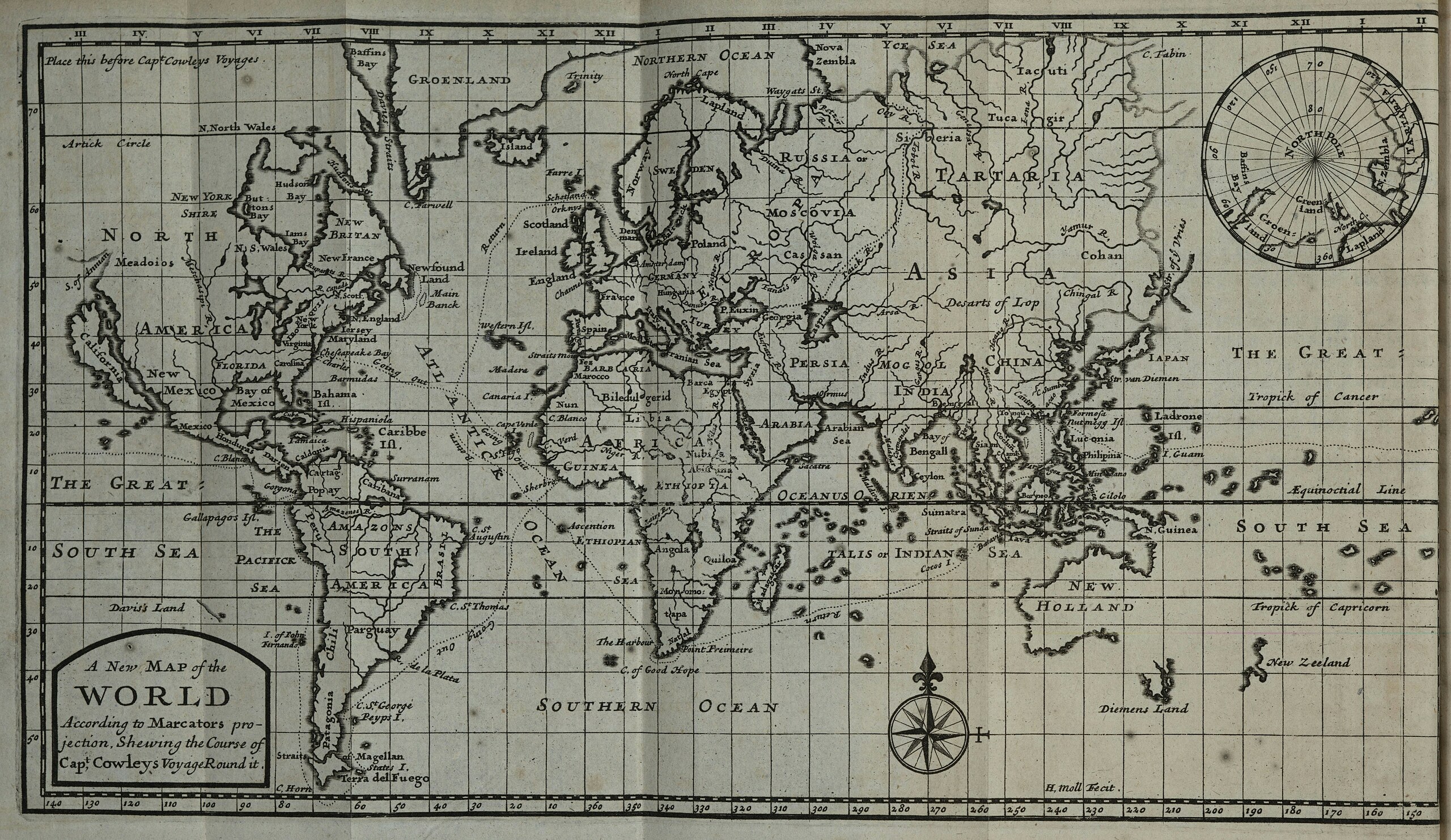
English: Herman Moll world map marked with the route of William Ambrosia Cowley's 1683–1686 circumnavigation of the world, included with the 1699 edition of his travels. Omits the initial passage from England to Virginia and the final passage from the Netherlands back to England. Includes an inset map of the North Pole, as known to the English in 1699. Title: A New Map of the World According to Marcators projection, Shewing the Course of Capt, Cowleys Voyage Round it. |
| Date | 1699, showing the course of Cowley's voyages 1683–1686 |
| Source | University of Kansas Kenneth Spenser Research Library copy (B82) of William Hacke's A Collection of Original Voyages..., 1st ed. |
| Author | Hermann Moll |
Licensing[edit]
|
This work is in the public domain in its country of origin and other countries and areas where the copyright term is the author's life plus 70 years or fewer. This work is in the public domain in the United States because it was published (or registered with the U.S. Copyright Office) before January 1, 1929. | |
| This file has been identified as being free of known restrictions under copyright law, including all related and neighboring rights. | |
| Annotations | This image is annotated: View the annotations at Commons |
File history
Click on a date/time to view the file as it appeared at that time.
| Date/Time | Thumbnail | Dimensions | User | Comment | |
|---|---|---|---|---|---|
| current | 06:56, 13 May 2023 | | 6,387 × 3,699 (5.24 MB) | LlywelynII (talk | contribs) | Uploaded a work by Will do soon from Will do soon with UploadWizard |
You cannot overwrite this file.
File usage on Commons
The following 3 pages use this file:
File usage on other wikis
The following other wikis use this file:
- Usage on en.wikipedia.org