File:Cuba hurricane 1910-10-17 weather map.jpg
Jump to navigation
Jump to search
Size of this preview: 800 × 532 pixels. Other resolutions: 320 × 213 pixels | 640 × 425 pixels | 865 × 575 pixels.
Original file (865 × 575 pixels, file size: 116 KB, MIME type: image/jpeg)
Captions
Captions
Add a one-line explanation of what this file represents
Summary
| Description | ||||
| Date | ||||
| Source | NOAA Central Library Data Imaging Project | |||
| Author | NOAA Central Library, Silver Spring, Maryland | |||
| Permission (Reusing this file) |
|
File history
Click on a date/time to view the file as it appeared at that time.
| Date/Time | Thumbnail | Dimensions | User | Comment | |
|---|---|---|---|---|---|
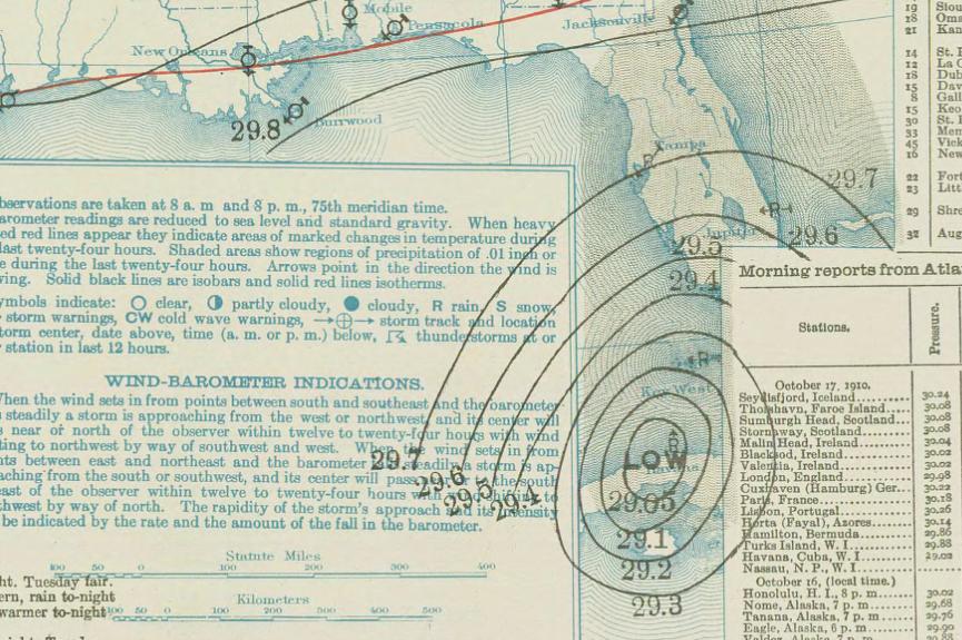
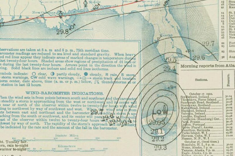
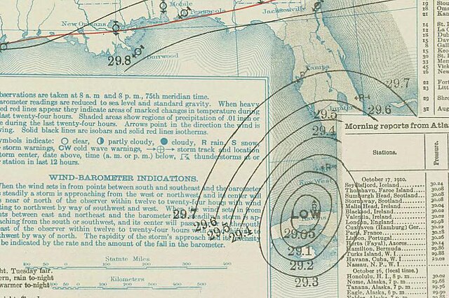
| current | 15:36, 24 December 2009 | | 865 × 575 (116 KB) | Juliancolton (talk | contribs) | {{Information |Description={{en|1=A weather map on October 17, 1910 of a hurricane over Cuba. }} |Source=http://docs.lib.noaa.gov/rescue/dwm/1910/19101017.djvu |Author=[http://docs.lib.noaa.gov/rescue/dwm/data_rescue_daily_weather_maps.html NOAA Central L |
You cannot overwrite this file.
File usage on Commons
The following page uses this file:
- File:October 1910 hurricane surface.jpg (file redirect)
File usage on other wikis
The following other wikis use this file:
- Usage on ar.wikipedia.org
- Usage on ca.wikipedia.org
- Usage on en.wikipedia.org
- Usage on es.wikipedia.org
- Usage on fr.wikipedia.org
- Usage on gl.wikipedia.org
- Usage on it.wikipedia.org
- Usage on ms.wikipedia.org
- Usage on pt.wikipedia.org
- Usage on ru.wikipedia.org
- Usage on simple.wikipedia.org
- Usage on ta.wikipedia.org
- Usage on uk.wikipedia.org
- Usage on zh.wikipedia.org
- Wikipedia:优良条目/2014年12月
- 1910年古巴飓风
- Wikipedia:优良条目/1910年古巴飓风
- Wikipedia:优良条目/2014年12月16日
- Wikipedia:典范条目/2015年2月
- 1910年大西洋飓风季
- Wikipedia:典范条目/1910年古巴飓风
- Wikipedia:典范条目/2015年2月14日
- Portal:美国/特色条目/242
- Wikipedia:典范条目/2017年4月
- Wikipedia:典范条目/2017年4月5日
- Wikipedia:典范条目/2019年8月
- Wikipedia:典范条目/2019年8月4日
- Wikipedia:典范条目/2023年7月
- Wikipedia:典范条目/2023年7月18日