File:Cueva de Basconcillos el Tozo.jpg
原始文件 (5,822 × 2,944像素,文件大小:8 MB,MIME类型:image/jpeg)
说明
说明
摘要[编辑]
| 描述 |
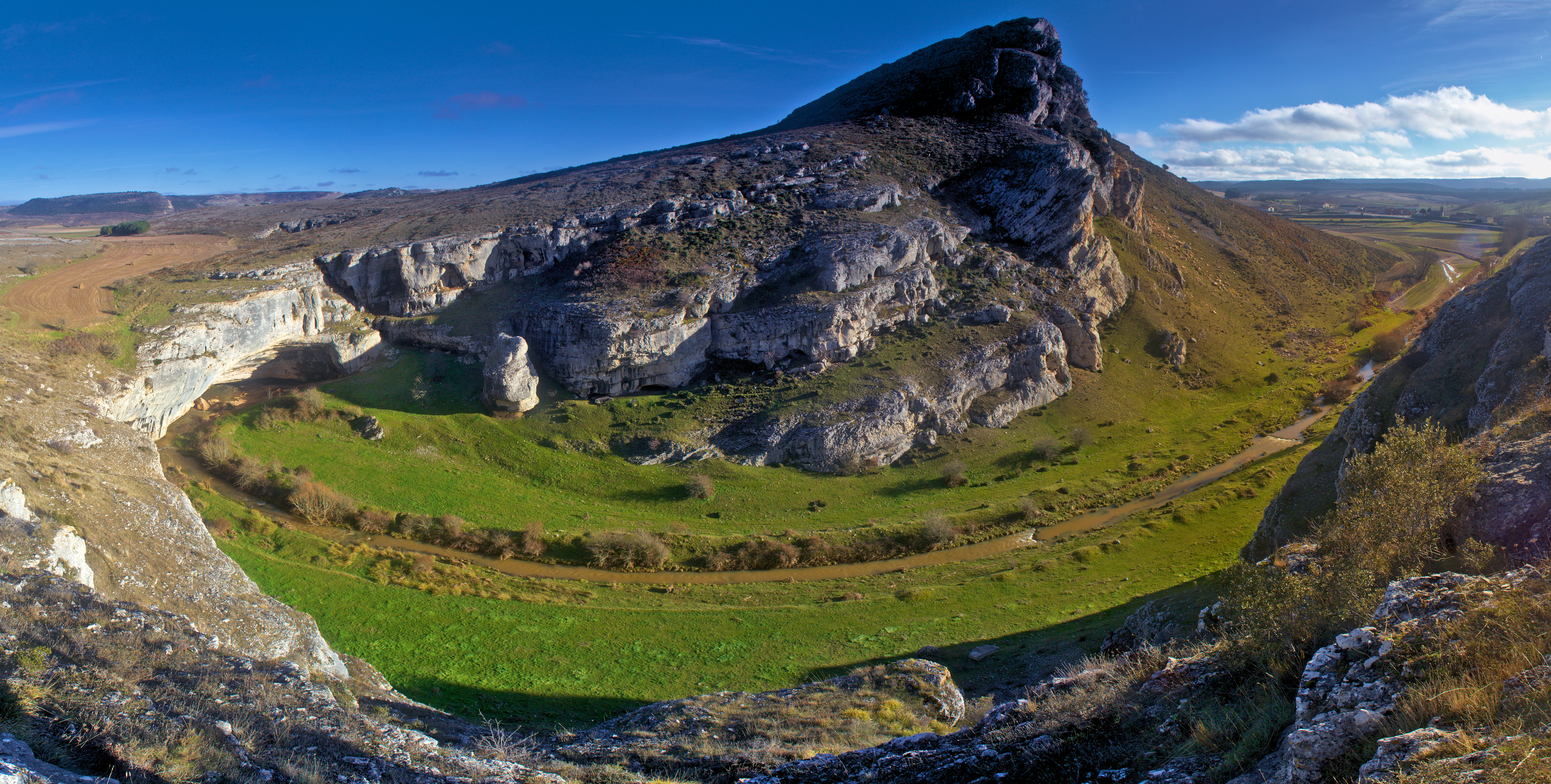
Español: Cueva de Basconcillos del Tozo, en Burgos. El río Hurón se mueve en dirección derecha a izquierda en en este valle, como se muestra en la imagen, introduciéndose en el sistema kárstico cuya entrada, que se conoce como Cueva de Basconcillos del Tozo, Cueva del Agua o Cueva de los Moros se observa a la izquierda. El río sale por la zona situada al fondo e izquierda de la imagen ya con el nombre de río Rudrón. |
| 日期 | |
| 来源 | 自己的作品 |
| 作者 | Mario Modesto Mata |
| 授权 (二次使用本文件) |
Summary:
In using this image or any subsequent derivatives of it, you are required to release the image under the same license. As such, any reproduction of this image, in any medium, must appear with a copy of, or full URL of the license. Attribution of this image to the author (Mario Modesto Mata) is required in a prominent location near to the image. No other conditions may be added to, or removed from this license without the permission of the author and copyright holder.Please review the full license requirements carefully before using this image. If you would like to clarify the terms of the license or negotiate less restrictive commercial licensing outside of the bounds of GFDL/CC-BY-SA, please contact me by email, or if you don't have a Wikipedia account you can leave a message on my talk page with your contact details and your request.
 |
| 相机位置 | | 在以下服务上查看本图像和附近其他图像: OpenStreetMap |
|---|
许可协议[编辑]
- 您可以自由地:
- 共享 – 复制、发行并传播本作品
- 修改 – 改编作品
- 惟须遵守下列条件:
- 署名 – 您必须对作品进行署名,提供授权条款的链接,并说明是否对原始内容进行了更改。您可以用任何合理的方式来署名,但不得以任何方式表明许可人认可您或您的使用。
- 相同方式共享 – 如果您再混合、转换或者基于本作品进行创作,您必须以与原先许可协议相同或相兼容的许可协议分发您贡献的作品。
文件历史
点击某个日期/时间查看对应时刻的文件。
| 日期/时间 | 缩略图 | 大小 | 用户 | 备注 | |
|---|---|---|---|---|---|
| 当前 | 2014年1月2日 (四) 15:15 | | 5,822 × 2,944(8 MB) | Mario modesto(留言 | 贡献) | Panorámica rehecha para corregir los problemas de empalme de la anterior y recortada para evitar los destellos de la derecha |
| 2013年12月30日 (一) 16:35 | 7,744 × 3,063(5.61 MB) | Mario modesto(留言 | 贡献) | User created page with UploadWizard |
您不可以覆盖此文件。
文件用途
以下5个页面使用本文件:
全域文件用途
以下其他wiki使用此文件:
- arz.wikipedia.org上的用途
- ast.wikipedia.org上的用途
- azb.wikipedia.org上的用途
- ceb.wikipedia.org上的用途
- da.wikipedia.org上的用途
- de.wikipedia.org上的用途
- en.wikipedia.org上的用途
- eo.wikipedia.org上的用途
- es.wikipedia.org上的用途
- eu.wikipedia.org上的用途
- fr.wikipedia.org上的用途
- www.wikidata.org上的用途
- zh.wikipedia.org上的用途