File:Cyclone Percy 2005.jpg
Ir a la navegación
Ir a la búsqueda
Tamaño de esta previsualización: 461 × 599 píxeles. Otras resoluciones: 184 × 240 píxeles | 369 × 480 píxeles | 591 × 768 píxeles | 788 × 1024 píxeles | 1575 × 2048 píxeles | 6000 × 7800 píxeles.
Archivo original (6000 × 7800 píxeles; tamaño de archivo: 5,6 MB; tipo MIME: image/jpeg)
Leyendas
Leyendas
Añade una explicación corta acerca de lo que representa este archivo
Resumen
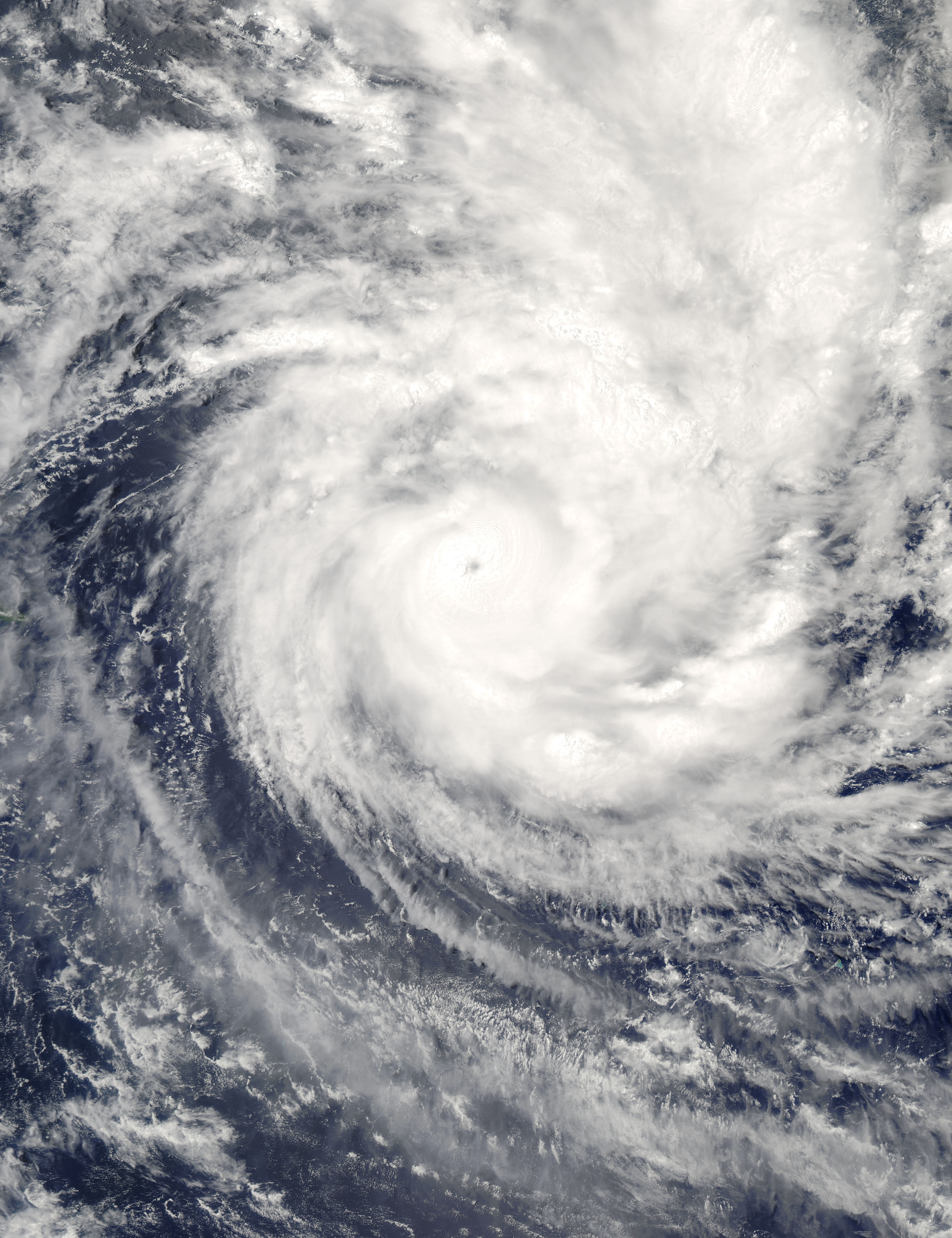
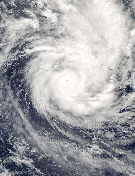
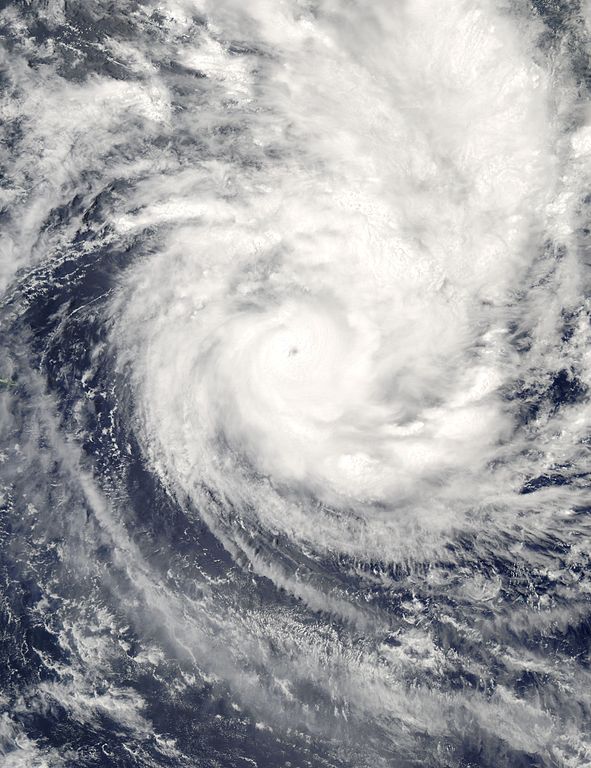
[editar]| Descripción | Cyclone Percy continued its rampage across the South Pacific on March 1, 2005, after battering the Northern Cook Islands with its powerful 140-knot wind gusts. This Moderate Resolution Imaging Spectroradiometer (MODIS) image taken by NASA’s Aqua satellite at 2:40 local time on February 28 (00:40 UTC on March 1), shows that the storm now has a clearly defined eye. When the image was taken, Percy had just passed over Pukapuku and Nassau, leaving both in shambles. According to news reports, no structures escaped damage on Nassau and just 10 buildings remain intact in Pukapuku. The storm had sustained winds of 213 kilometers per hour (132 mph) with gusts to 260 kph (160 mph), making it a Category 4 storm on the Saffir-Simpson scale. The storm is weakening as it moves south towards the southern Cook Islands and Rarotonga. Percy is the fourth cyclone to strike the Cook Islands in the past four weeks. | |||||
| Fecha | ||||||
| Fuente | http://visibleearth.nasa.gov/view_rec.php?id=6772 | |||||
| Autor | Jacques Descloitres, MODIS Rapid Response Team, NASA/GSFC | |||||
| Permiso (Reutilización de este archivo) |
|

Historial del archivo
Haz clic sobre una fecha y hora para ver el archivo tal como apareció en ese momento.
| Fecha y hora | Miniatura | Dimensiones | Usuario | Comentario | |
|---|---|---|---|---|---|
| actual | 15:42 2 sep 2006 | | 6000 × 7800 (5,6 MB) | Good kitty (discusión | contribs.) | == Summary == {{Information |Description=Cyclone Percy continued its rampage across the South Pacific on March 1, 2005, after battering the Northern Cook Islands with its powerful 140-knot wind gusts. This Moderate Resolution Imaging Spectroradiometer (MO |
No puedes sobrescribir este archivo.
Usos del archivo
No hay páginas que enlacen a este archivo.
Uso global del archivo
Las wikis siguientes utilizan este archivo:
- Uso en en.wikipedia.org
- Uso en es.wikipedia.org
- Uso en pt.wikipedia.org