File:Czarne (gmina) location map.png
Jump to navigation
Jump to search
Size of this preview: 613 × 600 pixels. Other resolutions: 245 × 240 pixels | 491 × 480 pixels | 1,002 × 980 pixels.
Original file (1,002 × 980 pixels, file size: 160 KB, MIME type: image/png)
Captions
Captions
Add a one-line explanation of what this file represents
| Description |
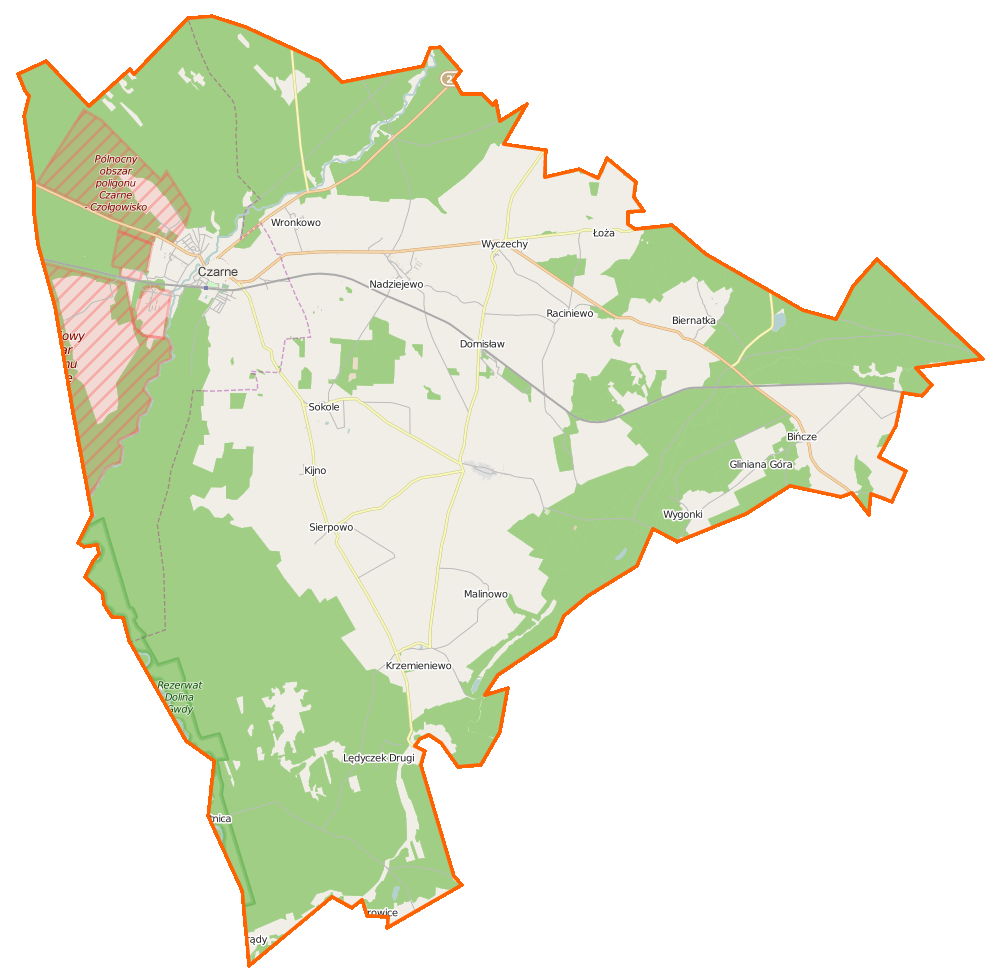
Polski: Mapa gminy Czarne, Polska
English: Map of Gmina Czarne, Poland |
|||||||||
| Date | ||||||||||
| Source | You may find a page on the OpenStreetMap wiki page for Czarne (gmina) | |||||||||
| Creator |
OpenStreetMap contributors OpenStreetMap contributors |
|||||||||
| Permission (Reusing this file) |
OpenStreetMap data is available under the Open Database License (details). Map tiles are licensed under the Creative Commons Attribution-ShareAlike 2.0 license (CC-BY-SA 2.0).
This file is licensed under the Creative Commons Attribution-Share Alike 2.0 Generic license.
|
|||||||||
| Geotemporal data | ||||||||||
| Bounding box |
|
|||||||||
| Georeferencing | If inappropriate please set warp_status = skip to hide. | |||||||||
File history
Click on a date/time to view the file as it appeared at that time.
| Date/Time | Thumbnail | Dimensions | User | Comment | |
|---|---|---|---|---|---|
| current | 07:08, 15 January 2015 | | 1,002 × 980 (160 KB) | VanWiel (talk | contribs) | {{OpenStreetMap | name = Czarne (gmina) | location = Czarne (gmina) | description = {{pl|Mapa gminy Czarne, Polska}} {{en|Map of Gmina Czarne, Poland}} | top = 53.7387 | bottom = 53.5391 | left... |
You cannot overwrite this file.
File usage on Commons
There are no pages that use this file.
File usage on other wikis
The following other wikis use this file:
- Usage on be.wikipedia.org
- Usage on fr.wikipedia.org
- Kijno
- Biernatka
- Bińcze
- Domisław (Poméranie)
- Domyśl
- Grabowiec (Człuchów)
- Janowiec (Poméranie)
- Krzemieniewo (Poméranie)
- Lędyczek Drugi
- Łoża
- Malinowo (Poméranie)
- Nadziejewo (Poméranie)
- Prądy (Poméranie)
- Raciniewo (Poméranie)
- Sierpowo (Poméranie)
- Sokole (Poméranie)
- Wierzbnik (Poméranie)
- Wronkowo
- Wyczechy
- Wygonki
- Usage on pl.wikipedia.org
- Czarne
- Czarne (gmina)
- Biernatka
- Bińcze
- Domisław (województwo pomorskie)
- Kijno
- Łoża
- Wyczechy
- Krzemieniewo (województwo pomorskie)
- Nadziejewo (województwo pomorskie)
- Raciniewo (województwo pomorskie)
- Sierpowo (województwo pomorskie)
- Sokole (gmina Czarne)
- Wronkowo
- Malinowo (województwo pomorskie)
- Wygonki
- Wierzbnik (województwo pomorskie)
- Lędyczek Drugi
- Grabowiec (powiat człuchowski)
- Rezerwat przyrody Dolina Gwdy
- Domyśl
- Janowiec (województwo pomorskie)
- Prądy (województwo pomorskie)
- Parafia Wniebowzięcia Najświętszej Maryi Panny w Czarnem
- Czarne (stacja kolejowa)
- Bińcze (stacja kolejowa)
- Domisław (przystanek kolejowy)
- Parafia Świętej Rodziny w Bińczu
- Parafia Chrystusa Króla Wszechświata w Krzemieniewie
View more global usage of this file.
_location_map.png)
_location_map.png&oldid=872515404)