File:Czarny Bór (gmina w powiecie wałbrzyskim) location map.png

Original file (674 × 926 pixels, file size: 169 KB, MIME type: image/png)
Captions
Captions
Summary
[edit]_location_map.png&action=edit§ion=1)
| Description |
English: Location map |
| Date | |
| Source | Own work |
| Author | Smat |
| Description |
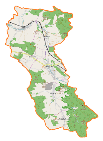
Polski: Mapa gminy Czarny Bór, Polska
English: Map of Czarny Bór (gmina w powiecie wałbrzyskim), Poland |
|||||||||
| Date | ||||||||||
| Source | You may find a page on the OpenStreetMap wiki page for Czarny Bór (gmina w powiecie wałbrzyskim) | |||||||||
| Creator |
OpenStreetMap contributors OpenStreetMap contributors |
|||||||||
| Permission (Reusing this file) |
OpenStreetMap data is available under the Open Database License (details). Map tiles are licensed under the Creative Commons Attribution-ShareAlike 2.0 license (CC-BY-SA 2.0).
This file is licensed under the Creative Commons Attribution-Share Alike 2.0 Generic license.
|
|||||||||
| Geotemporal data | ||||||||||
| Bounding box |
|
|||||||||
| Georeferencing | If inappropriate please set warp_status = skip to hide. | |||||||||
Licensing
[edit]_location_map.png&action=edit§ion=2)
| This work contains information from OpenStreetMap, which is made available under the Open Database License (ODbL).
The ODbL does not require any particular license for maps produced from ODbL data. Prior to 1 August 2020, map tiles produced by the OpenStreetMap Foundation were licensed under the CC-BY-SA-2.0 license. Maps produced by other people may be subject to other licences. |
File history
Click on a date/time to view the file as it appeared at that time.
| Date/Time | Thumbnail | Dimensions | User | Comment | |
|---|---|---|---|---|---|
| current | 15:34, 8 February 2017 | | 674 × 926 (169 KB) | Smat (talk | contribs) | User created page with UploadWizard |
You cannot overwrite this file.
File usage on Commons
The following page uses this file:
File usage on other wikis
The following other wikis use this file:
- Usage on de.wikipedia.org
- Usage on pl.wikipedia.org
- Czarny Bór (gmina w powiecie wałbrzyskim)
- Czarny Bór
- Jaczków
- Borówno (województwo dolnośląskie)
- Grzędy (województwo dolnośląskie)
- Witków (powiat wałbrzyski)
- Grzędzki Potok
- Grzędy Górne
- Parafia Najświętszego Serca Pana Jezusa w Czarnym Borze
- Mianka (dopływ Leska)
- Witków Śląski
- Zamek w Czarnym Borze
- Pałac w Czarnym Borze
- Pałac w Jaczkowie
- Zamek Wojaczów
- Parafia Zwiastowania Najświętszej Maryi Panny w Witkowie
- Moduł:Mapa/dane/Czarny Bór (gmina w powiecie wałbrzyskim)
- Kościół św. Jadwigi w Grzędach
- Kościół Najświętszego Serca Pana Jezusa w Czarnym Borze
- Kościół Chrystusa Króla w Borównie
- Kościół Matki Bożej Częstochowskiej w Jaczkowie
- Kościół Zwiastowania Najświętszej Maryi Panny w Witkowie
- Kaplica św. Anny w Witkowie
- Kaplica Matki Bożej Częstochowskiej w Borównie
- Usage on pl.wikibooks.org
- Usage on www.wikidata.org
_location_map.png&oldid=872517501)