File:Czech kraje and historic regions.svg
Jump to navigation
Jump to search

Size of this PNG preview of this SVG file: 800 × 460 pixels. Other resolutions: 320 × 184 pixels | 640 × 368 pixels | 1,024 × 589 pixels | 1,280 × 736 pixels | 2,560 × 1,472 pixels.
Original file (SVG file, nominally 800 × 460 pixels, file size: 53 KB)
Captions
Captions
Add a one-line explanation of what this file represents
Summary[edit]
| Description | |
| Date | |
| Source |
Own work, recreation of CZ Cechy Morava kraje.gif using: |
| Author |
|
Licensing[edit]
I, the copyright holder of this work, hereby publish it under the following licenses:

|
Permission is granted to copy, distribute and/or modify this document under the terms of the GNU Free Documentation License, Version 1.2 or any later version published by the Free Software Foundation; with no Invariant Sections, no Front-Cover Texts, and no Back-Cover Texts. A copy of the license is included in the section entitled GNU Free Documentation License. |
This file is licensed under the Creative Commons Attribution-Share Alike 4.0 International, 3.0 Unported, 2.5 Generic, 2.0 Generic and 1.0 Generic license.
- You are free:
- to share – to copy, distribute and transmit the work
- to remix – to adapt the work
- Under the following conditions:
- attribution – You must give appropriate credit, provide a link to the license, and indicate if changes were made. You may do so in any reasonable manner, but not in any way that suggests the licensor endorses you or your use.
- share alike – If you remix, transform, or build upon the material, you must distribute your contributions under the same or compatible license as the original.
You may select the license of your choice.
File history
Click on a date/time to view the file as it appeared at that time.
| Date/Time | Thumbnail | Dimensions | User | Comment | |
|---|---|---|---|---|---|
| current | 07:48, 13 April 2023 | | 800 × 460 (53 KB) | Martin Tauchman (talk | contribs) | File uploaded using svgtranslate tool (https://svgtranslate.toolforge.org/). Added translation for en. |
| 21:45, 12 April 2023 |  | 800 × 460 (51 KB) | Martin Tauchman (talk | contribs) | File uploaded using svgtranslate tool (https://svgtranslate.toolforge.org/). Added translation for eo. | |
| 21:38, 12 April 2023 |  | 800 × 460 (49 KB) | Martin Tauchman (talk | contribs) | File uploaded using svgtranslate tool (https://svgtranslate.toolforge.org/). Added translation for cs. | |
| 13:58, 14 August 2018 |  | 800 × 460 (46 KB) | Master Uegly (talk | contribs) | font size changed | |
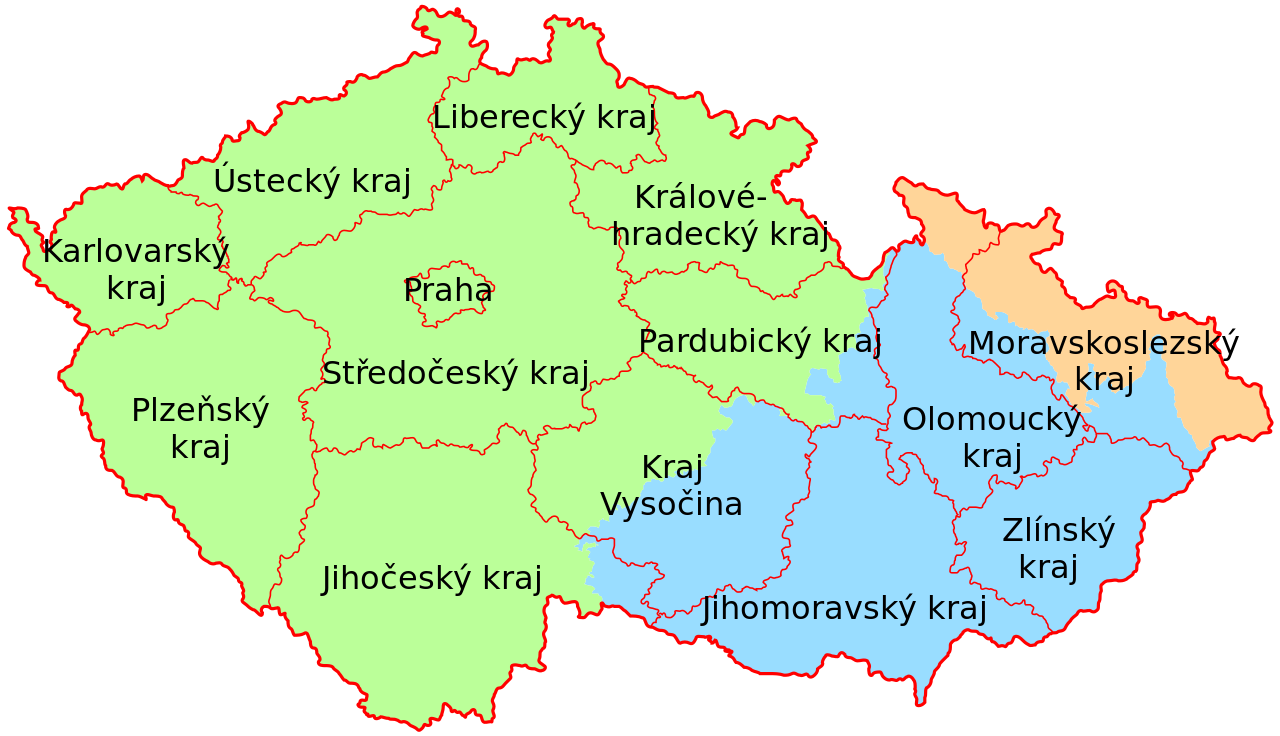
| 13:56, 14 August 2018 |  | 800 × 460 (46 KB) | Master Uegly (talk | contribs) | {{Information |description ={{en|1=Map of the historical Czech regions Bohemia, Moravia and Silesia and the actual division in krajs.}} {{de|1=Karte der historischen tschechischen Länder Böhmen, Mähren und Schlesien und die aktuelle Unterteilung in Kraje.}} |date =2018-08-14 |source ={{own}}, recreation of {{f|CZ Cechy Morava kraje.gif}} using: * {{f|Cesk... |
You cannot overwrite this file.
File usage on Commons
The following page uses this file:
File usage on other wikis
The following other wikis use this file:
- Usage on cs.wikipedia.org
- Usage on da.wikipedia.org
- Usage on de.wikipedia.org
- Usage on eo.wikipedia.org
- Usage on fr.wikipedia.org
- Usage on fy.wikipedia.org
- Usage on ia.wikipedia.org
- Usage on nl.wikipedia.org
- Usage on no.wikipedia.org
- Usage on www.wikidata.org