File:Czeremcha (gmina) location map.png
Jump to navigation
Jump to search

Size of this preview: 621 × 599 pixels. Other resolutions: 249 × 240 pixels | 498 × 480 pixels | 939 × 906 pixels.
Original file (939 × 906 pixels, file size: 132 KB, MIME type: image/png)
Captions
Captions
Add a one-line explanation of what this file represents
| Description |
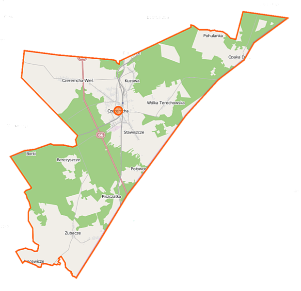
Polski: Mapa gminy Czeremcha, Polska
English: Map of Gmina Czeremcha, Poland |
|||||||||
| Date | ||||||||||
| Source | You may find a page on the OpenStreetMap wiki page for Czeremcha (gmina) | |||||||||
| Creator |
OpenStreetMap contributors OpenStreetMap contributors |
|||||||||
| Permission (Reusing this file) |
OpenStreetMap data is available under the Open Database License (details). Map tiles are licensed under the Creative Commons Attribution-ShareAlike 2.0 license (CC-BY-SA 2.0).
This file is licensed under the Creative Commons Attribution-Share Alike 2.0 Generic license.
|
|||||||||
| Geotemporal data | ||||||||||
| Bounding box |
|
|||||||||
| Georeferencing | If inappropriate please set warp_status = skip to hide. | |||||||||
File history
Click on a date/time to view the file as it appeared at that time.
| Date/Time | Thumbnail | Dimensions | User | Comment | |
|---|---|---|---|---|---|
| current | 09:44, 16 September 2014 | | 939 × 906 (132 KB) | VanWiel (talk | contribs) | |
| 09:34, 10 June 2014 |  | 939 × 906 (178 KB) | VanWiel (talk | contribs) | {{OpenStreetMap | name = Czeremcha (gmina wiejska) | location = Czeremcha (gmina wiejska) | description = {{pl|Mapa gminy Czeremcha, Polska}} {{en|Map of Gmina Czeremcha, Poland}} | top = 52.5713 | left... |
You cannot overwrite this file.
File usage on Commons
There are no pages that use this file.
File usage on other wikis
The following other wikis use this file:
- Usage on be.wikipedia.org
- Usage on pl.wikipedia.org
- Czeremcha (województwo podlaskie)
- Połowce (Polska)
- Czeremcha (gmina)
- Berezyszcze
- Czeremcha-Wieś
- Jancewicze
- Kuzawa
- Opaka Duża
- Wólka Terechowska
- Zubacze
- Bobrówka (powiat hajnowski)
- Czeremcha (stacja kolejowa)
- Pożniki
- Terechy
- Przejście graniczne Połowce-Pieszczatka
- Borki (powiat hajnowski)
- Chlewiszcze (Stawiszcze)
- Derhawka
- Gajki (Pohulanka)
- Konik (Połowce)
- Opalowanka
- Osyp
- Piszczatka (powiat hajnowski)
- Podorabie
- Pohulanka (województwo podlaskie)
- Repiszcza
- Sielakiewicz
- Turowszczyzna (Bobrówka)
- Stawiszcze (województwo podlaskie)
- Cerkiew Opieki Matki Bożej w Zubaczach
- Cerkiew Świętych Kosmy i Damiana w Czeremsze-Wsi
- Cerkiew Narodzenia Najświętszej Maryi Panny w Opace Dużej
- Parafia Najświętszej Maryi Panny Królowej Polski w Czeremsze
- Parafia Matki Bożej Miłującej w Czeremsze
- Parafia św. Barbary w Kuzawie
- Parafia Opieki Matki Bożej w Zubaczach
- Stawiszcze (przystanek kolejowy)
- Przejście graniczne Czeremcha-Wysokolitowsk
- Cerkiew Matki Bożej Miłującej w Czeremsze
- Cerkiew św. Anny w Wólce Terechowskiej
- Cerkiew św. Barbary w Kuzawie
- Cerkiew św. Apostoła Jana Teologa w Połowcach
- Cerkiew św. Mikołaja Cudotwórcy w Zubaczach
- Cerkiew Cudu św. Michała Archanioła w Stawiszczach
- Placówka Straży Granicznej w Czeremsze
- Moduł:Mapa/dane/Czeremcha (gmina)
- Kościół Najświętszej Maryi Panny Królowej Polski w Czeremsze (województwo podlaskie)
- Usage on pl.wikibooks.org
_location_map.png&oldid=872543387)