File:Détail d'une carte de 1750 - 1751 sur l'île Royale.jpg
Jump to navigation
Jump to search
Size of this preview: 800 × 419 pixels. Other resolutions: 320 × 168 pixels | 640 × 335 pixels | 1,403 × 735 pixels.
Original file (1,403 × 735 pixels, file size: 324 KB, MIME type: image/jpeg)
Captions
Captions
Add a one-line explanation of what this file represents
Summary
[edit]
| Description |
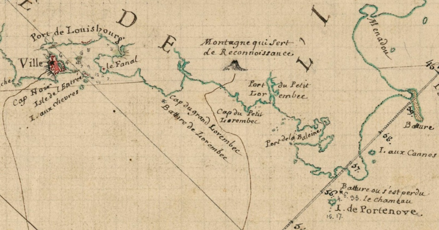
Français : Nom exact : Carte particulière des costes du Sud-Est de l'Isle Royale. Document levé en 1750 - 1751 par Joseph-Bernard de Chabert. Détail de la côte allant de Louisbourg jusqu'au lieu du naufrage de la flûte le Chameau en 1725. NB : les battures sont des récifs à fleur d'eau qui découvrent à marée basse. |
| Date | between 1750 and 1751 |
| Source | BNF |
| Author | Joseph-Bernard de Chabert (1724-1805). |
| Other versions | Vue complète |
Licensing
[edit]
|
This work is in the public domain in its country of origin and other countries and areas where the copyright term is the author's life plus 70 years or fewer. This work is in the public domain in the United States because it was published (or registered with the U.S. Copyright Office) before January 1, 1929. | |
| This file has been identified as being free of known restrictions under copyright law, including all related and neighboring rights. | |
File history
Click on a date/time to view the file as it appeared at that time.
| Date/Time | Thumbnail | Dimensions | User | Comment | |
|---|---|---|---|---|---|
| current | 22:47, 19 May 2018 | | 1,403 × 735 (324 KB) | AYE R (talk | contribs) | User created page with UploadWizard |
You cannot overwrite this file.
File usage on Commons
There are no pages that use this file.
File usage on other wikis
The following other wikis use this file:
- Usage on fr.wikipedia.org