File:Dřevíkov, CZ180224-049.jpg
Jump to navigation
Jump to search
Size of this preview: 800 × 450 pixels. Other resolutions: 320 × 180 pixels | 640 × 360 pixels | 1,024 × 576 pixels | 1,280 × 719 pixels | 2,560 × 1,439 pixels | 4,896 × 2,752 pixels.
Original file (4,896 × 2,752 pixels, file size: 3.36 MB, MIME type: image/jpeg)
Captions
Captions
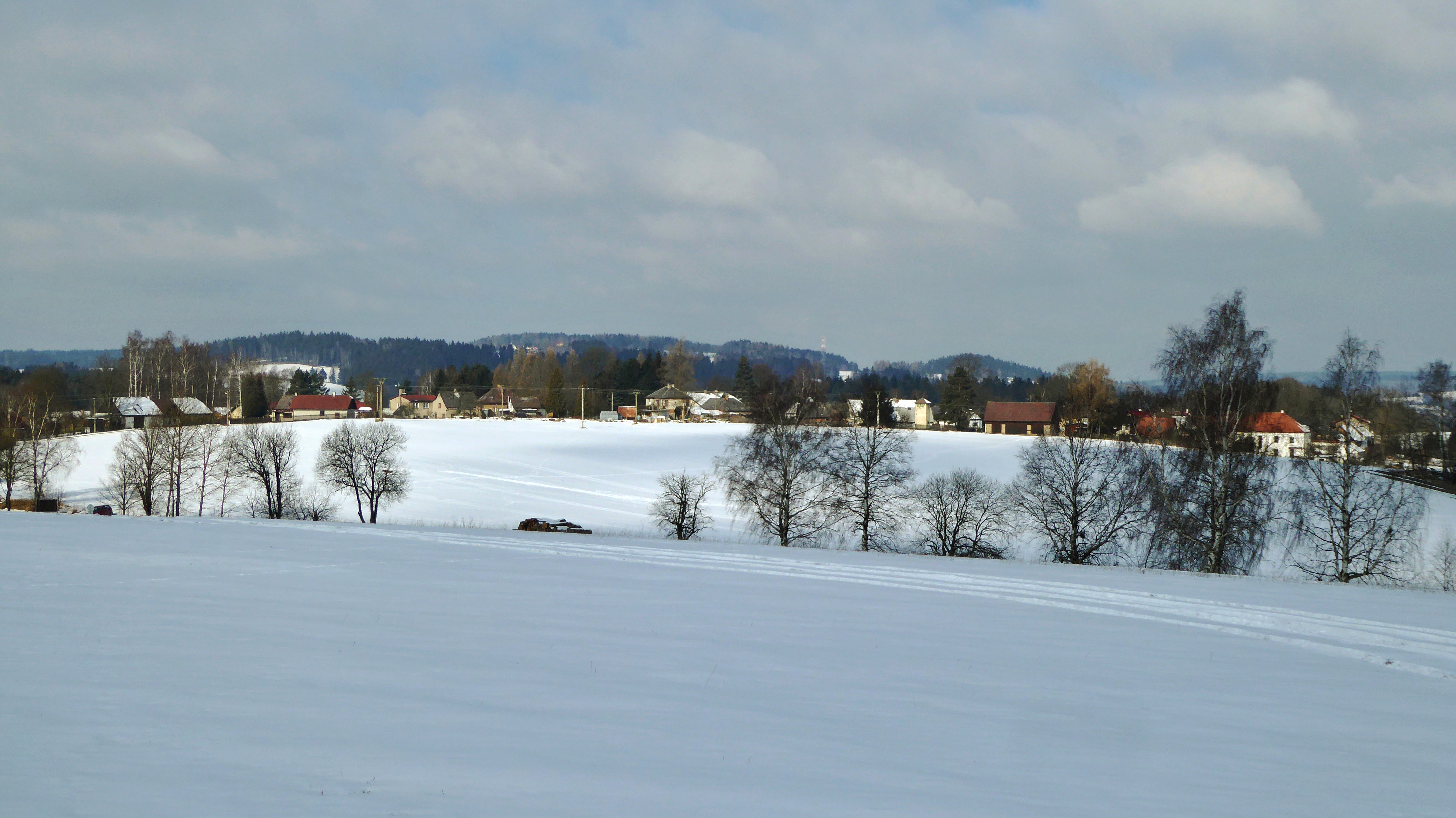
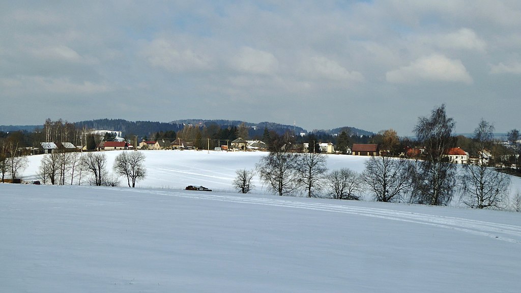
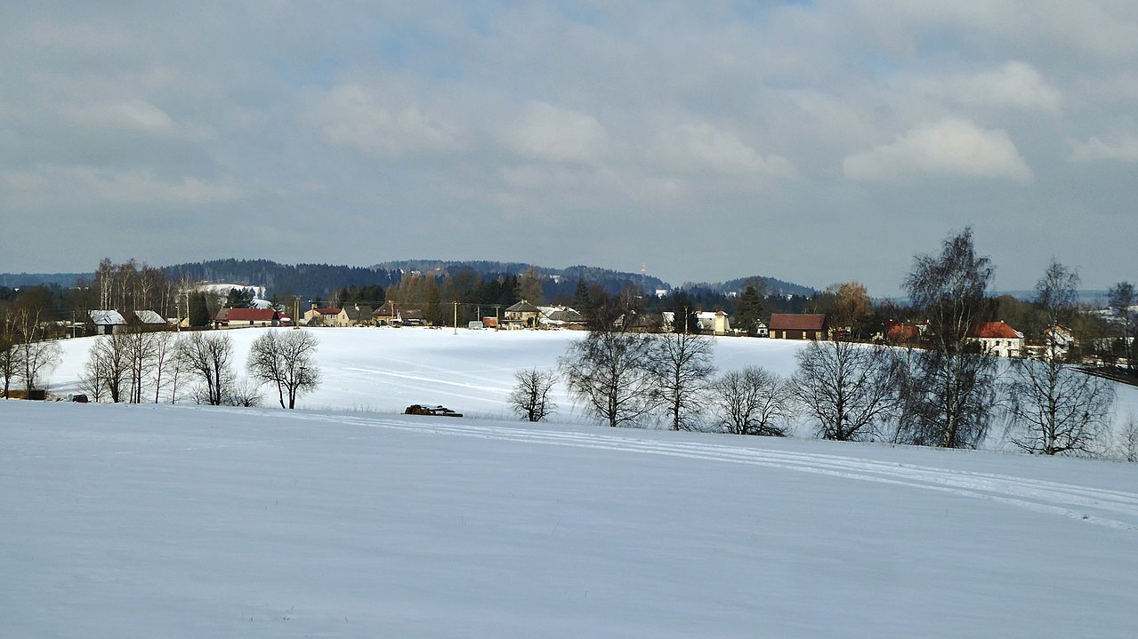
The winter landscape of Iron Mountains with a hamlet Dřevíkov in village Vysočina, Pardubice Region, Czechia.
Summary[edit]
| Description |
English: View from the top On the Merry Hill (578.5 m), winter landscape with the hamlet "Dřevíkov", trees under the slope near the road connecting the settlement sites "Dřevíkov" and "Veselý Kopec" (Merry Hill), on the horizon "Zuberský" hill (651 m, below is a lookout tower). The setlement locality of "Dřevíkov" lies in the top part of hill (no name) with an altitude of 571.5 m in the "Stružinecká" Highlands, about 2.5 km southeast of small town Trhová Kamenice and 6 km west of town Hlinsko. Village with folk buildings monuments (a wooden small bell tower, a timbered cottage, a former Jewish Lane and a Graveyard). In the cadastral territory there is also a small hamlet "Veselý Kopec" with a significant exposition of the museum in nature with name of the Set of folk buildings "Vysočina". "Dřevíkovská" village green is information point No. 10 on the Homeland trail the Region of Chrudimka River. "Dřevíkov" is settlement locality of the type of small hamlet and the name of the cadastral area with an area of 226.58 ha with a range of approximately 534 to 579 meters above sea level in the landscape area of the Iron Mountains, within the administrative is part municipality of Vysočina in the district of Chrudim belonging to the Pardubice Region in the territory of the Czech Republic. Photo location: Czechia, Pardubice Region, municipality Vysočina, hamlet of "Dřevíkov", "Stružinecká" knoll hill.
Čeština: Pohled z vrcholu Na Veselém kopci (578,5 m), zimní krajina s vesnicí Dřevíkov, stromy pod svahem u silnice spojující sídelní lokality Dřevíkov a Veselý Kopec, na obzoru Zuberský vrch (651 m, níže rozhledna). Sídelní lokalita Dřevíkov leží ve vrcholové části bezejmenné vyvýšeniny s nadmořskou výškou 571,5 m a přibližně 2,5 km na jihovýchod od městyse Trhová Kamenice a 6 km západně od města Hlinsko. Vesnice s památkami lidového stavitelství (dřevěná zvonička, roubená chalupa, bývalá židovská ulička a hřbitov). Na katastrálním území také malá vesnička Veselý Kopec s významnou expozicí muzea v přírodě s názvem Soubor lidových staveb "Vysočina". Dřevíkovská náves je stanoviště č. 10 na vlastivědné stezce Krajem Chrudimky. Dřevíkov je sídelní lokalita typu vesnice a název katastrálního území o rozloze 226,58 ha s rozsahem poloh přibližně 534 až 579 m n. m. v krajinné oblasti Železných hor, v rámci administrativně správním část obce Vysočina v okrese Chrudim náležejícím do Pardubického kraje na území České republiky. Foto lokace: Česko, Pardubický kraj, obec Vysočina, vesnice Dřevíkov, Stružinecká pahorkatina (320°). |
| Date | |
| Source | Own work |
| Author | Josef Kreuz (PEPan) |
| Camera location | | View this and other nearby images on: OpenStreetMap |
|---|
Externí odkazy:[edit]
- Mapy.cz, turistická mapa – Dřevíkov, Veselý Kopec viz
- Obec Vysočina – webové stránky viz
Licensing[edit]
I, the copyright holder of this work, hereby publish it under the following license:
This file is licensed under the Creative Commons Attribution-Share Alike 4.0 International license.
- You are free:
- to share – to copy, distribute and transmit the work
- to remix – to adapt the work
- Under the following conditions:
- attribution – You must give appropriate credit, provide a link to the license, and indicate if changes were made. You may do so in any reasonable manner, but not in any way that suggests the licensor endorses you or your use.
- share alike – If you remix, transform, or build upon the material, you must distribute your contributions under the same or compatible license as the original.
File history
Click on a date/time to view the file as it appeared at that time.
| Date/Time | Thumbnail | Dimensions | User | Comment | |
|---|---|---|---|---|---|
| current | 14:22, 25 February 2018 | | 4,896 × 2,752 (3.36 MB) | PEPan (talk | contribs) | User created page with UploadWizard |
You cannot overwrite this file.
File usage on Commons
There are no pages that use this file.
File usage on other wikis
The following other wikis use this file:
- Usage on cs.wikipedia.org