File:D.A. Green Bridge.jpg
Jump to navigation
Jump to search

Size of this preview: 800 × 503 pixels. Other resolutions: 320 × 201 pixels | 640 × 402 pixels | 1,024 × 643 pixels | 1,393 × 875 pixels.
Original file (1,393 × 875 pixels, file size: 416 KB, MIME type: image/jpeg)
Captions
Captions
Add a one-line explanation of what this file represents
Summary[edit]
| Description |
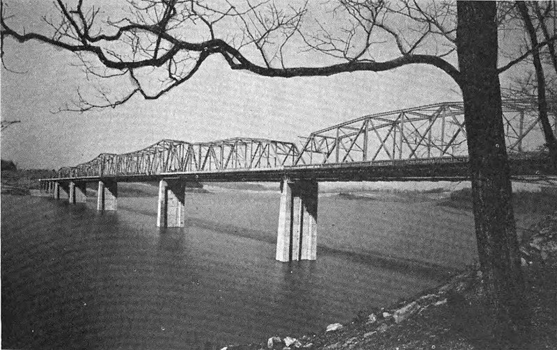
English: The former D.A. Green Bridge that carried U.S. Route 25E across the Holston River in Grainger/Hamblen counties in Tennessee. |
| Date | between 1941 and 1944 |
| Source | The Cherokee Project: A Comprehensive Report on the Planning, Design, Construction, and Initial Operations of the Cherokee Project |
| Author | Tennessee Valley Authority |
| Camera location | | View this and other nearby images on: OpenStreetMap |
|---|
Licensing[edit]
| This image is a work of a United States Tennessee Valley Authority employee, taken or made as part of that person's official duties. As a work of the U.S. federal government, the image is in the public domain in the United States. |
File history
Click on a date/time to view the file as it appeared at that time.
| Date/Time | Thumbnail | Dimensions | User | Comment | |
|---|---|---|---|---|---|
| current | 19:05, 3 June 2021 | | 1,393 × 875 (416 KB) | Vanished user 7782930114 (talk | contribs) | Uploaded a work by Tennessee Valley Authority from The Cherokee Project: A Comprehensive Report on the Planning, Design, Construction, and Initial Operations of the Cherokee Project with UploadWizard |
You cannot overwrite this file.
File usage on Commons
The following page uses this file:
File usage on other wikis
The following other wikis use this file:
- Usage on en.wikipedia.org