File:DE Wikinews 2010 Queensland floods map.png
Jump to navigation
Jump to search

Size of this preview: 459 × 599 pixels. Other resolutions: 184 × 240 pixels | 368 × 480 pixels | 1,000 × 1,305 pixels.
Original file (1,000 × 1,305 pixels, file size: 164 KB, MIME type: image/png)
Captions
Captions
Add a one-line explanation of what this file represents
Summary
[edit]
| Description |
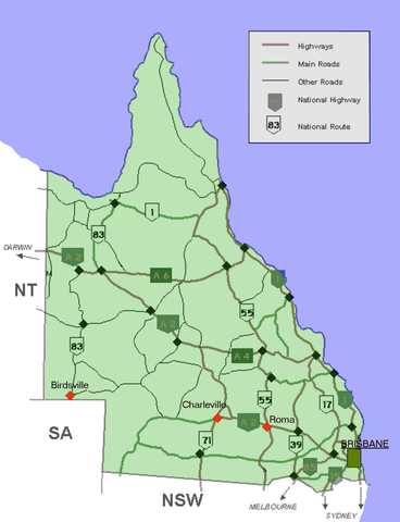
English: Location map showing in red some of the towns mentioned in de:n:Hunderte flüchten in Australien vor Überschwemmungen
Deutsch: Lagekarte, die in rot einige der in de:n:Hunderte flüchten in Australien vor Überschwemmungen genannten Städte zeigt. |
| Date | (UTC) |
| Source | |
| Author |
|
| This is a retouched picture, which means that it has been digitally altered from its original version. Modifications: Removed some geographic names, marked some features. The original can be viewed here: Blank locator map queensland.PNG:
|
This file is licensed under the Creative Commons Attribution-Share Alike 3.0 Unported license.
- You are free:
- to share – to copy, distribute and transmit the work
- to remix – to adapt the work
- Under the following conditions:
- attribution – You must give appropriate credit, provide a link to the license, and indicate if changes were made. You may do so in any reasonable manner, but not in any way that suggests the licensor endorses you or your use.
- share alike – If you remix, transform, or build upon the material, you must distribute your contributions under the same or compatible license as the original.
Original upload log
[edit]
This image is a derivative work of the following images:
- File:Queenslandroads.png licensed with Cc-by-sa-3.0-migrated, GFDL
- 2009-11-05T07:57:28Z File Upload Bot (Magnus Manske) 540x720 (12670 Bytes) {{BotMoveToCommons|en.wikipedia|year={{subst:CURRENTYEAR}}|month={{subst:CURRENTMONTHNAME}}|day={{subst:CURRENTDAY}}}} {{Information |Description={{en|Added alphanumeric markings}} |Source=Transferred from [http://en.wikiped
- File:Blank_locator_map_queensland.PNG licensed with Cc-by-sa-3.0-migrated, GFDL
- 2005-12-15T13:58:52Z Roke 1000x1305 (97284 Bytes) Shows [[w:Queensland]]. The map is a modified version of User:Fikri's GNU-licensed road map of Queensland on wikipedia [http://en.wikipedia.org/wiki/Image:Queenslandroads.png here] [[Category:Locator maps of Queensland]]
Uploaded with derivativeFX
File history
Click on a date/time to view the file as it appeared at that time.
| Date/Time | Thumbnail | Dimensions | User | Comment | |
|---|---|---|---|---|---|
| current | 08:47, 3 March 2010 | | 1,000 × 1,305 (164 KB) | Matthiasb (talk | contribs) | {{Information |Description={{en|Location map showing in red some of the towns mentioned in de:n:Hunderte flüchten in Australien vor Überschwemmungen}} {{de:Lagekarte, die in rot einige der in [[de:n:Hunderte flüchten in Australien vor Überschwemmu |
You cannot overwrite this file.
File usage on Commons
There are no pages that use this file.
File usage on other wikis
The following other wikis use this file:
- Usage on de.wikinews.org