File:Daito islands en.png
跳去導覽
跳去搵嘢

預覽大細:800 × 485 像素。 第啲解像度:320 × 194 像素 | 640 × 388 像素 | 1,024 × 621 像素 | 1,458 × 884 像素。
原本檔案 (1,458 × 884 像素,檔案大細:324 KB ,MIME類型:image/png)
Captions
Captions
Add a one-line explanation of what this file represents
摘要[編輯]
| 描述 |
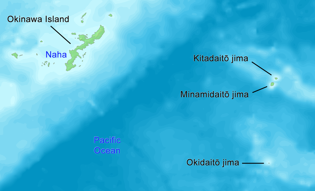
English: Map of Daito Islands (in English).
日本語: 大東諸島の地図(英語)。 |
||||
| 日期 | |||||
| 來源 | http://www.demis.nl/wms/mapclip.htm | ||||
| 作者 | Tdk | ||||
| 許可 (重用呢個檔案) |
|
協議[編輯]
| I, the copyright holder of this work, release this work into the public domain. This applies worldwide. In some countries this may not be legally possible; if so: I grant anyone the right to use this work for any purpose, without any conditions, unless such conditions are required by law. |
檔案歷史
撳個日期/時間去睇響嗰個時間出現過嘅檔案。
| 日期/時間 | 縮圖 | 尺寸 | 用戶 | 註解 | |
|---|---|---|---|---|---|
| 現時 | 2019年10月14號 (一) 14:58 | | 1,458 × 884(324 KB) | Artanisen(傾偈 | 貢獻) | {{en|English: High quality map of the Daito Islands. Created with DEMIS World Map Server.}} {{ja|日本語:高品質の地図、大東諸島。}} |
| 2008年6月8號 (日) 03:58 |  | 615 × 461(87 KB) | Tdk~commonswiki(傾偈 | 貢獻) | {{Information |Description={{en|1=Map of Daito Islands.(in English)}} {{ja|1=大東諸島の地図。(英語)}} |Source=http://www.demis.nl/wms/mapclip.htm |Author=Tdk |Date=2008/6/8 |Permission={{demis-pd}} |other_versions= }} {{ImageUpload|full}} |
你無得衾咗個檔案。
檔案用途
以下嘅2版用到呢個檔:
全域檔案使用情況
下面嘅維基都用緊呢個檔案:
- az.wikipedia.org嘅使用情況
- cs.wikipedia.org嘅使用情況
- de.wikipedia.org嘅使用情況
- en.wikipedia.org嘅使用情況
- es.wikipedia.org嘅使用情況
- eu.wikipedia.org嘅使用情況
- fi.wikipedia.org嘅使用情況
- fr.wikipedia.org嘅使用情況
- it.wikipedia.org嘅使用情況
- ko.wikipedia.org嘅使用情況
- lt.wikipedia.org嘅使用情況
- no.wikipedia.org嘅使用情況
- pl.wikipedia.org嘅使用情況
- pt.wikipedia.org嘅使用情況
- ru.wikipedia.org嘅使用情況
- sv.wikipedia.org嘅使用情況
- tr.wikipedia.org嘅使用情況
- uk.wikipedia.org嘅使用情況
- uz.wikipedia.org嘅使用情況
- vi.wikipedia.org嘅使用情況
- www.wikidata.org嘅使用情況
- zh-classical.wikipedia.org嘅使用情況
- zh-yue.wikipedia.org嘅使用情況