File:Dakotatribesmap.jpg
Jump to navigation
Jump to search
Size of this preview: 800 × 583 pixels. Other resolutions: 320 × 233 pixels | 640 × 466 pixels | 891 × 649 pixels.
Original file (891 × 649 pixels, file size: 212 KB, MIME type: image/jpeg)
Captions
Captions
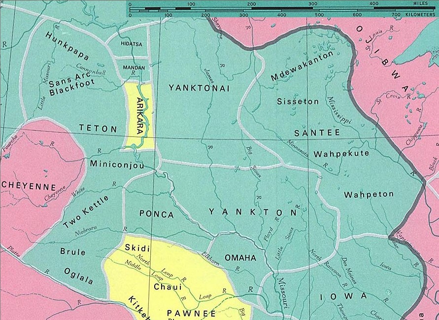
Territory of Sioux and neighboring tribes (capitals) and sub-tribes in the 1st half of the 19th century. The dark line separates cultural areas. Lang. groups: Sioux green (not all tribes belong to the Sioux nation), Algonkin pink and Caddian yellow
Dakota tribes
fragment from: http://www.lib.utexas.edu/maps/national_atlas_1970/ca000097.jpg
Most of the maps scanned by the University of Texas Libraries and served from this web site are in the public domain. No permissions are needed to copy them. You may download them and use them as you wish.
This file is in the public domain because Most of the maps scanned by the University of Texas Libraries and served from this web site (www.lib.utexas.edu) are in the public domain. No permissions are needed to copy them. You may download them and use them as you wish.
|
also see

File history
Click on a date/time to view the file as it appeared at that time.
| Date/Time | Thumbnail | Dimensions | User | Comment | |
|---|---|---|---|---|---|
| current | 23:37, 10 January 2006 | | 891 × 649 (212 KB) | Pitert (talk | contribs) | Dakota tribes fragment from: http://www.lib.utexas.edu/maps/national_atlas_1970/ca000097.jpg {{PD}} |
You cannot overwrite this file.
File usage on Commons
The following page uses this file:
File usage on other wikis
The following other wikis use this file:
- Usage on ca.wikipedia.org
- Usage on cs.wikipedia.org
- Usage on es.wikipedia.org
- Usage on fi.wikipedia.org
- Usage on fr.wikipedia.org
- Usage on ja.wikipedia.org
- Usage on pl.wikipedia.org