File:Dalila 25 july 2007 2100Z.jpg
跳转到导航
跳转到搜索

本预览的尺寸:600 × 600像素。 其他分辨率:240 × 240像素 | 480 × 480像素 | 768 × 768像素 | 1,024 × 1,024像素 | 2,048 × 2,048像素 | 4,400 × 4,400像素。
原始文件 (4,400 × 4,400像素,文件大小:3.19 MB,MIME类型:image/jpeg)
说明
说明
添加一行文字以描述该文件所表现的内容
摘要[编辑]
| 描述 |
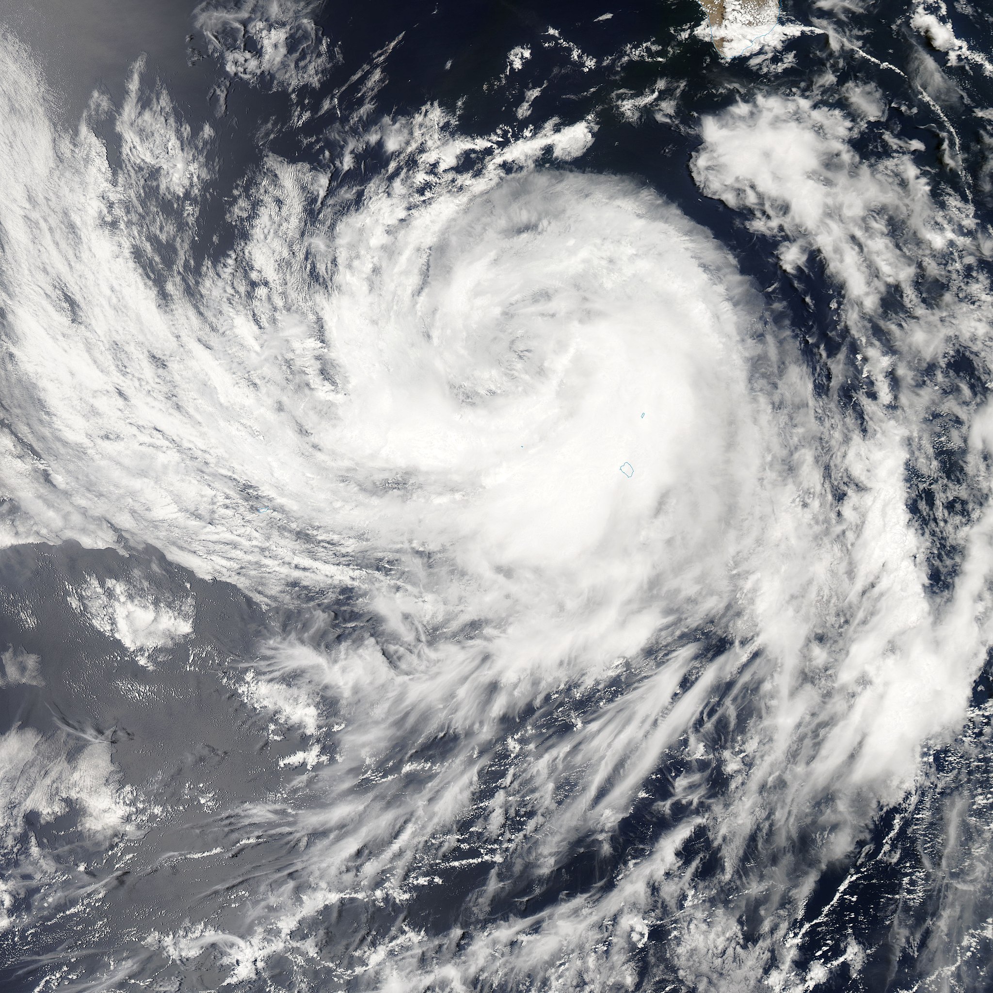
Tropical Storm Dalila is shown in this image, captured by the MODIS on the Aqua satellite on Wednesday, July 25, 2007. Out over Mexico's Pacific coast, the storm weakened, but still dumped a lot of rain on Baja California on Thursday. By Friday, it weakened into a tropical depression. Tropical Storm Dalila was the eighth tropical system to form in the East Pacific during the 2007 season, and the fourth named storm. Dalila formed south of Baja California and arced northwest over cooled waters as it degraded. |
|||||
| 日期 | ||||||
| 来源 | http://modis.gsfc.nasa.gov/gallery/individual.php?db_date=2007-07-31 | |||||
| 作者 | Image courtesy of MODIS Rapid Response Project at NASA/GSFC | |||||
| 授权 (二次使用本文件) |
|

文件历史
点击某个日期/时间查看对应时刻的文件。
| 日期/时间 | 缩略图 | 大小 | 用户 | 备注 | |
|---|---|---|---|---|---|
| 当前 | 2007年7月31日 (二) 17:00 | | 4,400 × 4,400(3.19 MB) | Good kitty(留言 | 贡献) | == Summary == {{Information |Description=Tropical Storm Dalila is shown in this image, captured by the MODIS on the Aqua satellite on Wednesday, July 25, 2007. Out over Mexico's Pacific coast, the storm weakened, but still dumped a lot of rain on Baja Cal |
您不可以覆盖此文件。
文件用途
以下页面使用本文件:
全域文件用途
以下其他wiki使用此文件:
- de.wikipedia.org上的用途
- en.wikipedia.org上的用途
- es.wikipedia.org上的用途
- nl.wikipedia.org上的用途
- sv.wikipedia.org上的用途
- zh.wikipedia.org上的用途