File:Darien Nautical Chart 1737.jpg
Jump to navigation
Jump to search
Size of this preview: 736 × 599 pixels. Other resolutions: 295 × 240 pixels | 589 × 480 pixels | 943 × 768 pixels | 1,257 × 1,024 pixels | 2,515 × 2,048 pixels | 6,704 × 5,460 pixels.
Original file (6,704 × 5,460 pixels, file size: 8.08 MB, MIME type: image/jpeg)
Captions
Captions
Darien Nautical Chart 1737
Summary
[edit]
| Description |
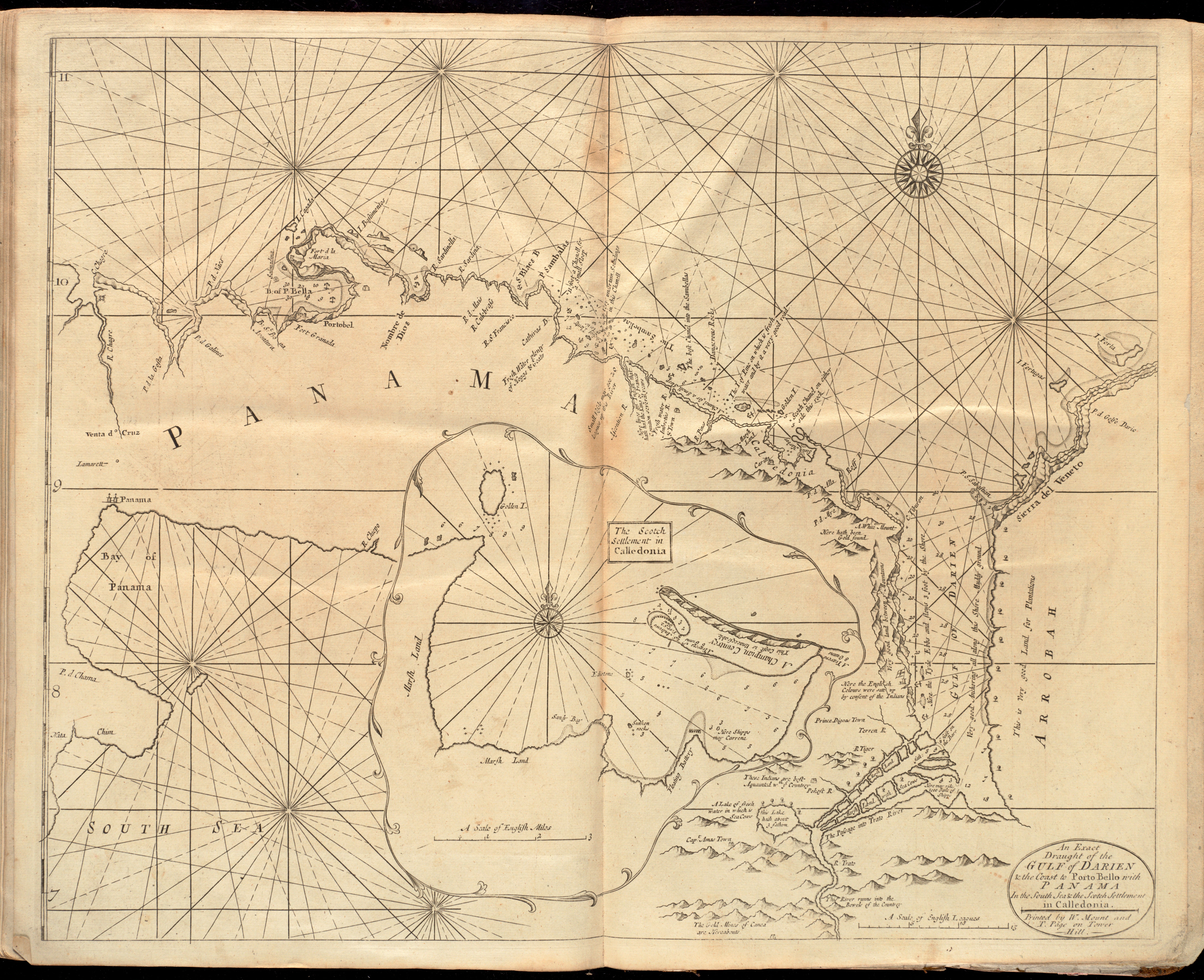
English: Darien Nautical Chart. Relief shown pictorially. Depths shown by soundings. Inset: The Scotch settlement in Calledonia. Includes notes about settlements and geographic features. In the English pilot, the fourth book. London : Printed for William Mount and Thomas Page, 1737. |
| Date | |
| Source | https://collections.leventhalmap.org/search/commonwealth:cj82m5427 |
| Author | W. Mount and T. Page |
Licensing
[edit]
|
This work is in the public domain in its country of origin and other countries and areas where the copyright term is the author's life plus 70 years or fewer. This work is in the public domain in the United States because it was published (or registered with the U.S. Copyright Office) before January 1, 1929. | |
| This file has been identified as being free of known restrictions under copyright law, including all related and neighboring rights. | |
File history
Click on a date/time to view the file as it appeared at that time.
| Date/Time | Thumbnail | Dimensions | User | Comment | |
|---|---|---|---|---|---|
| current | 22:09, 1 July 2019 | | 6,704 × 5,460 (8.08 MB) | Kognos (talk | contribs) | User created page with UploadWizard |
You cannot overwrite this file.
File usage on Commons
There are no pages that use this file.