File:DavidsonTrig.jpg
ナビゲーションに移動
検索に移動

このプレビューのサイズ: 479 × 599 ピクセル。 その他の解像度: 192 × 240 ピクセル | 384 × 480 ピクセル | 718 × 898 ピクセル。
元のファイル (718 × 898 ピクセル、ファイルサイズ: 59キロバイト、MIME タイプ: image/jpeg)
キャプション
キャプション
このファイルの内容を1行で記述してください
| 解説 |
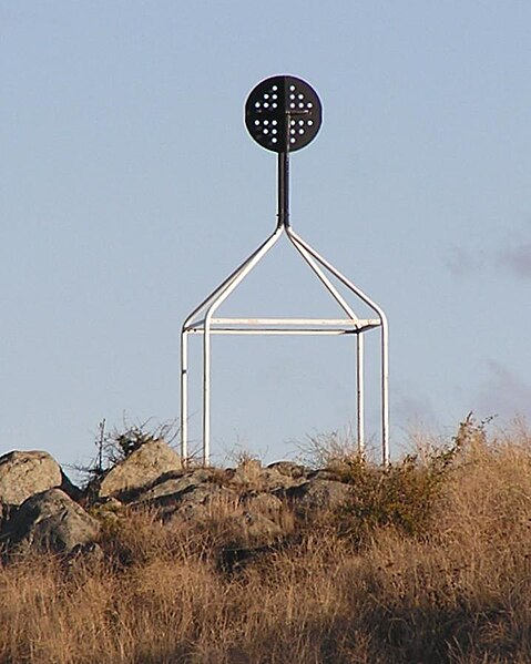
English: Davidson en:Trig point on en:Red Hill, Australian Capital Territory.
From ACT Govt info on Survey Control Marks - In the ACT trig stations consist of a ground mark with a white quadripod supporting a black disc above the ground mark. Most of these Trig Stations are part of the ACT Precision Zone: a national geodetic survey and adjustment carried out in the early 1970s. The ACT Precision Zone and its associated marks have been the primary control for all new development in the ACT since the early 1970s. The accuracy of ACT Precision Zone marks is 1 in 250,000. Further information on Geodetic survey in Australia - now and history. |
| 日付 | 2005年5月2日 (当初のアップロード日) |
| 原典 | en.wikipedia からコモンズに Bidgee によって CommonsHelper を用いて移動されました。 |
| 作者 | 英語版ウィキペディアのMatildaさん |
| 許可 (ファイルの再利用) |
PD-USER-W|EN|WIKIPEDIA. |
ライセンス[編集]
| この著作物は、著作者である英語版ウィキペディアのAYArktosさんによって権利が放棄され、パブリックドメインとされました。これは全世界で適用されます。 一部の国では、これが法的に可能ではない場合があります。その場合は、次のように宣言します。 AYArktosは、あらゆる人に対して、法により必要とされている条件を除き、如何なる条件も課すことなく、あらゆる目的のためにこの著作物を使用する権利を与えます。 |
元のアップロードログ[編集]
元のファイルページはこちら。以下の利用者は全てen.wikipediaに属します。
- 2005-05-02 00:25 Matilda 718×898× (60281 bytes) Davidson [[Trig point]] on [[Red Hill, Australian Capital Territory]]. From [http://www.actpla.act.gov.au/actlic/surveycontrolmarks/ ACT Govt info on Survey Control Marks] - In the ACT trig stations consist of a ground mark with a white quadripod support
ファイルの履歴
過去の版のファイルを表示するには、その版の日時をクリックしてください。
| 日付と時刻 | サムネイル | 寸法 | 利用者 | コメント | |
|---|---|---|---|---|---|
| 現在の版 | 2009年1月3日 (土) 01:59 | | 718 × 898 (59キロバイト) | Bidgee (トーク | 投稿記録) | {Information |Description={{en|Davidson en:Trig point on en:Red Hill, Australian Capital Territory. From [http://www.actpla.act.gov.au/actlic/surveycontrolmarks/ ACT Govt info on Survey Control Marks] - In the ACT trig stations consist of |
このファイルは上書きできません。
ファイルの使用状況
このファイルを使用しているページはありません。
グローバルなファイル使用状況
以下に挙げる他のウィキがこの画像を使っています:
- en.wikipedia.org での使用状況
- eo.wikipedia.org での使用状況
- ja.wikipedia.org での使用状況
- zh.wikipedia.org での使用状況