File:Denver Public Library 1.jpg
پرش به ناوبری
پرش به جستجو
اندازهٔ این پیشنمایش: ۸۰۰ × ۵۱۶ پیکسل. کیفیتهای دیگر: ۳۲۰ × ۲۰۶ پیکسل | ۶۴۰ × ۴۱۳ پیکسل | ۱٬۰۲۴ × ۶۶۰ پیکسل | ۱٬۴۵۲ × ۹۳۶ پیکسل.
پروندهٔ اصلی (۱٬۴۵۲ × ۹۳۶ پیکسل، اندازهٔ پرونده: ۱٫۲۵ مگابایت، نوع MIME پرونده: image/jpeg)
گزینهها
عنوان
شرحی یکخطی از محتوای این فایل اضافه کنید
|
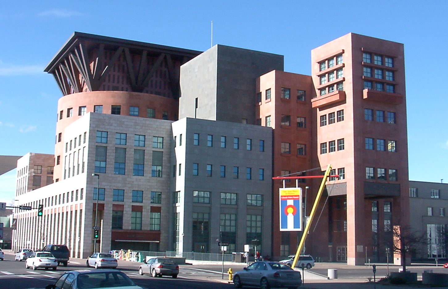
This is an image of a place or building that is listed on the National Register of Historic Places in the United States of America. Its reference number is 90001345. |
خلاصه
[ویرایش]
| توضیح |
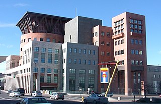
English: Central Library, Denver Public Library
Español: Biblioteca Central, Biblioteca Pública de Denver |
| تاریخ | |
| منبع | اثر شخصی |
| پدیدآور | KM Newnham |
| مختصات شیء | | محل قرارگیری این نگاره و سایر نگارهها در: نقشهٔ شهری باز |
|---|
اجازهنامه
[ویرایش]
این پرونده با اجازهنامهٔ کریتیو کامانز Attribution-Share Alike 2.5 عمومی منتشر شده است.
- شما اجازه دارید:
- برای به اشتراک گذاشتن – برای کپی، توزیع و انتقال اثر
- تلفیق کردن – برای انطباق اثر
- تحت شرایط زیر:
- انتساب – شما باید اعتبار مربوطه را به دست آورید، پیوندی به مجوز ارائه دهید و نشان دهید که آیا تغییرات ایجاد شدهاند یا خیر. شما ممکن است این کار را به هر روش منطقی انجام دهید، اما نه به هر شیوهای که پیشنهاد میکند که مجوزدهنده از شما یا استفادهتان حمایت کند.
- انتشار مشابه – اگر این اثر را تلفیق یا تبدیل میکنید، یا بر پایه آن اثری دیگر خلق میکنید، میبایست مشارکتهای خود را تحت مجوز یکسان یا مشابه با ا اصل آن توزیع کنید.
تاریخچهٔ پرونده
روی تاریخ/زمانها کلیک کنید تا نسخهٔ مربوط به آن هنگام را ببینید.
| تاریخ/زمان | بندانگشتی | ابعاد | کاربر | توضیح | |
|---|---|---|---|---|---|
| کنونی | ۲ ژانویهٔ ۲۰۰۶، ساعت ۲۱:۳۹ | | ۱٬۴۵۲ در ۹۳۶ (۱٫۲۵ مگابایت) | Mnewnham (بحث | مشارکتها) | Category:ArchitectureCategory:Denver, Colorado {{Information |Description = Denver Public Library |Source = Own Work |Date = 01-02-2006 |Author = KM Newnham |Permission = |other_versions = <i>none</i> |}} |
نمیتوانید این پرونده را رونویسی کنید.
کاربرد پرونده
بیش از ۱۰۰ صفحه از این پرونده استفاده میکنند. فهرست زیر تنها اولین ۱۰۰ استفاده از این پرونده را نشان میدهد. فهرست کامل نیز موجود است.
- File:'Denver from the Highlands' by Paul Frenzeny and Jules Tavernier, 1874.jpg
- File:1937 official road map, North Dakota, South Dakota - DPLA - 2d275d0cd6800bf9790cd56b7d2f03ad (page 1).jpg
- File:1937 official road map, North Dakota, South Dakota - DPLA - 2d275d0cd6800bf9790cd56b7d2f03ad (page 2).jpg
- File:A leisure time map of Denver, for members of the Armed Services - DPLA - 6229e5e5ef59dd2a002e40b1e317b2fa.jpg
- File:A tornado in the Rocky Mountains - DPLA - 55d244f77efab4affaf246a09d9ca29f.jpg
- File:Baist's real estate atlas of surveys of Denver, Col. (Plate 03) - DPLA - bb9038a474183e0992dfbed4228acb7a.jpg
- File:Baist's real estate atlas of surveys of Denver, Col. (Plate 12) - DPLA - 2cf25813c60f8e2f7dbdb82d2e117cbd.jpg
- File:Baist's real estate atlas of surveys of Denver, Col. (Plate 13) - DPLA - 13aa9e6151f93ec761d8d5d29baa6284.jpg
- File:Baist's real estate atlas of surveys of Denver, Col. (Plate 29) - DPLA - e676ae8aea3e4a855bce073ba419bb4e.jpg
- File:Bird's eye view Clayton Industrial School Denver, Colorado - DPLA - 2797bbd216730560dce2b3cf048d5a49.jpg
- File:Breckenridge, Colo., county seat, Summit County - DPLA - beb1fc98bd0304ebff81233e7cddede7.jpg
- File:City of Denver - DPLA - 99350370c0276b6e7f40eee870f5a523.jpg
- File:Clason's guide map of Denver, Colorado - DPLA - 642f5a2726c5185c3f9b48f5f90cfa29.jpg
- File:Clason's guide map of Denver, Colorado - DPLA - 9e1feda48997f51549b3cf4ae2d80fc0.jpg
- File:Colorado, Denver quadrangle - DPLA - 1097c532bc3f267b62426641ea086a16.jpg
- File:Colorado Springs map - DPLA - 2a76ec160777a662cc8c3eb01752d3b9.jpg
- File:Colton's new sectional map of the state of Colorado - DPLA - 4acb82fdff9783fc1244ca577e359614.jpg
- File:Commercial map of the city of Denver - DPLA - 4fd510b27ccf93198ccf418c121668c4.jpg
- File:Denver, Colorado, 1874 - DPLA - 036fc2a301fcc8d65bc4a1b14c74f264.jpg
- File:Denver, Colorado - DPLA - 32d265dfb7e80ae1129ca8d45bdcb725.jpg
- File:Denver, Colorado - DPLA - af0960215c2f4b3f723b26ee90def205.jpg
- File:Denver, Colorado - DPLA - f3741ef4773d302b9619c43bda7aac1b.jpg
- File:Denver City Park. - DPLA - 1ddf8e8d6285e916a5fd7a22490f9852.jpg
- File:Denver public housing site study, 1949, Tract-D vicinity south of Jefferson Park, Denver, Colorado. - DPLA - 10e7a2565fb562b137c8c8d749bff1a7.jpg
- File:Denver public housing site study, 1949, Tract-D vicinity south of Jefferson Park, Denver, Colorado. - DPLA - 633edcf3777068381b5bd44c1c19aa56.jpg
- File:Description and map of Denver Tramway's new routes and Denver's one-way street program - DPLA - fa23e6cc86b1f27eb097f0cd8fb2be75 (page 1).jpg
- File:Description and map of Denver Tramway's new routes and Denver's one-way street program - DPLA - fa23e6cc86b1f27eb097f0cd8fb2be75 (page 2).jpg
- File:Diagram of the Situation at the Battle of Wounded Knee at the time the Indians opened fire - DPLA - 43f9752f56c04c0480b9a09c22e5e6a0.jpg
- File:Distribution and concentration of persons with Spanish surnames - Denver metropolitan study area, 1960 - DPLA - 9106f49f27d9bbb13edfcb7ff234ad03.jpg
- File:District and precinct boundaries of the city and county of Denver - as established by resolution of the Election Commission of the city and county of Denver, passed Sept 11,1937 - DPLA - 9caea4d1846ac2a3238319914886e6c5.jpg
- File:District and precinct boundaries of the city and county of Denver - as established by resolution of the Election Commission of the city and county of Denver, passed Sept 26, 1941 - DPLA - f9efb92000d14206c56ff2a1e557adf8.jpg
- File:Future service areas metropolitan Denver, Boulder and Longmont - DPLA - aaedffc79f62d2e0df9c17b2dd498be0.jpg
- File:General locality map (northern Colorado) - DPLA - d7bfa2bac80a6218027abac06e4bbea2.jpg
- File:General plan for the village of Bow-Mar, Colorado - DPLA - 61eb523663d76dcd05e5ae57902e4f4f.jpg
- File:General plan for the village of Bow-Mar, Colorado - DPLA - d23bf83b3cf9e9936b48bb23abcc971b.jpg
- File:Geological sections, sheet XVIII - DPLA - b5ca4593e8131fbb6a34202e4eae9b11.jpg
- File:Guide map to the city of Denver, Colorado - DPLA - 1490955b0dd3ce67d0c14c89c527ac67.jpg
- File:Hay Field Fight - DPLA - 8f736cb6ea2dfbdba3c19f9716286bb3.jpg
- File:Mamie Eisenhower Park Development Plan Image 1 - DPLA - 96b6a2bbf3a589d10b4694961d1ee546.jpg
- File:Map of Brown, Sherman, Republican and Leavenworth Mountains Colorado - DPLA - 58d0496b441a84af38c53422fd52dc67.jpg
- File:Map of Colorado Territory, United States - DPLA - 6f1933128ed8b5cb38084a2e7ae991d7.jpg
- File:Map of Colorado Territory - DPLA - 932ef8c896be1de660571df98784ed2f.jpg
- File:Map of Denver's business center - from Union Depot to State Capitol... - DPLA - d2c8314c12726735199d930592f120ac.jpg
- File:Map of Denver & surroundings, from Sloan's Lake and Berkerly Park in west, to Boston Heights in east. - DPLA - 7e8657db1b47f7c20a1eaf2403e6b647.jpg
- File:Map of Gilpin Co., Colo. - DPLA - 337f0de111963c22003de78799daa7a3.jpg
- File:Map of University Park Denver, Colorado - DPLA - 91c0c7cb8040612ad571f4eda7a644b7.jpg
- File:Map of northwestern Colorado - DPLA - 794486fb3a6b406d6cc9cda2ae1089a0.jpg
- File:Map of the Trenchara and Costilla Estates forming the Sangre De Christo Grant - situate in San Luis Valley, Colorado Territory - DPLA - b08256355eba9b1fee4809b7004ca274.jpg
- File:Map of the United States - DPLA - 5f03bf3bb6db46ed511f436337daebff.jpg
- File:Map of the United States and Territories together with Canada &c. - DPLA - 3794f8c299cb54eb01585176cc80b444.jpg
- File:Map of the central portion of the city of Denver - DPLA - d1e5b0b283cfcccc6e0e266134137356 (page 1).jpg
- File:Map of the central portion of the city of Denver - DPLA - d1e5b0b283cfcccc6e0e266134137356 (page 2).jpg
- File:Map of the town of Basalt - DPLA - 69be30b89d139962c104dc852f8bc878.jpg
- File:Map showing the gold lodes on Silver Mountain, Union District, Clear Creek, Co., Colorado Ter. - DPLA - b4d2ce216ac69e15afce09d29a7ad132.jpg
- File:Maysville, Colo - DPLA - 0219b111295c92c05270960a8368efba.jpg
- File:Ninth Street Historic District Planting Plan - DPLA - c7b7fa23ee278e0c353d6a781a56e2ad.jpg
- File:Official map of Denver. - DPLA - d88e666beea983130f74b6702644f280.jpg
- File:Official route map of the Denver Tramway Corp. - DPLA - c6505b825ae42e53f5aee419973bb24a.jpg
- File:Old Town Mine plat with map - DPLA - ffc206aae71ba3c96eb014283650f56d.jpg
- File:Photograph of an illustrated relief map of Colorado Springs & Cripple Creek District Railway line - DPLA - 1de20d444b96d6d697731fe8ff53b16d.jpg
- File:Plan of rustic shelter for Congress park - DPLA - 5dfd4ff15b97e534fcc9920e6f2b7850.jpg
- File:Plat of portion of Water District no. 8, in South Platte Division (no. 1), State of Colorado - DPLA - 210d89fc1421df72bb5eb11a780abacd.jpg
- File:Plate 13 of King's 1933 aerial coverage of Denver, Colorado - DPLA - a27d147c6fc034afa7cb10ebfc8dc1c7.jpg
- File:Plate 31 of King's 1933 aerial coverage of Denver, Colorado - DPLA - 167880c9dce06cf9f5974c15770753f1.jpg
- File:Plate 38 of King's 1933 aerial coverage of Denver, Colorado - DPLA - 1ac19f7057b796c865b26c9bd75c7bcb.jpg
- File:Plate 42 of King's 1933 aerial coverage of Denver, Colorado - DPLA - 1a3d78bafbef39dca37d6f72a74d6e3f.jpg
- File:Plate 43 of King's 1933 aerial coverage of Denver, Colorado - DPLA - 68967f9c9f229e78ce184bd75c3b6471.jpg
- File:Plate 49 of King's 1933 aerial coverage of Denver, Colorado - DPLA - 4c3f5ad9bfac4097b95c9f8deb8e1a21.jpg
- File:Plate 50 of King's 1933 aerial coverage of Denver, Colorado - DPLA - 05c4b5c382655810cdafd1f5128e43e3.jpg
- File:Plate 57 of King's 1933 aerial coverage of Denver, Colorado - DPLA - bfdaadb977dfc9ce9871b43bd5bb2c1a.jpg
- File:Plate 65 of King's 1933 aerial coverage of Denver, Colorado - DPLA - ccc04a627f3e73dff0b320d5d62f65c5.jpg
- File:Plate 70 of King's 1933 aerial coverage of Denver, Colorado - DPLA - 83623d78b711f920d8ec1ea198660202.jpg
- File:Plate 83 of King's 1933 aerial coverage of Denver, Colorado - DPLA - 30044d978fcb666402842aa40062c0e3.jpg
- File:Plate 89 of King's 1933 aerial coverage of Denver, Colorado - DPLA - 308fed8d9d38cab16e0a4fae3e98c2bf.jpg
- File:Population distribution - Denver metropolitan study area, 1960 - DPLA - 75a5956ae6e5fff6933eb213484b73d1.jpg
- File:Post route map of the State of Colorado - DPLA - dead92060869f2e6e65b7b43947a542b.jpg
- File:Potter Highlands, Denver, Colorado Territory - being the N.E. 1-4 Sec 29 T3S R68W. - DPLA - 2567f81de51a43045f231b7a58b01200.jpg
- File:Prather's aerial view of Denver mountain parks and Mt. Evans region - DPLA - 25dc2ea40d9e72f82b98c6afa0a73871.jpg
- File:Proposed land use - Skyline - DPLA - ee0b811bea0d67d66c0af28cda36d719.jpg
- File:Relief map of Colorado showing territory served by Public Service Company of Colorado and subsidiaries - DPLA - 0df6fbee771d46f96c57b6cb5de89280.jpg
- File:Robinson Atlas of the City of Denver (Plate 05) - DPLA - b756820abb2783b015f04fd5ddf06b38.jpg
- File:Robinson Atlas of the City of Denver (Plate 14) - DPLA - 3c103921ff453c17b045a549968899b1.jpg
- File:Robinson Atlas of the City of Denver (Plate 16) - DPLA - c418c36c09cc1184ebf49130972684b5.jpg
- File:Robinson Atlas of the City of Denver (Plate 17) - DPLA - e9c86199438cc86d1b2b2e82f59f88cb.jpg
- File:Robinson Atlas of the City of Denver (Plate 29) - DPLA - 5520c95129b67db61e6c58452bcb10b7.jpg
- File:Rollandet's map of the city of Denver, Colorado - DPLA - 0b5962f313aefa67ad7170956a39b8ba.jpg
- File:Rollandet's map of the city of Denver, pocket edition - DPLA - e656a435288f78e1fc7793161fdeae81.jpg
- File:Skyline Project area land use map - DPLA - e6d686a6f308b63078ed794c5c5ebc37.jpg
- File:Thayer's map of Denver, Colorado - DPLA - 72e68334e32d4e1fe4b8d98b5975e448.jpg
- File:The City of Denver - DPLA - 3e1ff7b751a106e963750715f46429cc.jpg
- File:The Denver & Rio Grande system - DPLA - 5d9bb8fa0e514245339053304175ba87.jpg
- File:The English Westerners' Brand Book - DPLA - 7d1a0e9bda9eeee77f25b73f7a3174c3.jpg
- File:The Leadville mining district - DPLA - 9b91a1e983d70d0c26da37439af088cc.jpg
- File:Township 3 south, range 69 west - DPLA - 534805ae7336435e7d489f5b991d7764.jpg
- File:Villa Park Map - DPLA - 649bc9aa2905dd36fa5e0401f4902479.jpg
- File:Willits farm map - DPLA - 901fb1578eecf96488f7ae17f68efd5e (page 1).jpg
- File:Willits farm map - DPLA - 901fb1578eecf96488f7ae17f68efd5e (page 2).jpg
- File:Willits farm map - DPLA - 901fb1578eecf96488f7ae17f68efd5e (page 3).jpg
- File:Willits farm map - DPLA - 901fb1578eecf96488f7ae17f68efd5e (page 4).jpg
- File:Willits farm map - DPLA - 901fb1578eecf96488f7ae17f68efd5e (page 5).jpg
.jpg)
.jpg)
_-_DPLA_-_bb9038a474183e0992dfbed4228acb7a.jpg)
_-_DPLA_-_2cf25813c60f8e2f7dbdb82d2e117cbd.jpg)
_-_DPLA_-_13aa9e6151f93ec761d8d5d29baa6284.jpg)
_-_DPLA_-_e676ae8aea3e4a855bce073ba419bb4e.jpg)
.jpg)
.jpg)
_-_DPLA_-_d7bfa2bac80a6218027abac06e4bbea2.jpg)
.jpg)
.jpg)
,_State_of_Colorado_-_DPLA_-_210d89fc1421df72bb5eb11a780abacd.jpg)
_-_DPLA_-_b756820abb2783b015f04fd5ddf06b38.jpg)
_-_DPLA_-_3c103921ff453c17b045a549968899b1.jpg)
_-_DPLA_-_c418c36c09cc1184ebf49130972684b5.jpg)
_-_DPLA_-_e9c86199438cc86d1b2b2e82f59f88cb.jpg)
_-_DPLA_-_5520c95129b67db61e6c58452bcb10b7.jpg)
.jpg)
.jpg)
.jpg)
.jpg)
.jpg)
پیوندهای دیگر به این پرونده را ببینید.
کاربرد سراسری پرونده
ویکیهای دیگر زیر از این پرونده استفاده میکنند:
- کاربرد در br.wikipedia.org
- کاربرد در bs.wikipedia.org
- کاربرد در ca.wikipedia.org
- کاربرد در de.wikivoyage.org
- کاربرد در en.wikipedia.org
- کاربرد در es.wikipedia.org
- کاربرد در fa.wikipedia.org
- کاربرد در fr.wikipedia.org
- کاربرد در he.wikipedia.org
- کاربرد در mk.wikipedia.org
- کاربرد در nn.wikipedia.org
- کاربرد در pt.wikipedia.org
- کاربرد در sv.wikipedia.org
- کاربرد در th.wikipedia.org
- کاربرد در uk.wikipedia.org
- کاربرد در www.wikidata.org