File:Desembocadura del estuario del río Oka (Urdaibai).jpg
Jump to navigation
Jump to search
Size of this preview: 800 × 600 pixels. Other resolutions: 320 × 240 pixels | 640 × 480 pixels | 1,024 × 768 pixels | 1,280 × 960 pixels | 2,560 × 1,920 pixels | 4,000 × 3,000 pixels.
Original file (4,000 × 3,000 pixels, file size: 4.64 MB, MIME type: image/jpeg)
Captions
Captions
Add a one-line explanation of what this file represents
Summary
[edit].jpg&action=edit§ion=1)
| Description |
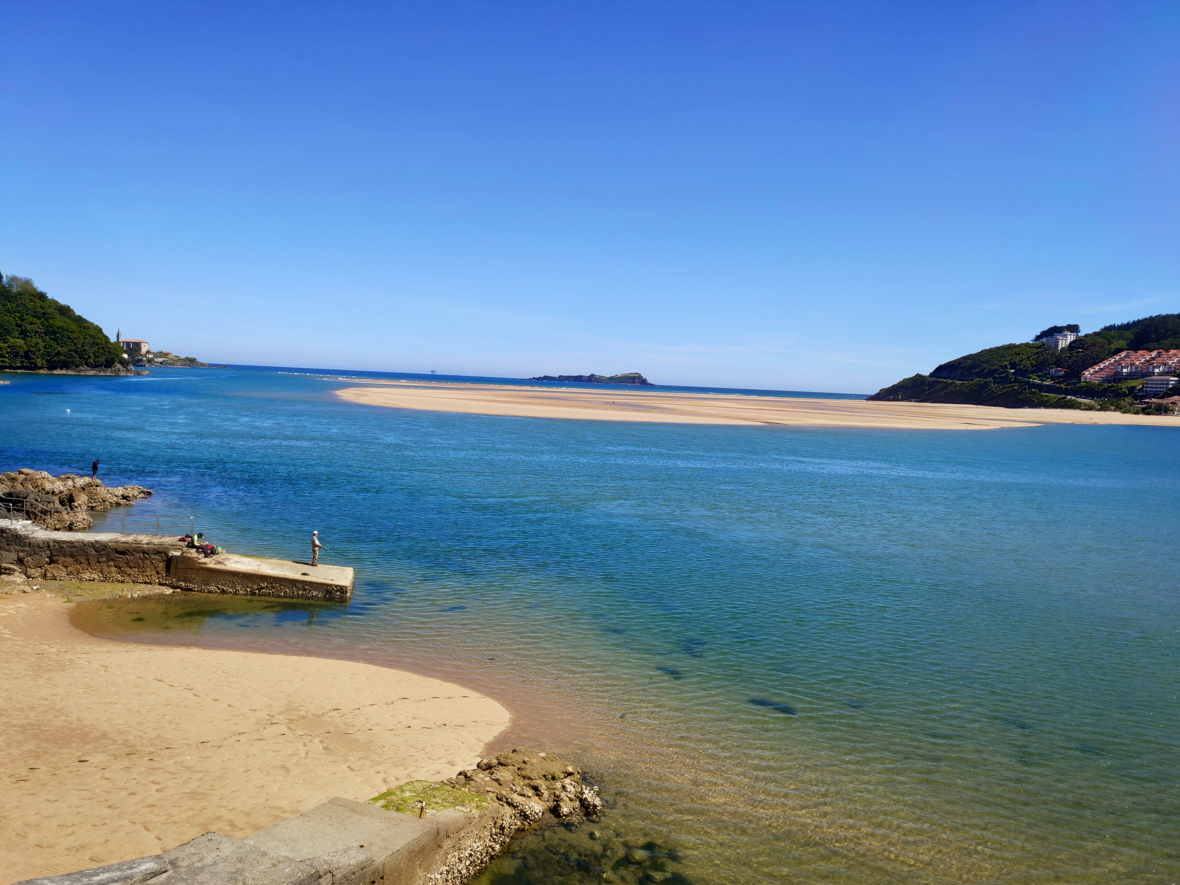
Español: El estuario de Urdaibai es un área natural formada en la desembocadura del río Oka, en la comarca vizcaína de Busturialdea, en el País Vasco (España). Ocupa una superficie de 220 km² y cuenta con una gran riqueza ecológica que le ha servido para ser calificada como reserva de la biosfera por el comité MaB de la Unesco en 1984, recibiendo el nombre de Reserva de la Biosfera de Urdaibai. También se le conoce como estuario de Mundaca o de Guernica.
|
|||||
| Date | ||||||
| Source | Own work | |||||
| Author | Iker Pereda |
| Camera location | | View this and other nearby images on: OpenStreetMap |
|---|
.jpg¶ms=043.394334_N_-002.691982_E_globe:Earth_type:camera__&language=en)
Licensing
[edit].jpg&action=edit§ion=2)
I, the copyright holder of this work, hereby publish it under the following license:
This file is licensed under the Creative Commons Attribution-Share Alike 4.0 International license.
- You are free:
- to share – to copy, distribute and transmit the work
- to remix – to adapt the work
- Under the following conditions:
- attribution – You must give appropriate credit, provide a link to the license, and indicate if changes were made. You may do so in any reasonable manner, but not in any way that suggests the licensor endorses you or your use.
- share alike – If you remix, transform, or build upon the material, you must distribute your contributions under the same or compatible license as the original.
This image was uploaded as part of Wiki Loves Earth 2019.
|
 |
File history
Click on a date/time to view the file as it appeared at that time.
| Date/Time | Thumbnail | Dimensions | User | Comment | |
|---|---|---|---|---|---|
| current | 09:57, 30 May 2019 | | 4,000 × 3,000 (4.64 MB) | Ik3rp3r3 (talk | contribs) | User created page with UploadWizard |
You cannot overwrite this file.
File usage on Commons
There are no pages that use this file.
File usage on other wikis
The following other wikis use this file:
- Usage on de.wikipedia.org
.jpg&oldid=908698785)