File:Detail of the main, continuous tract of territory of Malerkotla State from a map created by the British East India Company of the Malwa region of Punjab showing the various polities, borders, and settlements of the area, ca.1829–1835.jpg

Original file (1,411 × 1,466 pixels, file size: 242 KB, MIME type: image/jpeg)
Captions
Captions
Summary
[edit]
| Description |
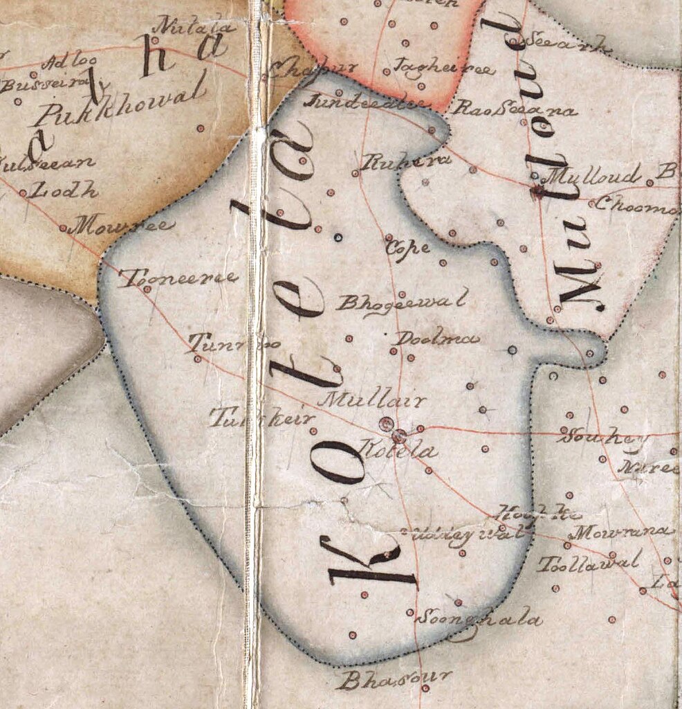
English: Detail of the main, continuous tract of territory of Malerkotla State from a map created by the British East India Company of the Malwa region of Punjab showing the various polities, borders, and settlements of the area, ca.1829–1835. This crop of the map does not include any possible exclaves of the erstwhile state that may have been depicted on the map. |
| Date | ca.1829–1835 |
| Source | Cropped from: File:Map_created_by_the_British_East_India_Company_of_the_Malwa_region_of_Punjab_showing_the_various_polities,_borders,_and_settlements_of_the_area,_ca.1829–1835.jpg |
| Author | Cartographers and surveyors of the British East India Company |
Licensing
[edit]
This image is in the public domain because it is a mere mechanical scan or photocopy of a public domain original, or – from the available evidence – is so similar to such a scan or photocopy that no copyright protection can be expected to arise. The original itself is in the public domain for the following reason:
This tag is designed for use where there may be a need to assert that any enhancements (eg brightness, contrast, colour-matching, sharpening) are in themselves insufficiently creative to generate a new copyright. It can be used where it is unknown whether any enhancements have been made, as well as when the enhancements are clear but insufficient. For known raw unenhanced scans you can use an appropriate {{PD-old}} tag instead. For usage, see Commons:When to use the PD-scan tag.  | ||||

|
This media file is uncategorized.
Please help improve this media file by adding it to one or more categories, so it may be associated with related media files (how?), and so that it can be more easily found.
Please notify the uploader with {{subst:Please link images|File:Detail of the main, continuous tract of territory of Malerkotla State from a map created by the British East India Company of the Malwa region of Punjab showing the various polities, borders, and settlements of the area, ca.1829–1835.jpg}} ~~~~ |
File history
Click on a date/time to view the file as it appeared at that time.
| Date/Time | Thumbnail | Dimensions | User | Comment | |
|---|---|---|---|---|---|
| current | 02:18, 10 August 2024 | | 1,411 × 1,466 (242 KB) | MaplesyrupSushi (talk | contribs) | Uploaded a work by Cartographers and surveyors of the British East India Company from Cropped from: [https://commons.wikimedia.org/wiki/File:Map_created_by_the_British_East_India_Company_of_the_Malwa_region_of_Punjab_showing_the_various_polities,_borders,_and_settlements_of_the_area,_ca.1829%E2%80%931835.jpg] with UploadWizard |
You cannot overwrite this file.
File usage on Commons
There are no pages that use this file.
File usage on other wikis
The following other wikis use this file:
- Usage on en.wikipedia.org