File:Deutsches Reich Historische Karten 2.jpg
Jump to navigation
Jump to search
Size of this preview: 799 × 599 pixels. Other resolutions: 320 × 240 pixels | 640 × 480 pixels | 1,024 × 768 pixels | 1,280 × 960 pixels | 2,393 × 1,795 pixels.
Original file (2,393 × 1,795 pixels, file size: 1.86 MB, MIME type: image/jpeg)
Captions
Captions
Add a one-line explanation of what this file represents
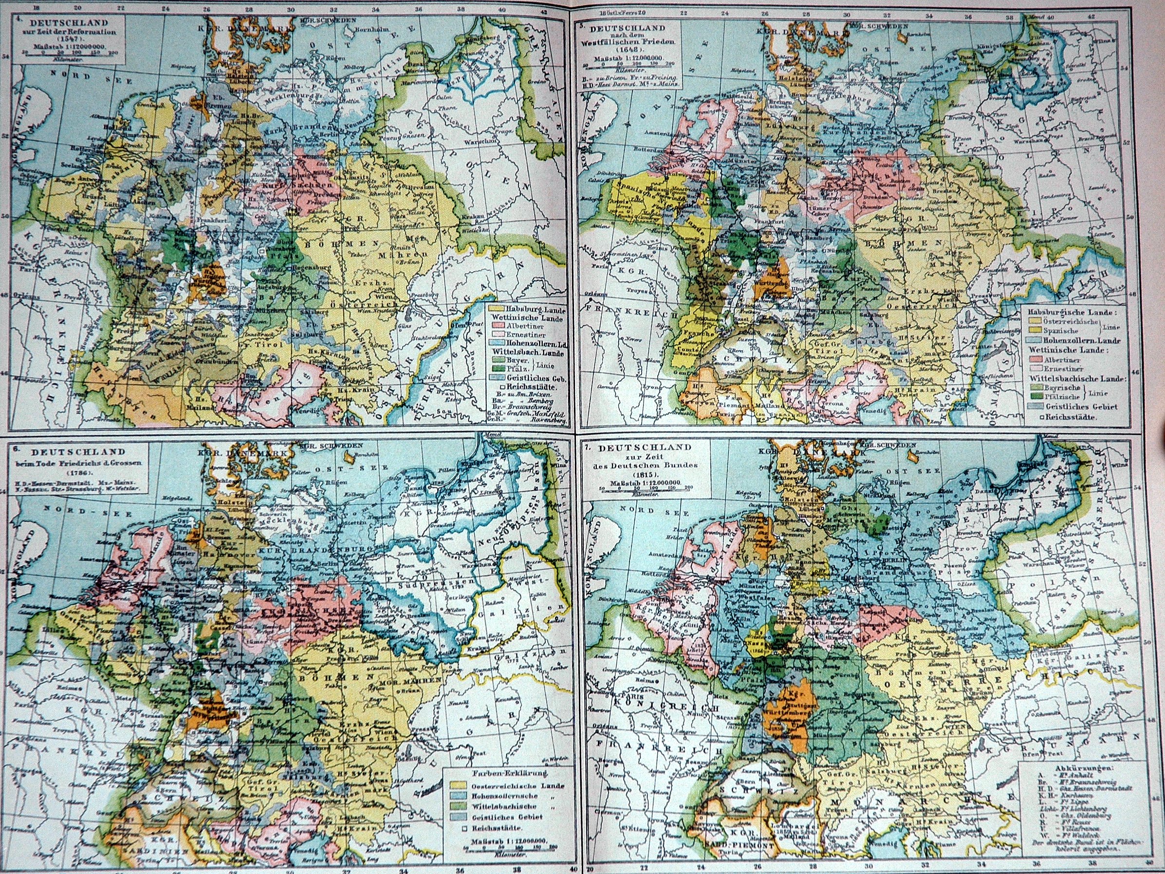
- Description: Historical map of the German Empire: Historical maps 2
- Source: German Brockhaus Konversations-Lexikon, 1892
- Author: Photo made by User:SebastianBreier
- License: Public Domain, because copyright expired
- Upper Left: Germany at the time of reformation
- Upper Right: Germany at the time of the Westfalian peace
- Lower Left: Germany at the death of Frederick the Great
- Lower Right: Germany at the time of the German Confederation
|
This work is in the public domain in its country of origin and other countries and areas where the copyright term is the author's life plus 70 years or fewer. | |
| This file has been identified as being free of known restrictions under copyright law, including all related and neighboring rights. | |
File history
Click on a date/time to view the file as it appeared at that time.
| Date/Time | Thumbnail | Dimensions | User | Comment | |
|---|---|---|---|---|---|
| current | 14:15, 5 March 2005 | | 2,393 × 1,795 (1.86 MB) | SebastianBreier~commonswiki (talk | contribs) |
You cannot overwrite this file.
File usage on Commons
The following 3 pages use this file: