File:Diezebrug aansluiting luchtfoto.jpg
Jump to navigation
Jump to search

Size of this preview: 800 × 533 pixels. Other resolutions: 320 × 213 pixels | 640 × 427 pixels | 1,024 × 683 pixels | 1,280 × 853 pixels | 2,560 × 1,707 pixels | 3,888 × 2,592 pixels.
Original file (3,888 × 2,592 pixels, file size: 1.39 MB, MIME type: image/jpeg)
Captions
Captions
Add a one-line explanation of what this file represents
Summary
[edit]| Description |
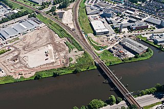
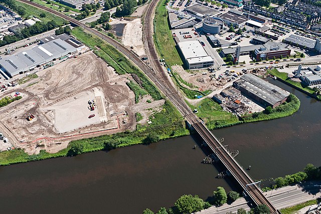
Nederlands: Spoor Den Bosch, ter hoogte van de aansluiting Diezebrug (foto: Rijkswaterstaat) |
|||
| Source | https://beeldbank.rws.nl/MediaObject/Details/416452 | |||
| Author | Joop van Houdt | |||
| Permission (Reusing this file) |
https://beeldbank.rws.nl, Rijkswaterstaat must be mentioned as the source. Original text: Nederlands: "De (intellectuele) eigendomsrechten van het beeldmateriaal liggen bij de Rijkswaterstaat, Data-ICT-Dienst, Beeldarchief Rijkswaterstaat. Er gelden geen extra kosten voor auteursrechten maar wel is bij iedere publicatie bronvermelding verplicht: https://beeldbank.rws.nl, Rijkswaterstaat".
English: "The (intellectual) ownership of the image material lies with the Rijkswaterstaat, Data-ICT-Dienst, Beeldarchief Rijkswaterstaat. No extra costs are associated with copyright, although it is mandatory to acknowledge the source with each publication: https://beeldbank.rws.nl, Rijkswaterstaat".
The original location of the image was here |

| Camera location | | View this and other nearby images on: OpenStreetMap |
|---|
Licensing
[edit]
I, the copyright holder of this work, hereby publish it under the following licenses:
This file is licensed under the Creative Commons Attribution-Share Alike 3.0 Unported license.
- You are free:
- to share – to copy, distribute and transmit the work
- to remix – to adapt the work
- Under the following conditions:
- attribution – You must give appropriate credit, provide a link to the license, and indicate if changes were made. You may do so in any reasonable manner, but not in any way that suggests the licensor endorses you or your use.
- share alike – If you remix, transform, or build upon the material, you must distribute your contributions under the same or compatible license as the original.

|
Permission is granted to copy, distribute and/or modify this document under the terms of the GNU Free Documentation License, Version 1.2 or any later version published by the Free Software Foundation; with no Invariant Sections, no Front-Cover Texts, and no Back-Cover Texts. A copy of the license is included in the section entitled GNU Free Documentation License. |
You may select the license of your choice.
File history
Click on a date/time to view the file as it appeared at that time.
| Date/Time | Thumbnail | Dimensions | User | Comment | |
|---|---|---|---|---|---|
| current | 20:00, 3 October 2015 | | 3,888 × 2,592 (1.39 MB) | Bennie91 (talk | contribs) | higher quality, same source |
| 00:06, 6 January 2012 |  | 600 × 400 (63 KB) | Bonaber (talk | contribs) | {{Information |Description ={{nl|1=Spoor Den Bosch, ter hoogte van de aansluiting Diezebrug (foto: Rijkswaterstaat)}} |Source =https://beeldbank.rws.nl/MediaObject/Details/416452 |Author =Joop van Houdt |Date = |Permission |
You cannot overwrite this file.
File usage on Commons
The following page uses this file:
File usage on other wikis
The following other wikis use this file:
- Usage on fr.wikipedia.org
- Usage on nl.wikipedia.org