File:Districts and PBT of Johor.svg
跳至導覽
跳至搜尋

此 SVG 檔案的 PNG 預覽的大小:629 × 599 像素。 其他解析度:252 × 240 像素 | 504 × 480 像素 | 806 × 768 像素 | 1,075 × 1,024 像素 | 2,150 × 2,048 像素 | 1,035 × 986 像素。
原始檔案 (SVG 檔案,表面大小:1,035 × 986 像素,檔案大小:83 KB)
說明
說明
添加單行說明來描述出檔案所代表的內容
| 描述 |
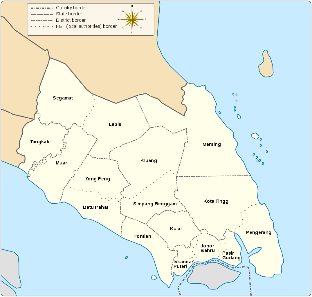
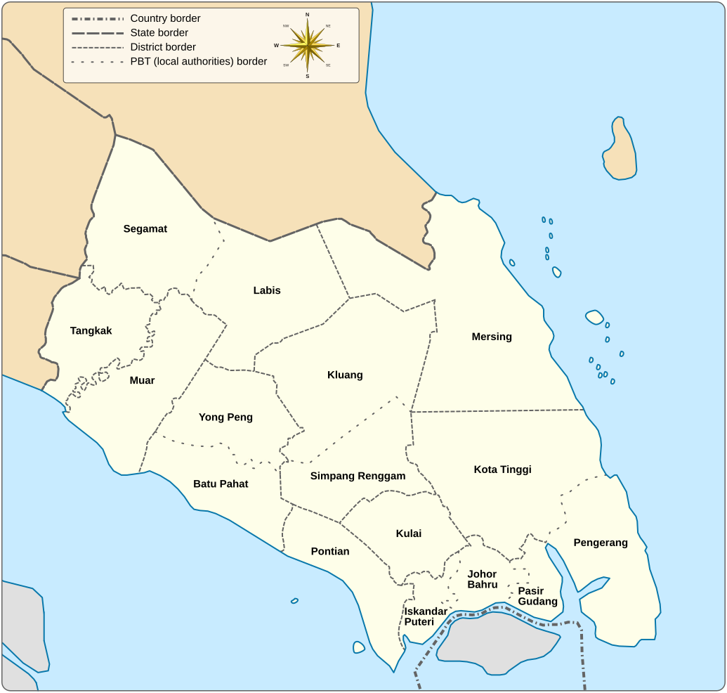
English: A map showing districts and PBT (local authorities) of Johor |
||
| 日期 | |||
| 來源 |
自己的作品 |
||
| 作者 | Goran tek-en, following request by :en:*angys* (留言 | 貢獻) | ||
| 授權許可 (重用此檔案) |
此檔案採用創用CC 姓名標示-相同方式分享 4.0 國際授權條款。 姓名標示: Goran tek-en
|
||
| 其他版本 |
|
||
| SVG開發 | 本vector image使用Inkscape創作,或使用了其他工具。 |

檔案歷史
點選日期/時間以檢視該時間的檔案版本。
| 日期/時間 | 縮圖 | 尺寸 | 使用者 | 備註 | |
|---|---|---|---|---|---|
| 目前 | 2018年1月13日 (六) 13:11 | | 1,035 × 986(83 KB) | Goran tek-en(留言 | 貢獻) | Typo edit in legend |
| 2018年1月12日 (五) 16:36 |  | 1,035 × 986(83 KB) | Goran tek-en(留言 | 貢獻) | {{Information |description ={{en|1=A map showing districts and PBT (local authorities) of Johor}} |date =20180112 |source ={{Own}}<br> {{Derived from|Malaysia location map.svg}} Derived from; * [http://epublisiti.townplan.gov.my... |
無法覆蓋此檔案。
檔案用途
全域檔案使用狀況
以下其他 wiki 使用了這個檔案:
- cs.wikipedia.org 的使用狀況
- en.wikipedia.org 的使用狀況
- it.wikipedia.org 的使用狀況
- ms.wikipedia.org 的使用狀況
- ta.wikipedia.org 的使用狀況