File:Dong Nai River.png
Jump to navigation
Jump to search
Size of this preview: 538 × 600 pixels. Other resolutions: 215 × 240 pixels | 431 × 480 pixels | 778 × 867 pixels.
Original file (778 × 867 pixels, file size: 713 KB, MIME type: image/png)
Captions
Captions
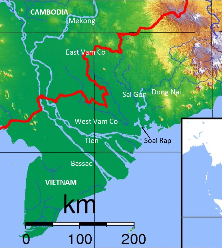
Dong Nai River
Summary
[edit]| Description |
English: Dong Nai River and its tributaries include West Vam Co (Vàm Cỏ Tây), East Vam Co (Vàm Cỏ Đông), Sai Gon. |
| Date | |
| Source | |
| Author | [1] |

Licensing
[edit]
This file is licensed under the Creative Commons Attribution-Share Alike 4.0 International license.
- You are free:
- to share – to copy, distribute and transmit the work
- to remix – to adapt the work
- Under the following conditions:
- attribution – You must give appropriate credit, provide a link to the license, and indicate if changes were made. You may do so in any reasonable manner, but not in any way that suggests the licensor endorses you or your use.
- share alike – If you remix, transform, or build upon the material, you must distribute your contributions under the same or compatible license as the original.
File history
Click on a date/time to view the file as it appeared at that time.
| Date/Time | Thumbnail | Dimensions | User | Comment | |
|---|---|---|---|---|---|
| current | 12:31, 30 October 2021 | | 778 × 867 (713 KB) | Phó Nháy (talk | contribs) | Uploaded a work by [https://commons.wikimedia.org/wiki/User:Sadalmelik|Sadalmelik] from Cropped from https://commons.wikimedia.org/wiki/File:Cambodia_Topography.png with UploadWizard |
You cannot overwrite this file.
File usage on Commons
There are no pages that use this file.
File usage on other wikis
The following other wikis use this file:
- Usage on en.wikipedia.org
- Usage on pl.wikipedia.org
- Usage on vi.wikipedia.org