File:Door Peninsula is flanked by Green Bay and Lake Michigan.jpg
ナビゲーションに移動
検索に移動
このプレビューのサイズ: 800 × 532 ピクセル。 その他の解像度: 320 × 213 ピクセル | 640 × 426 ピクセル | 1,024 × 682 ピクセル | 1,280 × 852 ピクセル | 2,560 × 1,704 ピクセル | 4,928 × 3,280 ピクセル。
元のファイル (4,928 × 3,280 ピクセル、ファイルサイズ: 1.29メガバイト、MIME タイプ: image/jpeg)
キャプション
キャプション
このファイルの内容を1行で記述してください
概要
[編集]
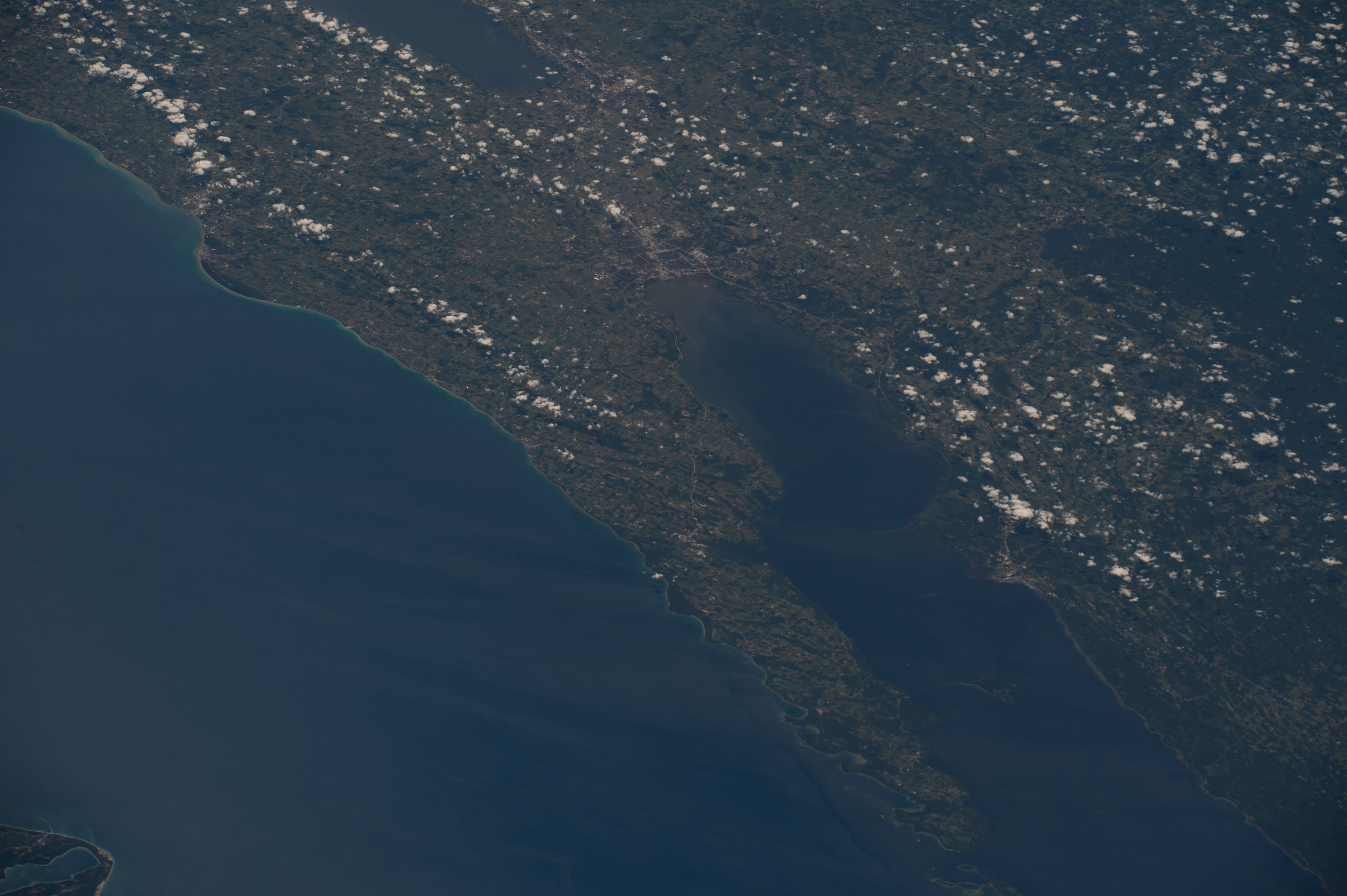
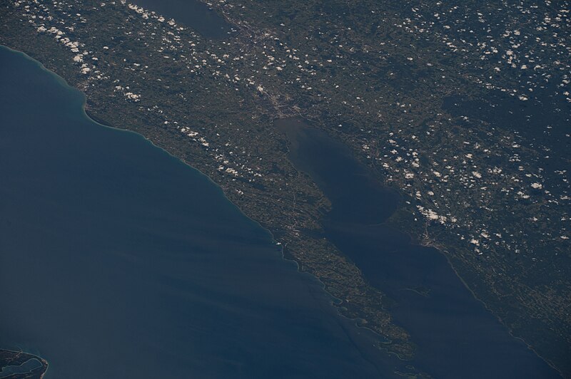
| 解説 | The Door Peninsula is flanked by a foggy Green Bay and Lake Michigan, with small white clouds over the southern part of the peninsula. Sturgeon Bay and Green Bay appear gray, and are linked by Highway 57, also in gray. Opposite from Sturgeon Bay on the other side of the bay of Green Bay is the city of Marinette, in gray. In the upper left, Manitowoc and Two Rivers appear in gray next to each other. Lake Winnebago is partly visible along the upper right border. An algae bloom appears at the mouth of the Fox River. Taken at 12:04:26 PM, Central Daylight Savings Time on June 28, 2016 during Expediton 48 of the International Space Station. | ||
| 日付 | |||
| 原典 | https://eol.jsc.nasa.gov/SearchPhotos/photo.pl?mission=ISS048&roll=E&frame=15904 | ||
| 作者 | NASA | ||
| 許可 (ファイルの再利用) |
|
ファイルの履歴
過去の版のファイルを表示するには、その版の日時をクリックしてください。
| 日付と時刻 | サムネイル | 寸法 | 利用者 | コメント | |
|---|---|---|---|---|---|
| 現在の版 | 2020年2月20日 (木) 05:37 | | 4,928 × 3,280 (1.29メガバイト) | Epiphyllumlover (トーク | 投稿記録) | {{Information |description=The Door Peninsula is flanked by a foggy Green Bay and Lake Michigan, with small white clouds over the southern part of the peninsula. Sturgeon Bay and Green Bay appear gray, and are linked by Highway 57, also in gray. Opposite from Sturgeon Bay on the other side of the bay of Green Bay is the city of Marinette, in gray. In the upper left, Manitowoc and Two Rivers appear in gray next to each other. Lake Oshkosh is partly visible along the upper right border. An alga... |
このファイルは上書きできません。
ファイルの使用状況
以下の 3 ページがこのファイルを使用しています:
グローバルなファイル使用状況
以下に挙げる他のウィキがこの画像を使っています:
- ar.wikipedia.org での使用状況
- ceb.wikipedia.org での使用状況
- es.wikipedia.org での使用状況
- fa.wikipedia.org での使用状況
- fr.wikipedia.org での使用状況
- he.wikipedia.org での使用状況
- ja.wikipedia.org での使用状況
- ko.wikipedia.org での使用状況
- sh.wikipedia.org での使用状況
- simple.wikipedia.org での使用状況
- sq.wikipedia.org での使用状況
- sr.wikipedia.org での使用状況
- sv.wikipedia.org での使用状況
- tl.wikipedia.org での使用状況
- uk.wikipedia.org での使用状況
- ur.wikipedia.org での使用状況
- vi.wikipedia.org での使用状況
- www.wikidata.org での使用状況
- zh.wikipedia.org での使用状況
メタデータ
カテゴリ:
- PD NASA-AP
- Astronaut photography of Door County, Wisconsin
- Kewaunee County, Wisconsin
- Brown County, Wisconsin
- Manitowoc County, Wisconsin
- Calumet County, Wisconsin
- Green Bay (Lake Michigan)
- Appleton, Wisconsin
- Marinette County, Wisconsin
- Geography of Florence County, Wisconsin
- Oconto County, Wisconsin
- Door Peninsula
- Satellite pictures of Wisconsin
- ISS Expedition 48 Crew Earth Observations (dump)