File:Douglas County Georgia Incorporated and Unincorporated areas Douglasville Highlighted.svg
Jump to navigation
Jump to search

Size of this PNG preview of this SVG file: 750 × 550 pixels. Other resolutions: 320 × 235 pixels | 640 × 469 pixels | 1,024 × 751 pixels | 1,280 × 939 pixels | 2,560 × 1,877 pixels.
Original file (SVG file, nominally 750 × 550 pixels, file size: 198 KB)
Captions
Captions
Add a one-line explanation of what this file represents
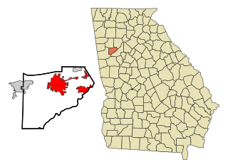
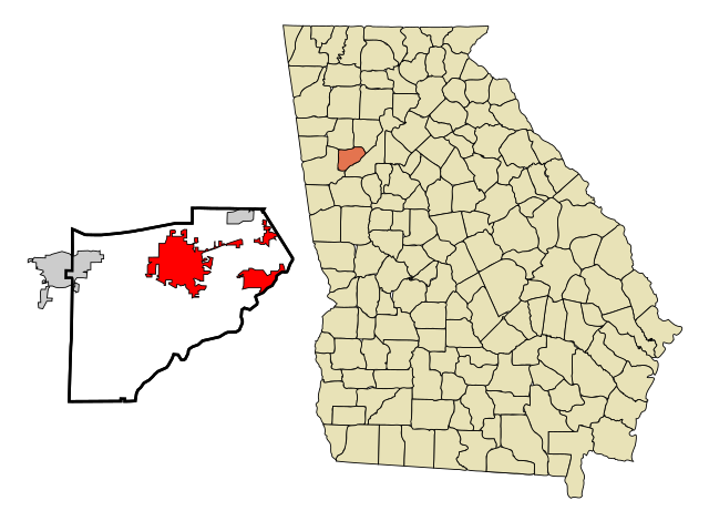
| Description | This map shows the incorporated and unincorporated areas in Douglas County, Georgia, highlighting Douglasville in red. It was created with a custom script with US Census Bureau data and modified with Inkscape. |
| Date | |
| Source | My own work, based on public domain information. Based on similar map concepts by Ixnayonthetimmay |
| Author | Arkyan |
| Other versions | Derivative works of this file: Douglas County Georgia Winston Highlighted.svg.png |
I, the copyright holder of this work, hereby publish it under the following licenses:

|
Permission is granted to copy, distribute and/or modify this document under the terms of the GNU Free Documentation License, Version 1.2 or any later version published by the Free Software Foundation; with no Invariant Sections, no Front-Cover Texts, and no Back-Cover Texts. A copy of the license is included in the section entitled GNU Free Documentation License. |
| This file is licensed under the Creative Commons Attribution-Share Alike 3.0 Unported license. | ||
| ||
| This licensing tag was added to this file as part of the GFDL licensing update. |
This file is licensed under the Creative Commons Attribution-Share Alike 2.5 Generic, 2.0 Generic and 1.0 Generic license.
- You are free:
- to share – to copy, distribute and transmit the work
- to remix – to adapt the work
- Under the following conditions:
- attribution – You must give appropriate credit, provide a link to the license, and indicate if changes were made. You may do so in any reasonable manner, but not in any way that suggests the licensor endorses you or your use.
- share alike – If you remix, transform, or build upon the material, you must distribute your contributions under the same or compatible license as the original.
You may select the license of your choice.
File history
Click on a date/time to view the file as it appeared at that time.
| Date/Time | Thumbnail | Dimensions | User | Comment | |
|---|---|---|---|---|---|
| current | 20:46, 19 September 2007 | | 750 × 550 (198 KB) | ArkyBot~commonswiki (talk | contribs) | {{Information |Description=This map shows the incorporated and unincorporated areas in Douglas County, Georgia, highlighting Douglasville in red. It was |
You cannot overwrite this file.
File usage on Commons
The following 2 pages use this file:
File usage on other wikis
The following other wikis use this file:
- Usage on ar.wikipedia.org
- Usage on arz.wikipedia.org
- Usage on azb.wikipedia.org
- Usage on ca.wikipedia.org
- Usage on cy.wikipedia.org
- Usage on de.wikipedia.org
- Usage on en.wikipedia.org
- Usage on es.wikipedia.org
- Usage on eu.wikipedia.org
- Usage on fa.wikipedia.org
- Usage on fr.wikipedia.org
- Usage on ht.wikipedia.org
- Usage on hu.wikipedia.org
- Usage on it.wikipedia.org
- Usage on ja.wikipedia.org
- Usage on no.wikipedia.org
- Usage on sh.wikipedia.org
- Usage on sr.wikipedia.org
- Usage on tt.wikipedia.org
- Usage on ur.wikipedia.org
- Usage on vo.wikipedia.org
- Usage on www.wikidata.org
- Usage on zh.wikipedia.org