File:Dragon's Backbone Rice Terraces (Longsheng) - panoramio.jpg
Jump to navigation
Jump to search

Size of this preview: 800 × 237 pixels. Other resolutions: 320 × 95 pixels | 640 × 190 pixels | 1,024 × 303 pixels | 1,280 × 379 pixels | 2,560 × 758 pixels | 7,781 × 2,304 pixels.
Original file (7,781 × 2,304 pixels, file size: 19.66 MB, MIME type: image/jpeg)
Captions
Captions
Add a one-line explanation of what this file represents
Summary[edit]
_-_panoramio.jpg&action=edit§ion=1)
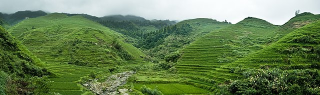
| Description | Dragon's Backbone Rice Terraces (Longsheng) | ||
| Date | 12 December 2010 (original upload date) | ||
| Source | https://web.archive.org/web/20161016152745/http://www.panoramio.com/photo/44897286 | ||
| Author | Raffaele Nicolussi | ||
| Permission (Reusing this file) |
This file is licensed under the Creative Commons Attribution 3.0 Unported license. Attribution: Raffaele Nicolussi
|
||
| Tags (from Panoramio photo page) | Shaoyang, Asia, china, CHN, cina, Dazhai, Dragon's Backbone, Dragon's Backbone Rice Terraces, geo:lat=25.81083100, geo:lon=110.14507800, geotagged, Guangxi, largo, Longsheng, Longsheng County, Longsheng Rice Terraces, Lóngshèng Tītián, Paese Centrale, panorama, People's Republic of China, PRC, Repubblica Popolare Cinese, rice terraces, terrazze di riso, wide, Zhōngguó, Zhōnghuá Rénmín Gònghéguó, 中华人民共和国, 中国, 中國, 中華人民共和國, 龍勝梯田, 龙胜梯田 |
| Camera location | | View this and other nearby images on: OpenStreetMap |
|---|
_-_panoramio.jpg¶ms=026.883167_N_0111.307831_E_globe:Earth_type:camera_source:Panoramio_&language=en)
File history
Click on a date/time to view the file as it appeared at that time.
| Date/Time | Thumbnail | Dimensions | User | Comment | |
|---|---|---|---|---|---|
| current | 19:35, 21 November 2016 | 7,781 × 2,304 (19.66 MB) | Panoramio upload bot (talk | contribs) | == {{int:filedesc}} == {{Information |description=Dragon's Backbone Rice Terraces (Longsheng) |date={{Original upload date|2010-12-12}} |source=http://www.panoramio.com/photo/44897286 |author=[http://www.panoramio.com/user/38219?with_photo_id=44897286... |
You cannot overwrite this file.
File usage on Commons
There are no pages that use this file.
_-_panoramio.jpg&oldid=643598810)