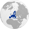
File:EC06-1957-58 European Community map.svg
De Wikimedia Commons
Salta a la navegació
Salta a la cerca

Mida d'aquesta previsualització PNG del fitxer SVG: 680 × 520 píxels. Altres resolucions: 314 × 240 píxels | 628 × 480 píxels | 1.004 × 768 píxels | 1.280 × 979 píxels | 2.560 × 1.958 píxels.
Fitxer original (fitxer SVG, nominalment 680 × 520 píxels, mida del fitxer: 511 Ko)
Informació del fitxer
Dades estructurades
Llegendes
Llegendes
Afegeix una explicació d'una línia del que representa aquest fitxer
| Anotacions InfoField | Aquesta imatge té anotacions: Vegeu-les a Commons |
264
309
8
8
680
520
Netherlands/Нидерландия
257
324
8
8
680
520
Belgium/Белгия
241
356
8
8
680
520
France/Франция
286
325
8
8
680
520
West Germany/Западна Германия
268
338
8
8
680
520
Luxembourg/Люксембург
325
435
8
8
680
520
Italy/Италия
242
509
8
8
680
520
Algeria (France)/Алжир (Франция)
Resum
[modifica]| DescripcióEC06-1957-58 European Community map.svg |
English: European Community (EC 6)
Deutsch: Europäische Gemeinschaft (EG)
Svenska: Europeiska Gemenskaperna (EG) |
| Data | |
| Font | Treball propi |
| Autor | Kolja21 |
| Altres versions |
|
| SVG genesis InfoField | El codi font d’aquest SVG no és vàlid perquè hi 2 han errors. Aquesta imatge vectorial ha estat creada amb Inkscape. |
Color scheme
[modifica]- Europe blue / Europablau / azul europeo / bleu européenne (Pantone; RGB 003399): EU current members
- Regent St Blue (RAL 6034; RGB 9ac0cd): Transition period (see Brexit withdrawal agreement)
- Pantone yellow / Gelb / amarillo / jaune (Pantone; RGB ffcc00): EU new members
- Light blue / Lichtblau / azul claro / bleu clair (RGB 2782bb): EU candidate countries
- Light green / Lichtgrün / verde claro / vert clair (RGB 77bbbc): EU potential candidate countries
- Lawngreen / Grasgrün / verde hierba / vert pré (RGB a0e200): EU membership possible
- Orange / Orange / anaranjado / orange (RGB ff6600): Eastern Partnership
- Emerald green / Smaragdgrün / verde esmeralda / smaragdin (RAL 6001; RGB 276d3a): EFTA member states
- Pastel green / Weißgrün / verde blanquecino / vert blanc (RAL 6019; RGB b3d9b4): EFTA former member states
Llicència
[modifica]Jo, el titular dels drets d'autor d'aquest treball, el public sota la següent llicència:
Aquest fitxer està subjecte a la llicència de Creative Commons Reconeixement 3.0 No adaptada.
- Sou lliure de:
- compartir – copiar, distribuir i comunicar públicament l'obra
- adaptar – fer-ne obres derivades
- Amb les condicions següents:
- reconeixement – Heu de donar la informació adequada sobre l'autor, proporcionar un enllaç a la llicència i indicar si s'han realitzat canvis. Podeu fer-ho amb qualsevol mitjà raonable, però de cap manera no suggereixi que l'autor us dóna suport o aprova l'ús que en feu.
Historial del fitxer
Cliqueu una data/hora per veure el fitxer tal com era aleshores.
| Data/hora | Miniatura | Dimensions | Usuari/a | Comentari | |
|---|---|---|---|---|---|
| actual | 04:07, 26 maig 2009 |  | 680 × 520 (511 Ko) | Kolja21 (discussió | contribucions) | {{Information |Description={{en|1=European Community (EC 6)}} {{de|1=Europäische Gemeinschaft}} |Source=Eigenes Werk (own work) |Author=Kolja21 |Date=2009-05-26 |Permission= |other_versions={{User:Kolja21/Map |
No podeu sobreescriure aquest fitxer.
Ús del fitxer
Les 38 pàgines següents utilitzen aquest fitxer:
- Atlas of the European Union
- Enlargement of the European Union
- User:Kolja21
- User:Kolja21/Maps of the European Union
- User:Kolja21/Maps of the European Union enlargement
- File:EC-EU-enlargement animation.gif
- File:EC06-1957-58 EC and USSR map.svg
- File:EC06-1957-58 European Community map.svg
- File:EC09-1973 European Community map.svg
- File:EC09-1973 European Community map enlargement.svg
- File:EC10-1981 European Community map.svg
- File:EC10-1981 European Community map enlargement.svg
- File:EC12-1986 EC and USSR map.svg
- File:EC12-1986 European Community map.svg
- File:EC12-1986 European Community map enlargement.svg
- File:EC12-1990 European Community map.svg
- File:EC12-1990 European Community map enlargement.svg
- File:EU-Erweiterung 1972-Norwegen.svg
- File:EU-candidate countries map.svg
- File:EU12-1992-93 European Union map.svg
- File:EU15-1995 European Union map.svg
- File:EU15-1995 European Union map enlargement.svg
- File:EU25-2004 European Union map.svg
- File:EU25-2004 European Union map enlargement.svg
- File:EU27-2007 European Union map.svg
- File:EU27-2007 European Union map enlargement.svg
- File:EU27-2007 as a single entity.svg
- File:EU27-2007 globe.svg
- File:EU27-2008 as a single entity in the world.svg
- File:EU27-2012-candidate countries map.svg
- File:EU27-2012-candidate countries only map.svg
- File:EU27-2012-further enlargement map.svg
- File:EU28-2013 European Union map enlargement.svg
- File:EU28-candidate countries only map.svg
- File:EU membership possible map.svg
- File:EUenl-EU6.png
- File:Eu - members, candidates, association.svg
- File:European Coal and Steel Community Map 1952.svg
Ús global del fitxer
Utilització d'aquest fitxer en altres wikis:
- Utilització a an.wikipedia.org
- Utilització a bg.wikipedia.org
- Utilització a ca.wikipedia.org
- Utilització a cs.wikipedia.org
- Utilització a da.wikipedia.org
- Utilització a de.wikipedia.org
- Utilització a el.wikipedia.org
- Utilització a en.wikipedia.org
- Utilització a en.wikibooks.org
- Utilització a es.wikipedia.org
- Utilització a et.wikipedia.org
- Utilització a eu.wikipedia.org
- Utilització a fr.wikipedia.org
- Utilització a fr.wiktionary.org
- Utilització a hr.wikipedia.org
- Utilització a it.wikipedia.org
- Utilització a nl.wikipedia.org
- Utilització a oc.wikipedia.org
- Utilització a pt.wikipedia.org
- Utilització a www.wikidata.org
- Utilització a zh-classical.wikipedia.org
- Utilització a zh.wikipedia.org
Metadades
Aquest fitxer conté informació addicional, probablement afegida per la càmera digital o l'escàner utilitzat per a crear-lo o digitalitzar-lo. Si s'ha modificat posteriorment, alguns detalls poden no reflectir les dades reals del fitxer modificat.
| Amplada | 680 |
|---|---|
| Alçària | 520 |


